Archives:
- Ten State Tour
- Gadsden Hotel
Cochise Co. - David's Sardinia trip
- Downtown Huntsville
- Pima County Fair '07
- Phoenix Trip '07
- Space & Rocket Center
- California Desert
- Saguaro Monument
- Rodeo Days '08
- Butterflies
- David's Sweden trip
- South and Midwest
Grand Tour
Pt 1 Pt 2 Pt 3
Pt 4 Pt 5 Pt 6
Pt 7 Pt 8 Pt 9 - David's Germany trip
- Biosphere 2
- Tucson Rodeo 09
- Sabino Canyon
- Rose Canyon Camping
- Southern California
- North Texas
- Labour Day '09
- Tucson Presidio '09
- Phoenix Trip '09
- David's Utah Trip '10
- David's Dallas Trip '10
- Colorado Trip '10
- North Arizona '10
- NmTxOkAr '10
- Portland & Maryland '10
- Las Vegas '10
- Dillinger Days '10
- Rodeo Days '11
- Penn, Maryland, WV
- Faith's SCUBA trip
- Mount Lemmon '11
- Los Angeles '11
- Phoenix '11
- Flagstaff '11
- Alberta, CA
- Glendale '11
- Pinnacle Peak '11
- Arizona Centennial
- 2012 Tour - Missouri
Pt 1 Pt 2 Pt 3 - Barrio Viejo Home Tour '13
- Apache Trail '13
- AZ Route 66 '13
- Tucson Walking Tour '13
- Veteran's Day Parade '13
- Lake Havasu '14
- Charity in France '14
- Colorado '15
- Medicine Hat/ Calgary '15
- LA & San Diego '16
- Phoenix Mystery Castle
- Sequoia & Yosemite
- Route 66: NM, TX, OK, KS
- NM, CO, WY, NB in '17
- Phoenix Summer '17
- July 4th '17 in Colorado
- Orlando '17
- Consumer Electronics Show '19
- Denver/Brown Palace '19
- Pacific NW '19 p1
- Pacific NW '19 p2
- Pacific NW '19 p3
- Colorado '20
- July 4th '21 in Colorado
- Texas Lighthouses '20
Ormand Family Activity
To read about our October 2021 Texas Lighthouse Tour, go here.
To read about our July 2021 Independence Day celebration, go here.
November 2021: California Lighthouse Tour - Part 4
Tuesday November 2: Angel Island
Today is our trip out to Angel Island, and I have ferry reservations for 10:15. We get up at 6:30 to prepare for day. I go down to check on breakfast - which is a bag with a sausage sandwich, a muffin, and an apple. Like Carmel, the rooms have no microwave so I have to heat the sandwiches in the breakfast room. A hotel staffer hands the bags over a barrier of tables. This is all so dumb.
I wanted to leave by 8:30, but we don't leave until 9:10. I really, really don't want to surrender our parking spot in the limited-availability parking garage downstairs, or be exposed to damaging the car or getting it stuck down there while trying to get it out, or paying $50 to park it near the Embarcadero, so I have done a timing/distance study for walking to the pier. The route from the hotel on Lombard and Van Ness to Pier 39 is 1.3 miles and 26 minutes. I figure if we double it to 52 minutes we should still get there in time. BUT: I didn't count on all the fool hills that slow us down. We cut down to Beach Street and see the back side of the Ghirardelli's sign, and Boudin, and Madam Tussaud's. We pass lots of touristy places. We stop by In-n-Out to get a bagged lunch but it isn't open yet; we'll just have to rely on the cafe on the island. Down to the Embarcadero, Pier 39, just in time for boarding (10 minutes to spare). Now, having done some additional research last night, I learned that as of November 1, the tram around the island operates only on weekends, bikes are rented only on weekends, the Segway tours operate only on weekends, so who knows about the cafe? I decide to buy some snacks on the boat just in case. There's a group of people all with identical stapled brown bags; could they know something we don't?
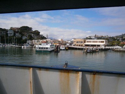
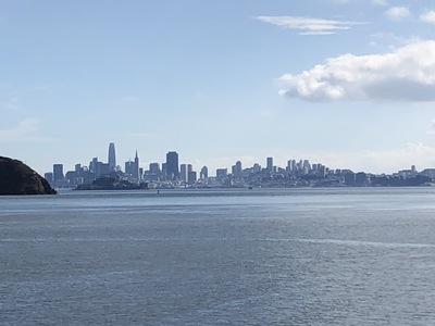
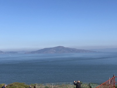
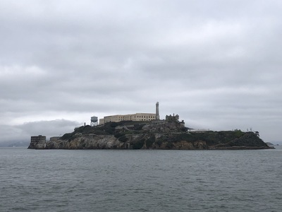 It's a nice trip out. On the way, we pass Alcatraz. I guess you can't hardly go anywhere in the bay without passing Alcatraz.
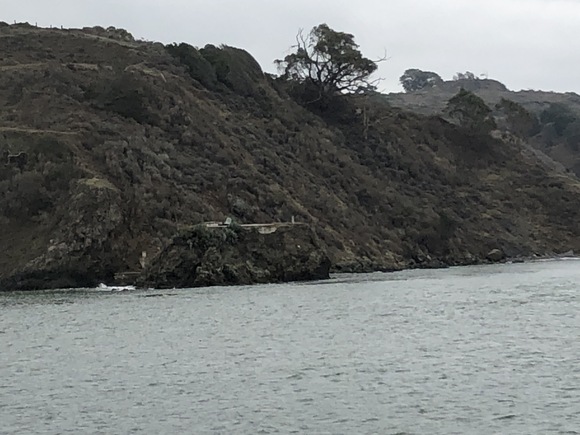
The ferry approaches Angel Island on the west side. I was anticipating this. On a little rocky bump is a flat spot and a bell in a frame. This is all that remains of the Point Knox lighthouse.
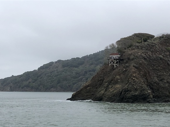 Turning around the western point of the island, we see a little shack on the side of the cliff. That's Point Stuart lighthouse. This is the best view of these sites we are going to get, since they're really not visible from the roads and paths on the island.
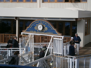
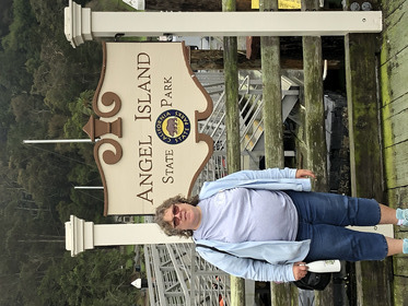 The ferry docks and nearly everyone gets off. Jerri has arrived at Angel Island. The first thing we do is ask the state park ranger at the kiosk for camping permits if he has the lighthouse stamp. No, he does not, and can't find them in the kiosk after a brief search. Then we start walking over to the cafe. A concession employee comes by and I ask her about the lighthouse stamp. She doesn't know, but leads me to the gift shop, unlocks it (it's closed today), goes in and roots around, and then comes back apoligetically to say she can't find them. It's possible they're at the other gift shop at the north of the cove, but it's closed for the season and nobody can get in there, sorry.
 And... yes: The cafe is closed except on weekends. Total strikeout. There's nothing to do until the next ferry comes by in three hours.
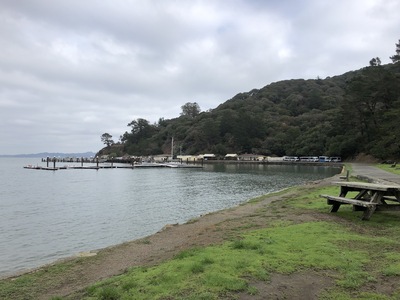
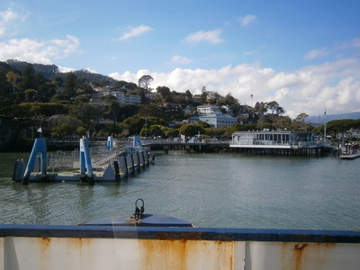
The group with the brown paper bags were indeed together, and they sit on the grassy area for their picnic before most of them go off on a hike. After Jerri and I waste some time munching snacks and playing with cellphones, we figure we can walk around, too. This is the view of Ayala Cove from the other side.
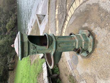 I guess this is, or was, a drinking fountain.
 Up the hill are big houses formerly used by the Army medical officers who ran the quarantine station here. Now used by park employees, with "No Trespassing" signs to deter casual sightseers like us.
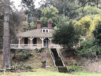
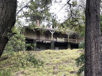 Not all the old buildings are kept up. This one is falling apart, or at least the porch or veranda is.
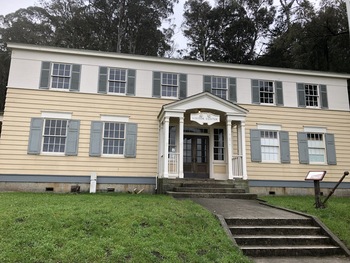 The park visitor center was the headquarters for the quarantine station. Closed except for weekends.
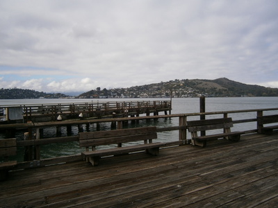 View across the channel to the mainland; that is the city of Tiburon.
 After a relaxing but useless morning, here comes the ferry.
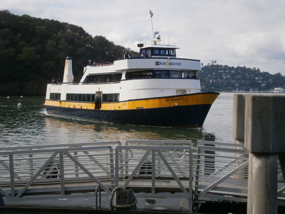
 It's an actual ferry, running between San Francisco and the north bay communities. Angel Island is just a convenience stop. As we approach the dock in Tiburon, I can see the regular Angel Island ferry that runs between Tiburon and Angel Island hourly every day during the regular season.
 The ferry docks at Tiburon, some people get off, more people get on, some with bicycles.
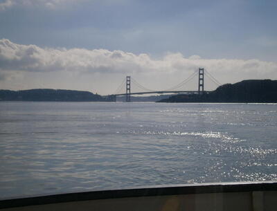 Different perspective of the Golden Gate Bridge, from the north side of the bay.
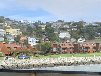 Tiburon is a nice community, with houses stacked up the side of the hill and a broad grassy park at the bottom.
 View of the big city from the north side. I'll bet it's a treat in the evening with the city all lit up.
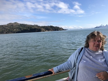 Jerri on a ferry, at Tiburon, California.
 Then the ferry runs over to Sausalito. I think a few people get on. And then the long run back to San Francisco. After we dock, we go looking for a belated lunch. Oh, look, there's In-n-Out, they're open now. Except San Francisco has a stupid wuhan rule for no indoor dining; fortunately we can sit at a shady table in Anchorage Square, near the restrooms that have locks with a code you can get as a restaurant customer.
Then it's the long walk back up-hill. It takes a while, and there's a lot of grumbling all around, and it involves a stop at the Walgreen's on the way, but we get there. Jerri tries to call Charity for her birthday greeting, but Charity is at dinner. While Jerri rests and waits, I go back out.
 Van Ness seems to be the demarcation between the Union Street and Russian Hill neighborhoods. I start walking up Russian Hill toward the "curviest street in America" which is "just" a few blocks away from our hotel. It. Is. A. Hill. Wow. The cars have to park orthogonally to the slope. Most houses have a garage at street level; I can see one just beyond the uppermost car. I'll bet it's fun getting your car into and out of your own garage on this slope!
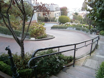
 About halfway up, a pedestrian staircase runs up the hill. I'm thinking it might be a pedestrian shortcut to the top, so I take it. Turns out there is a little park up there with a nice view. I should have looked around the park for a "back gate" but I don't see one so I just go back down the stairs and resume climbing the hill on the slopey sidewalk.
 At the top, one of the famous San Francisco cable cars goes by.
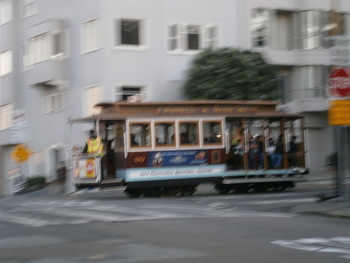 There it goes, up Hyde Street. As I cross the street, I can hear the cable groaning in the channel under street level.
 The famous crooked section of Lombard goes down on the other side of the hill, just as steep. This is looking down. There are scads of people with cameras doing the same thing, I'm sure that's irritating for the residents who live in these obviously fabulously expensive houses.
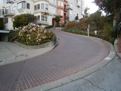 Looking up the hill at the "crookedest street in America".
At the top, at the intersection of Lombard and Hyde (this isn't the top of the hill, as Hyde keeps going up), I get a tremendous view of the city, including Coit Tower and dthe Golden Gate Bridge.
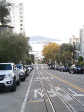 Looking down Hyde. Note the cable car tracks. Also note the cars parallel-parked by the curb. Even though the near car has its wheels cocked like we're taught in driver's ed, I hate to think what would happen if the parking brake failed.
 Looking back down Lombard. I can't see it behind the trees, but I daresay I'm level with the top of our hotel.
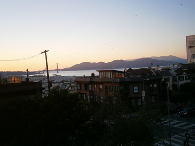
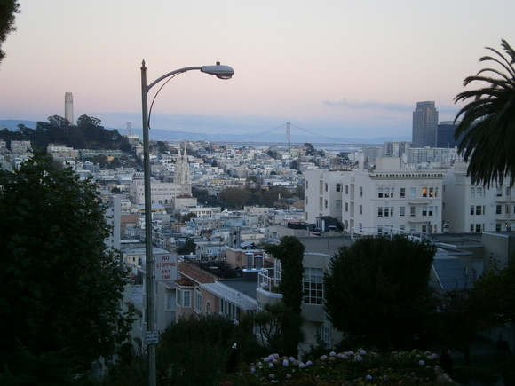
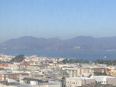 Meanwhile, Jerri is taking some photos from the window of our hotel room. We can see the Golden Gate Bridge from here.
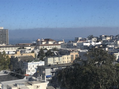 Over the city and across the bay to the northeast.
Charity calls shortly after I return from my little jaunt. At the end of the call, we do a Google Maps search for any eating places nearby. Los Hermanos is 8 blocks away. By the time I recover from some mis-steps and get there, it's around 8:45, and even though the website says they're open until 9:30, it's already closed. I had noticed a pizza place right across the street from our hotel, even though it's not (yet) on Google Maps, and when I return it is still open, so I step inside and get two slices of pizza and two cheesy garlic bread knots.
Note: Today's forecast said ther was a good chance of rain, which induced us to carry our umbrellas all day long. It doesn't rain.
Wednesday November 3: Point Reyes
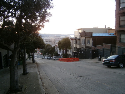
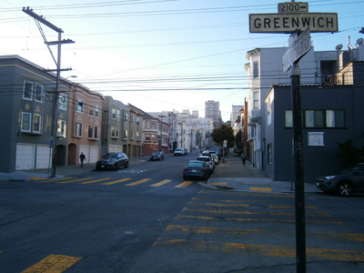 I've noticed a Post Office down Lombard from the hotel, about six blocks. Jerri sends me out to mail Charity's birthday card while she does her preparations. After posting the card, I figure I can walk back the scenic way, up Greenwich, the major street to the south of Lombard.
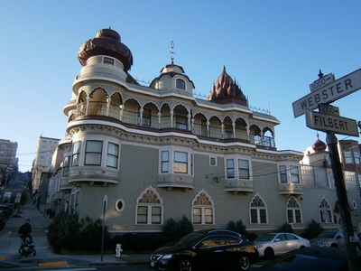 Very eclectic. I don't know if it's Russian or merely something fantastic in view.
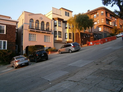
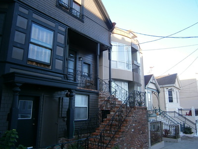
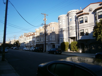 Typical streetfronts. I think it's amazing that all the buildings are different, even if they seem to share a light pastel paint scheme. I wonder if there is a neighborhood association that enforces some degree of uniformity.
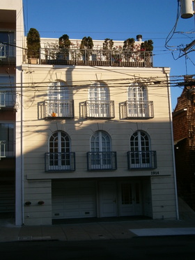 A house with a rooftop garden. Better than a back-yard. Unless you're a dog or a kid.
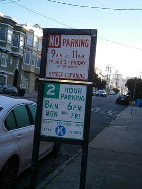 The streets are clogged with parked cars. Most of the buildings have a single-car garage, so I supposed if you have a second car, you just drive around town for a few hours twice a month until the street sweepers are done.
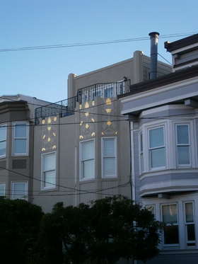 Gilt patterns under airy balcony.
 A string of very divergent houses. I'll bet it's tough carrying the groceries up all those steps.
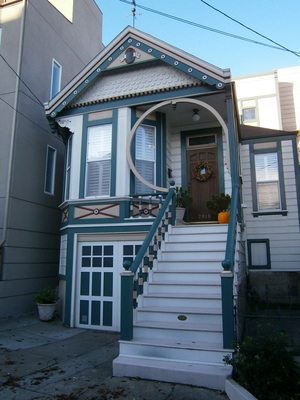 A classic Victorian with a modernist accent. Note again the tiny garage at street level.
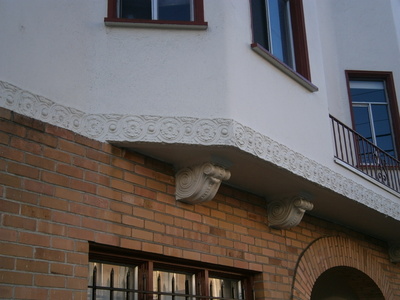 Architectural features of a sort you just wouldn't see any more. Even the frieze at the border is classic. I don't know if they can even do that sort of thing nowadays.
 I get the boring breakfast bags on the way back up to the room. It's not a bad hotel. Except for being optimal to see Russian Hill, I could wish it were closer to the waterfront. But I'm sure it would be rather more expensive if it were.
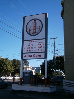 After packing up, fetching the car out of the dungeon, and loading it up, we are on our way. The objective for the morning is the Land's End visitor's center on the northwest corner of the peninsula, where Jerri hopes to get the "nice" Mile Rock Lighthouse stamp. It's not hard to get to, but when we arrive... open Friday through Monday. See? It's just hard to schedule everything, especially when most everything happens only on weekends. Driving back, we refuel for the day for ridiculous prices at a characteristic San Francisco gas station.
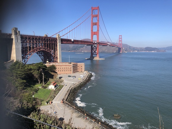
Jerri wants to stop at the Golden Gate Visitor's Center. When we've been by here before, it has been incredibly congested; today, I actually manage to find a spot in the pay lot in front of the center. Jerri gets her National Park stamp and some loot. The visitors' center, or more accurately the gift shop (there's not much else here) has informative displays about the builder of the bridge, the techniques involved, even the unusual color choice. Then we can go out and look around. At the end of the walkway is a great panorama of the Golden Gate Bridge, the entrance to the Bay, and Fort Point.
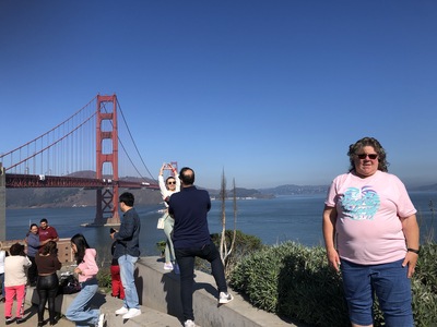 There are a lot of young families, especially Hispanic ones, and couples getting photos of each other in front of the bridge. Well... we do, too.
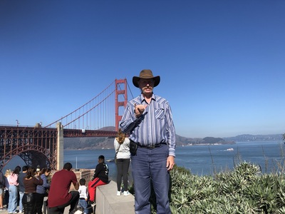 My turn. Hang loose!
 Way up north - Angel Island. We've been there. We probably won't be back.
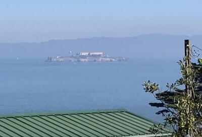 And just to the east of it - Alcatraz. Ditto.
 We are now ready to get back on 101, cross the Golden Gate for the last time this trip, and leave the Bay area. Where have we been this time? Coming into Oakland and seeing the harbor area, then up to Vallejo and the marina, then down to Tilden Park and over to San Pablo and a night at the East Brother Lighthouse. Then across the bay to the north side, down and across the bridge to San Francisco proper where we saw Alcatraz, Angel Island, and Pier 39. And now, Land's End and the road north. This time we do not get off at Highway 1, but the GPS takes us north of there and off 101 up a local highway through Marin County, through little towns like Lagunitas and San Geronimo (hah, as a Zonie, "Holy Geronimo" is pretty jarring). Lots of school crossings. A pleasant and non-stressful drive.
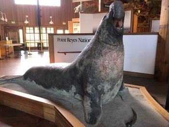 We get back on Highway 1 near the turnoff into Point Reyes National Seashore. At the visitors' center, Jerri gets her National Park and Point Reyes Lighthouse stamps and we look at the little museum. The elephant seal model here is pretty much identical to the elephant seal model at the Channel Islands Visitors' Center in Ventura. The ranger says it's about a 45-minute drive out to the point, one-way. Just down the road is Inverness, where we stop at a general store and deli and get some sandwiches. Jerri eats hers while I drive.
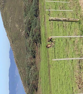 The Point Reyes region was originally settled by a family who raised dairy cattle. As we go along, we see the little signs "Historic Ranch B", and "F", and "M", because that's how the family set up all their individual operations. They have since sold out, and the ranches are in many cases still operated as dairy farms under new owners. In the field of one ranch, we spotted some deer.
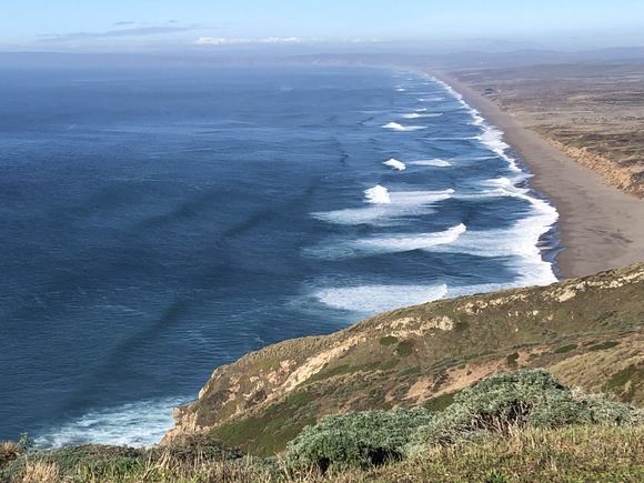
The road ends in a parking lot with restrooms and a footpath to the lighthouse site. It's about a half-mile long. On the way, there are fantastic views of the Point Reyes shoreline to the north.
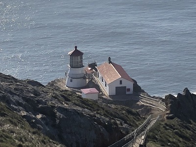 At the end of the footpath is a platform from which the lighthouse can be viewed. The lighthouse is closed except for the weekends (of course) and the tower is currently closed "due to COVID". So we have to be satisfied to look at it, and get Jerri's official picture with it.
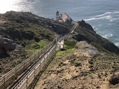 If we were here when it was open, we would have to climb down all these stairs to get to it. And then climb up all those stairs to get back. This is what the keeper's family had to do all the time.
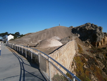 The catchment and the storage tank for the water for the fog whistle is way up here.
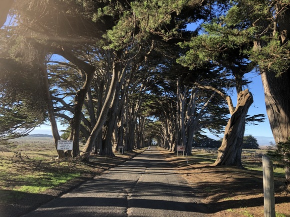
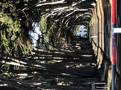
Done with the lighthouse, we start the 45-minute trip back. Jerri drives while I eat my lunch. Past the historic ranches. About midway, there's a feature indicated on the map - the Cypress Tunnel. Apparently the farmers had planted a windbreak of cypress trees and now they are all grown up.
 I think there is a building down there. There is also a "No Trespassing" sign on the gate. Which doesn't stop some people, clearly.
We take a scenic road through the hills from Highway 1 and the coast to where we pick up 101 going north at Petaluma. Our arrival time at Shelter Cove is 8:30 by the GPS. At Ukiah, we get off the road to grab a McDonald's sandwich for dinner. Still a long ways to go. As 101 continues north, it gets curvy, and as night falls, frequent rain showers fall on us and the highway gets even more curvy. At Garberville, we get onto the road to Shelter Cove. It runs through the forest, very curvy, rainy, fog in patches. Sometimes the fallen leaves scattered across the road obscure the lane markings. Some hairpin turns that happen suddenly. All of this in the dark, and due to the curves the headlights are only good for a few dozen feet out. It's a long miserable drive, and of course I'm trying to get there as fast as possible. Above Shelter Cove, the road drops down a steep grade, with many tight switchbacks, and more rain and fog. Finally we arrive at the outskirts of Shelter Cove, still doing down, and the brakes feel weird. At last we arrive at our hotel. It's a lot later than 8:30. Obviously the estimator couldn't handle the terrible road from Garberville.
There's a note in the box outside the closed office saying there was a problem with our payment, could we please ring the doorbell. After the lady, Donna, shows up and we get the problem resolved, she shows us the hotel laundry (there is no guest laundry) she is going to let us use. I shuttle our stuff up to the third floor, up the exterior staircases in light misty rain. The brakes on the old car smell burnt; I sure hope they work tomorrow. We start the laundry late at night. There are two washers and two dryers. They take a lot longer than the 20-30 minutes for the guest laundry at San Simeon. Then we discover that the left-side washer appears to have stopped after the wash cycle and we can't get it to unlatch the door. I go to the office and ring the doorbell to get Richard up after 11:30; he doesn't know how to operate the machines but confirms from Donna that the machine is broken. She had left the door propped open with a steel pan but had not warned us not to use it. It's too late to do anything now, we will have to let it sit til the morning.
Thursday November 4: Shelter Cove and Cape Mendocino Light
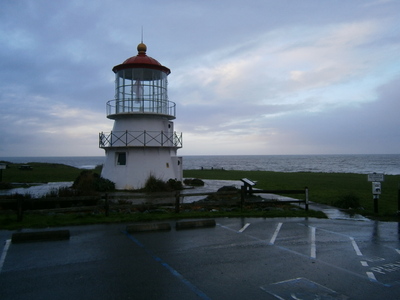 I arise a bit early and go down to the laundry; the clothes are still locked in the washer. The morning is cloudy but not rainy. I walk around a bit including a visit to the lighthouse in the next lot over to discover it's closed "due to COVID"
By the time I return to the room, Jerri is up. After a while we go down to check again and find that the clothes are now in the other washer on the rinse/spin cycle. We see Donna, and she explains how the broken washer needs a pump but she can't get it or can't get a repairman out here. Then we ask for breakfast recommendation (she says "Fish Tank") and whether she knows who has the stamp for the lighthouse. She says she will ask around. As we're finishing packing our clean (and rescued) laundry, Donna comes by the room with the name and phone number of the man with the stamp.
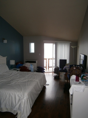 It really is a nice room. It's a bit of a shame to be here only for one night. But it is after all Shelter Cove in the Lost Coast.
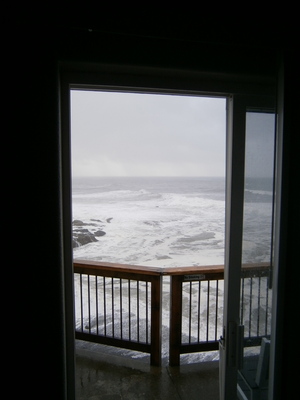 Outside the balcony door is a wild sea scene.
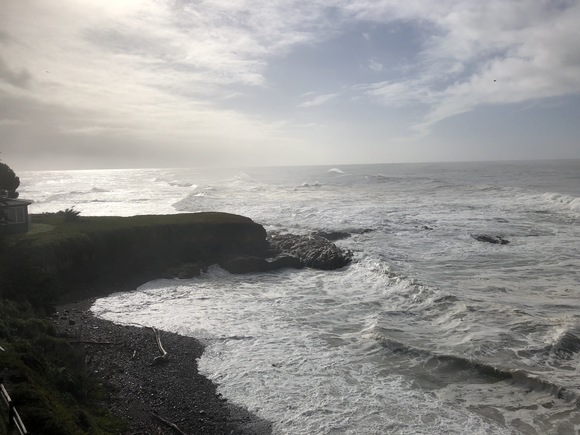
Looking south at the wild Northern California coast. There's a little bit of blue up there...
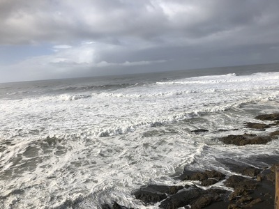 Looking south. Jerri would like to go down and do some beach-combing. I suppose I should have given in; it's not like we're in a big hurry today, but I'm worried about the brakes.
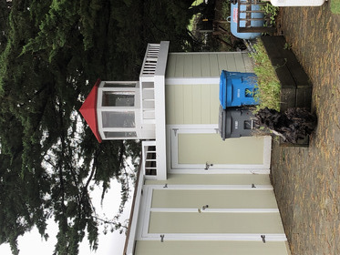 A little fake lighthouse, right here at the hotel.
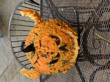 Halloween was just a few days ago.
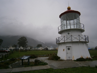 Cape Mendocino is out in the middle of the Lost Coast, a long stretch of coastal California where there are no roads due to light population and rough terrain. When the old first-order lighthouse was no longer needed and had been replaced by the usual low-maintenance automatic beacon, the Coast Guard offered the structure to whomwever would come and get it. The preservation society moved it to Shelter Cove piecemeal (I guess they could take the bolts apart?) and reassembled it right here in Mal Coombs Park. There are several plaques around the lighthouse, including one about the Coast Guard helicopter that crashed into the cliffs nearby on a Search and Rescue mission, and all the crew died.
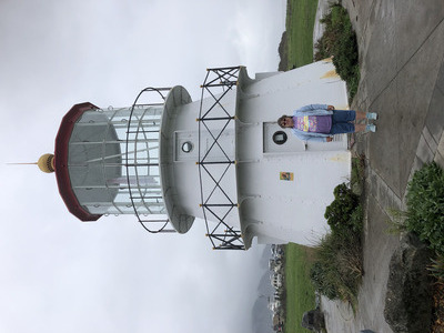 Official photo with Cape Mendocino Lighthouse.
 Mal Coombs Park goes right up to the edge of the cliff. I'm guessing there aren't a lot of young children in the community. Maybe it's nicer on other days, but if it's usually this dark and cool and wet, I can't see how this park would be appealing.
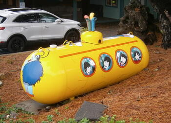 We go up along the north side of Shelter Cove to Wave Street. A local resident directs us to the corner of the inn there, and there it is, a teeny cafe with no seating. Nearby is a propane tank with an imaginative paint scheme and some PVC pipe accessories.
While waiting after placing our order, we chat with a schoolteacher couple from Long Beach in their 70s who are retiring to Shelter Cove. The man says that there is an EMT here and a helipad if an emergency requires an airlift to the hospital in Eureka (I think it sounds very costly, from what I know about the helicopter ambulance insurance offers I keep getting pushed on me). She's from Kentucky/Appalachia, and sounds it. We get our food and take it to the car (the picnic tables here are reserved for inn guests). It starts to rain lightly, while we eat and watch a young fellow blowing wet leaves off the inn decks and the street.
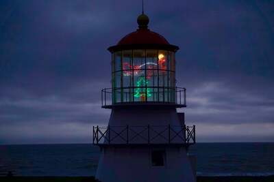 Then we go further up the hill to Whale Street. Dale is waiting for us, working on his next lighted display (a turkey) to hang in the empty lens chamber of the lighthouse. He shows us pictures of other light sculptures he's made, and tells us that other photos are available on Facebook (www.facebook.com/LostcoastCA). Like this Christmas-themed display! He tells us that the Coast Guard requires display faciilty with lots of environmental controls for the original first-order lens, which is currently too expensive for the Shelter Cove lighthouse society, so they are keeping it in storage (rather like Point Sur). He also assures me that the brake-burning grade of road is coming down to Shelter Cove, not so bad the other way.
capemendocinolighthouse.org
Now we're ready to end our exciting time at Shelter Cove and the Lost Coast. We go up the road quite a ways to the General Store/Gift Shop (gasoline, some groceries, camp stuff) where Jerri gets the two Shelter Cove postcards they have. Continuing along - Dale is not quite right; the road goes up the ridge and then down the other side, but this time I am careful to downshift and use the brakes sparingly. At least I can see road; it's not so bad in the daylight. It's still a long way back through Briceland to Garberville. There we get gasoline before getting back on Highway 101. Other than occasional rain showers, it's an uneventful trip up to Eureka. Except for the one time that the silly Dodge wipers screw up again, and I have to take the next exit and fix them. I think I will have to deal with this until we no longer have this vehicle. At Eureka, Jerri notices a nice-looking Mexican place, Tres Chiles Picosos, which is a great lunch but too much food. Check in at our favorite Best Western Humboldt Bay Inn hotel, where we immediately crash for a nap. That evening, I go out the secret door in the hotel property wall, walk down to the corner (which means crossing Highway 101 twice) to the Wendy's and get salads and Frosties for dinner.
For Part 5, go here.