Archives:
- Ten State Tour
- Gadsden Hotel
Cochise Co. - David's Sardinia trip
- Downtown Huntsville
- Pima County Fair '07
- Phoenix Trip '07
- Space & Rocket Center
- California Desert
- Saguaro Monument
- Rodeo Days '08
- Butterflies
- David's Sweden trip
- South and Midwest
Grand Tour
Pt 1 Pt 2 Pt 3
Pt 4 Pt 5 Pt 6
Pt 7 Pt 8 Pt 9 - David's Germany trip
- Biosphere 2
- Tucson Rodeo 09
- Sabino Canyon
- Rose Canyon Camping
- Southern California
- North Texas
- Labour Day '09
- Tucson Presidio '09
- Phoenix Trip '09
- David's Utah Trip '10
- David's Dallas Trip '10
- Colorado Trip '10
- North Arizona '10
- NmTxOkAr '10
- Portland & Maryland '10
- Las Vegas '10
- Dillinger Days '10
- Rodeo Days '11
- Penn, Maryland, WV
- Faith's SCUBA trip
- Mount Lemmon '11
- Los Angeles '11
- Phoenix '11
- Flagstaff '11
- Alberta, CA
- Glendale '11
- Pinnacle Peak '11
- Arizona Centennial
- 2012 Tour - Missouri
Pt 1 Pt 2 Pt 3 - Barrio Viejo Home Tour '13
- Apache Trail '13
- AZ Route 66 '13
- Tucson Walking Tour '13
- Veteran's Day Parade '13
- Lake Havasu '14
- Charity in France '14
- Colorado '15
- Medicine Hat/ Calgary '15
- LA & San Diego '16
- Phoenix Mystery Castle
- Sequoia & Yosemite
- Route 66: NM, TX, OK, KS
- NM, CO, WY, NB in '17
- Phoenix Summer '17
- July 4th '17 in Colorado
- Orlando '17
- Consumer Electronics Show '19
- Denver/Brown Palace '19
- Pacific NW '19 p1
- Pacific NW '19 p2
- Pacific NW '19 p3
- Colorado '20
- July 4th '21 in Colorado
- Texas Lighthouses '20
Ormand Family Activity
To read about our November 2021 California Lighthouse Tour, go here.
To read about our July 2021 Independence Day celebration, go here.
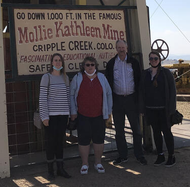
October 2021: Texas Lighthouse Tour
Up to now, the terms of my employment at Raytheon as a rehired retiree include a limit on my hours in order to avoid affecting my pension. This implies that I keep track of how much I work so as to not (a) use up all my hours before the end of the year, which wouldn't be good for me or the Program, or (b) arrive at the end of the year without working and getting paid for all the time I can claim. Since I put in a lot of additional time in the previous part of the year, I have several weeks I need to take off in order to accomplish both of these objectives, and so we made plans for extensive Texas and California vacation trips. Just before we left on the Texas trip, for whatever reason, Raytheon revised the policy for rehired retirees to remove the limit on worked time. However, we had already made our plans and informed people, so we are going all the same. Next year I may want to take advantage of the unlimited work time, considering how the federal administration is ruining the economy, but for 2021, we're going to see some lighthouses.
Before we leave, Jerri wants me to have the minivan inspected for road-worthiness. The time is too short to get it into a garage, so the best I can do is visit a drive-through lube and oil-change place. The one near my house took the car in and started working, but confessed that (in addition to being overworked because they can't hire enough staff - a common story anymore), there are supply-chain problems and they don't have the oil filter for our Dodge in stock. They inspect all the fluid levels, verify that the oil looks fine and doesn't need a boost, top off the radiator fluid, and don't charge me for the time. The car is as good as we can expect given the constraints, and as it turns out, it worked Just Fine.
Especially after Faith visited the previous weekend for the marriage of my niece Susanna. She used the van to visit her friends, and the next we hear from her, she is stuck in the Walgreen's parking lot just north of us. I went to look at the van with her, and concluded it was the battery. A nice fellow in a Ford pick-up gave us a jump - it took a few minutes with his engine running to charge the battery to where it would allow the starter to kick the motor over. He agreed that it was probably the battery. So we got it home and I took the battery to Auto Zone and confirmed it was bad and got a new one. Sure glad this happened on the day before we left rather than on the day after we left!
Tuesday September 28: Tucson to Big Bend National Park
The day after my 60th birthday! I can now claim the senior discounts at businesses on the road!
We finish the packing and leave later than I wanted (of course), and on the way, we stop by the dry cleaners to drop off a dress. Then it's down Alvernon to I-10. Everything is going fine until after Kolb, and then we run smack into bumper-to-bumper stop-and-go traffic in the eastbound lanes. At least an hour, creeping up, close, closer, until at last we're under the Houghton overpass and emerging from the road construction that has been dragging on for years. I'm fuming at the lost time; we should have gone around all this by taking surface streets to Vail. Lunch is grab-and-go chicken sandwiches at "The Thing". I've seen people wearing "The Thing" tee-shirts, and I've been thinking I really need to get one of those, but today is not the time (besides, we really ought to revisit the museum and see the actual "Thing" before I can legitimately wear the shirt).
Some light rain falls on us through Deming, and we can enjoy some magnificent rainbows. We are across New Mexico and out of Las Cruces in a couple of hours. As we go through El Paso, I am reminded of what a large and old city it is, full of different things; it calls for a closer look on a future visit. Dusk is already setting in; we already figured the nine-hour drive to the lodge at the Big Bend park would get us there late, but Jerri reminds me of something I forgot - most of Texas is two hours later than Arizona - it's effectively an eleven-hour drive! Jerri calls the lodge to inform them of our (very) late arrival; they apparently are used to that and give her the usual instructions for getting the room key. The road turns south at Van Horn, and we stop for dinner at Wendy's. The next surprise delay: There is a 30-girl volleyball team with two coaches getting their dinners. I note their nice uniforms and athletic jackets, so when we finally get up to the counter to place our order and the coaches are still there trying to sort out the complications, I ask where they're from. "Kermit, about two hours away on on the New Mexico border". The "Lady Jackets".
kermitisdtx.apptegy.us/o/khs/page/lady-jacket-volleyball--2).
After Alpine, the road is into the park is very twisty and I can't mainain the 75MPH posted limit. After 1 in the morning, we finally enter Big Bend National Park and zip past the empty fee booths. The signage in the park is a bit poor, and I have to turn around once to get on the road to the lodge. At last we arrive at 2:00. The late arrival arrangements are just as we were told. As I am unpacking the car, I notice how dark and starry the night is... this late/early.
Wednesday September 29: Big Bend National Park
Among the other things the clerk told Jerri last night, the lodge restaurant is not open for business, but they are providing bagged breakfasts. I arise early and sneak out to complete the registration before 9:00am, and discover that the "breakfast" is also not complementary. The sun is just kissing the craggy mountain ridges around the lodge. The content of the bags is "Hikers Breakfast": a bagel, cream cheese, yogurt, granola, an apple, and a little bottle of orange juice. After breakfast, while Jerri prepares herself for the day, I drift over to the ranger station to pay the fee (or actually buy an annual pass) and enquire about the availablility of gasoline in the park, since we arrived pretty close to running on fumes last night. There's a hiking couple getting advice from the rangers, so I hang out looking at their cougar exhibit. Meanwhile, a mother with her small child comes in. When the hikers are done and leaving, the mother looks at me and says "I'm in line here". I don't really care, since I'm not in a hurry, but the ranger knows I've been hanging around and so waves her off and calls me to the counter.
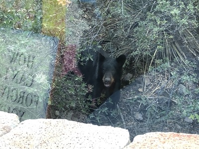 When Jerri is ready, she wants to stop at the ranger station to get her first stamp. Soon we are on the road down the mountain (well, as much as anything in Texas can be called a "mountain"). We had been told there was wildlife in the area, and sure enough, as I go around a corner, there's a bear shambling across the road. By the time we get to that place, she's already in the bushes, looking up to get her picture taken.
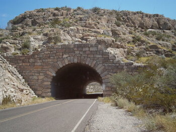 The first stop is the Panther visitor's center, where we look at the exhibits and Jerri gets a second stamp for her books. The station is midway between the two extreme points in the park, and Rio Grande Village is to the east, closer, and that's where the gas is. About twenty minutes later, we come to a tunnel through the ridges of hills around the river.
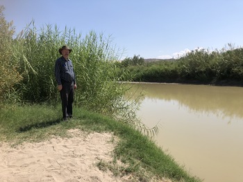 No stamp at the Rio Grande Village Visitor's Center; it's closed for the season. The camp store has a single pump. After filling it up, we continue into the "village" (campsite, really) to look at the river. It's not actually easy to get to, and the one place where the heavy brush is cleared away is the boat ramp. The river is turgid and green, and the steep banks are muddy. All the same, it is the famous Rio Grande, and Mexico is just on the other side.
In fact, Boquillas is a village on the border nearby. Under other circumstances, visitors can cross the border and visit, but nowadays, the border is closed to all that.
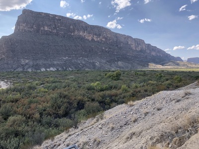
I mentioned above that the Chisos Mountains in the park was about as much "mountains" as there are in Texas. This is not the case just across the river. The awe-inspiring Sierras Del Carmen loom above the Rio Grande campground.
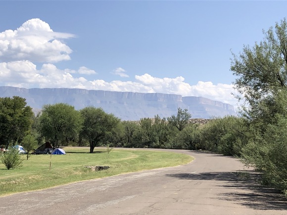
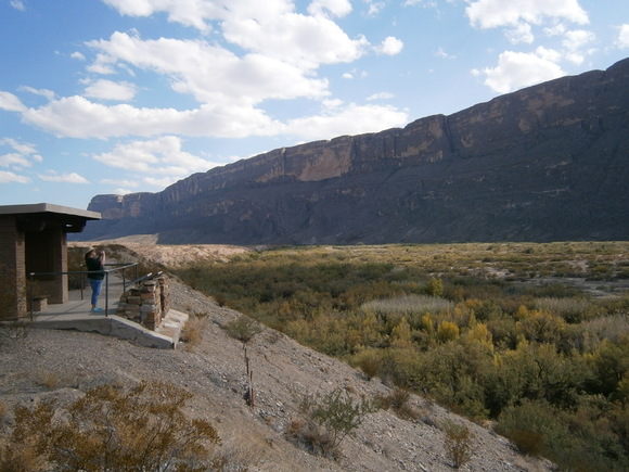
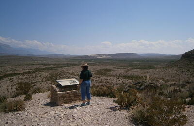 There's not that much in the Rio Grande Village to do after looking at the river (it is a campground, after all). The Rio Grande Overlook is a little ways on the road to Panther Junction and the rest of the park. The green strip under the farther ridges is the river, and those farther ridges are Mexico.
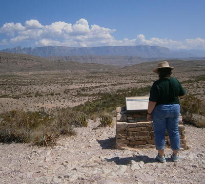 Even from farther away and higher up, the Sierra Del Carmen cliffs are impressive.
The ground up here is marked by fragrant creosote and mean prickly pear. When we're done enjoying the view, we return to the road and locate the turn-off for the Hot Springs trail. We follow about four other vehicles in. It's a dirt road, but it's not too bad. About a mile in, there's a sign indicating that the road is closed to "dual wheel vehicles". Is that motorcycles? Seems unlikely. I guess it means "two-wheel-drive vehicles. Like ours. It would be tragic to get high-centered in there or break an axle. We turn around and return to the road.
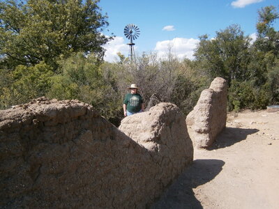
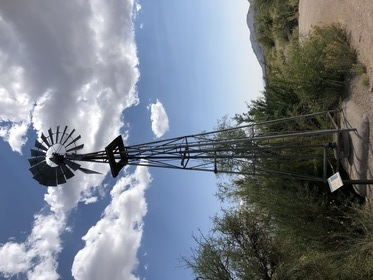 Further up is the turnout for "Dugout Wells". The placards indicate that there was a natural spring or seep here that produced a pool or an oasis. The settlers to the area developed this resource, and in time a schoolhouse was located here, the focus for the surrounding small community. There's nothing left but this wind turbine, which doesn't seem to be pumping anything. However, there is a lot of vegetation, including a few stunted palm trees, so there must be water even though it's not obvious after tracing through the trails in the little patch.
Back on the road, we blast (well, at the "safe" 45MPH park limit) on to the other side of the park, past Panther Junction and the turnoff to the lodge. The map shows a store at the Castelon center, so I'm confident we can get our lunch there. Oops.
 On the other side of the park, on the Ross Maxwell Scenic Drive, is a pull-off and a trail for the Sam Nail Ranch. On a whim, I stop and we look around. There is a short ~0.3 mile path through the oasis. At the heart is another wind turbine, and this one apparently pumps, for there is a soggy spot with bees buzzing around it and a "Contaminated Water" sign posted.
 The adobe ruins of a ranch building are also here. This was once a pretty nice place. Apparently, a lot of the vegetation here is shrubbery brought by the ranch family. It's just hard to imagine how this land could support any sort of profitable cattle operation.
The road continues on to and through Castelon. There is some Park Service restoration work in progress on what appears to be a former mining operation. Not even a town. There are some bits of old mining equipment standing around next to what appears to be a ranger station, but there's no sign of activity. The ruins are fenced off. There is an old-style gasoline pump in the fenced-off area, the antique kind where the gas was pumped up into the glass tank. There's the store - but as we walk toward it, a woman in a truck drives up, looks aside at us and says that the store is closed, but she couldn't remember flipping the sign over. It's 4:30. That's late for lunch, sure, but it's way too early for a store serving a campground to close. We should have been safe and got some sandwiches at the Rio Grande Village store. Hindsight is 20/20.
That kind of scotches the afternoon. But, since we're here, and the Santa Elena Canyon overlook is another six miles, we continue on and encounter an amazing sight. The river threads out of a deep canyon in enourmously high cliffs.
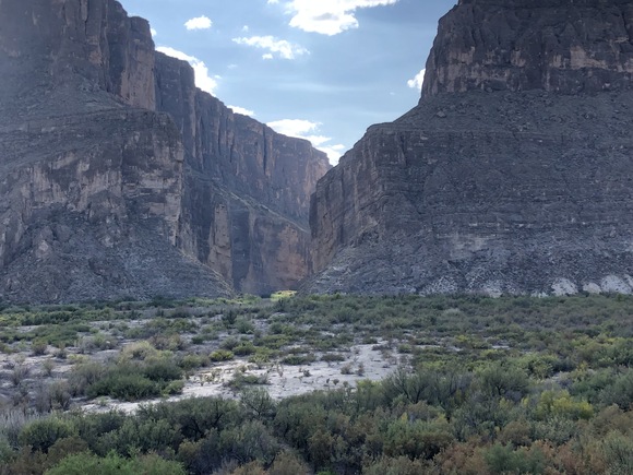
And then runs along the base of these stupendous mind-blowing cliffs. I suppose some die-hard uniformitarian could argue that Santa Elena Canyon itself could have been cut over eons by a much more active Rio Grande than we have now, but there's nothing less than a superflood that could have carved away everything in the valley up to these imposing cliffs.
 The cliffs extend to a considerable distance on either side of the mouth of the canyon.
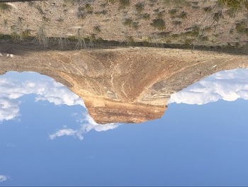 The return road loops around a majestic mesa, a landform unique to the area. From the map, this must be "Cerro Castellan", which obviously gives its name in a corrupted form to the mining installation.
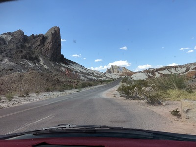 Just a little farther is a canyon with obvious volcanic formations. The whitish material is "tuff", or volcanic ash.
We get back to the lodge and our room in the early afternoon. This morning, I had discovered that, since the restaurant is closed for dining, visitors can turn in dinner orders before seven. I get a form and consult with Jerri and turn it in. Then we can have a little nap to compensate somewhat for the early arising after a 3:00am bedtime. After a couple of hours, I can go pick up the bagged dinners. The girl handing out the pick-ups informs me that the restaurant is operating on short staff, but they will be able to seat people starting this Friday and Saturday, if we're still around. We won't be.
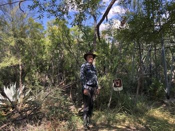
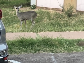 This morning I had overheard the ranger telling the hiking couple about the recommended sunset spectacle from the short Window View Trail in the basin. After taking the dinner bags (and tomorrow's breakfast bags purchased at the same time) to the room, Jerri recovers and puts her shoes back on and we amble over to the trailhead. On the other side of the parking lot is a mule deer.
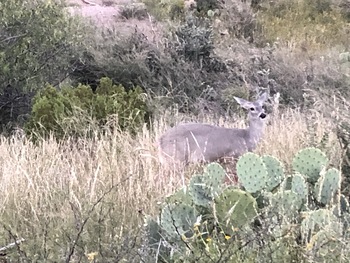 After starting on the path, we encounter a bunch of people looking at something off the trail. In a low voice, I ask what's going on, "There's a deer and her fawn", I'm told. Sure enough, just off the path is a doe and a little brown spotted baby. The baby is pretty nicely camouflaged and doesn't show up in the pictures, but the mommy is watching all these humans suspiciously.
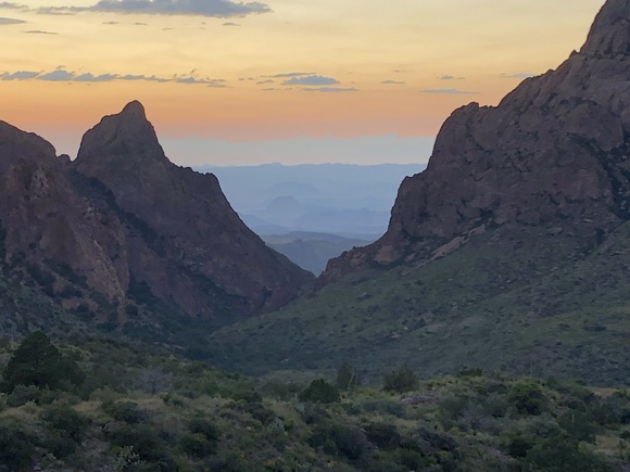
At the far end of the trail is the view of the "window"; a cleft in the rocky walls of the Chisos basin. We actually missed the sunset painting the walls red, but there's enough of the dying day to enjoy for quite a while.
In the gathering gloom of the approaching evening, we return to our room and warm up our meals in the microwave. Jerri's is a delicious pork chop and mashed potatoes, mine is salmon with an excellent cilantro-pesto rice, both include a side of mixed vegetables in a savory preparation and mixed-greens salads. Very good. Better if it had been served freshly cooked in a sit down restaurant.
Thursday September 30: Big Bend to San Antonio; Fort Davis
 The next morning, we attempt to rise early enough to see the sunrise in the Chisos Basin. Well, it's close. Then, after we pack up, and consume our "Hiker's Breakfasts", it's time for one more visit to the ranger station to finish seeing the little exhibit there and then to the camp store to check out some souvenirs. Jerri shows her picture of the bear from yesterday to the rangers, who remark, "He looks like he's smiling!"
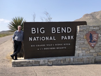 Official Big Bend sign photo; yep, we were here. Further up the road, I spot a dead deer on the side of the road - a buck with a full set of antlers. What a pity.
It's an uneventful drive out to Marathon - it's a much better road than the one we came in on from Alpine. If I'd known that, I would have continued on to Marathon and in this way rather than the "scenic route". Marathon is a dinky little place, but Alpine is somewhat bigger with an interesting-looking town center; I wish there was more time to visit little towns on our vacations.
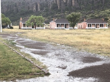
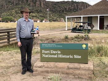 North of Alpine is the town of Fort Davis, and on a side road on the other side of town is the National Historic Site. Inside the nearest building is the visitor's center with an old volunteer who runs through the canned presentation. Jerri gets her stamp, buys some postcards, and we're off to walk around all the paths through the old fort. It's a fine, sunny day with a light breeze... so far...
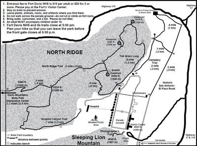 It's a typical 19th Century frontier army post, with the officers' houses and the enlisted men's barracks on the sides of the parade ground with a huge flagpole at the center, and the other structures around beyond that. There's a lot of reconstruction work going on, and it's not entirely clear from the brochure what is available for visitors and what is not.
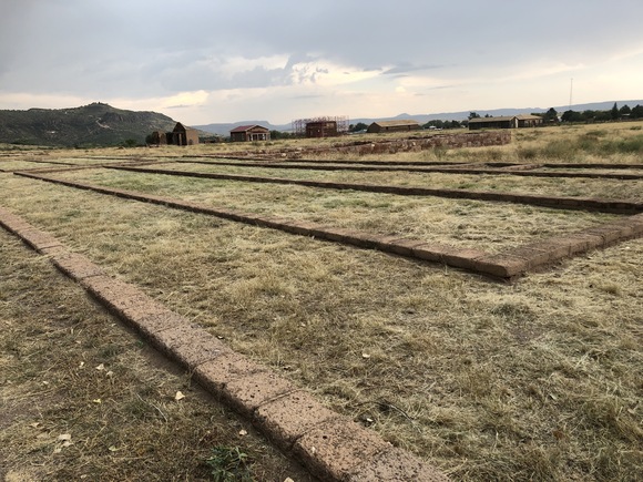
Some of the reconstruction is farther along than other bits. I guess this barracks will always only be foundations, since the barracks buildings we've already walked through are adequately restored. There's work off to the east from here, where the bakery, chapel, and commissary are located.
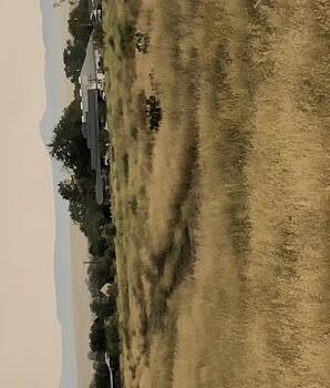 After looking through the commissary (and the examples of goods sold in the 1850s), you can step to the southern edge of the porch and see the remains of the old San Antonio to El Paso Road. This is what this fort was here for, to protect travellers on the road from Comanches and Apaches. I think I can make out wagon wheel ruts, as are still visible at the Santa Fe Trail site at Fort Union in New Mexico.
As we return from the side road from the commissary back to the main trail around the fort, the face of the day has changed. A cool wind is whipping through the grass, and the sky is darkening. However, it's still fixed in our heads that we're here to see the fort. Jerri sends me back to the car to get the jackets. From the map, it looks like the buildings at the north part of the loop in the trail are open for visiting, so I tell her to proceed to those buildings and I'll return there with the jackets. Within minutes of parting, I hear an ominous hissing sound from the mountain pass to the west, and the sky is strangely misty-white. Then suddenly the hissing is all around me and I'm being pelted with pea-gravel hailstones. Ouch! Ow! And then violent rain. I look back to see if I can spot Jerri on the path, thinking it would be better to fetch her and run to the buildings, but I realize she's closer to those buildings than she would be to the barracks buildings I'm headed to, and she will need her jacket. So I continue on to the porches of the barracks with the hail hammering my hat and the hand I'm holding onto the hat with. By the time I make the porch, I'm soaked through.
With resolve, I continue to the car and get the jackets out of the suitcase. The hail has stopped, but the rain has not. I put on my jacket and then stuff Jerri's underneath mine and head back toward those farther buildings - about as far as you can get on the park. There's no point in running; I'm already as wet as I can get and I don't need to make things worse by slipping or running into something in the blinding downpour. Eventually I make it to the buildings. Oh, great, they're not restored and available for visitors. I walk around them calling, wondering if Jerri had been able to return to the (rain/hail-proof) commissary, and then she answers from where she's huddled in a boarded-up doorway trying to keep out of the runoff from the roof. I help her into her jacket and off we go back again, trying to step across the rivulets and into the shallowest parts of puddles.
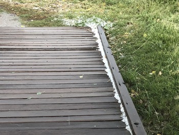 By the time we get back to the barracks buildings, the rain has moderated some. The hailstones are scattered through the grass and drifted into the corners of the porches and this ramp up to the porch.
 The rain water is sluicing from the trails and the parade ground. I think our visit to Fort Davis is over. As we approach the parking lot and manage to work around the big puddle in front of the footbridge by the welcome sign, another painful hailstore starts up. It's a relief to get into the car. After waiting without effect for the hailstorm to lighten up a bit, I give up and start the car and drive slowly over the hail spread all over the road.
It's still a long drive from Fort Davis to I-10 via Balmorhea. Just before getting on the interstate, it's not raining much at the moment so I can pull off the road and take off my soaking wet socks. We have to sit in our soaking wet clothes for another 50 miles to Fort Stockton, which is the first opportunity to see any sort of rest facilities and food. We change into dry clothes in the restrooms at the Burger King and get our lunch at 4:00. The Burger King has posters of Elijah Escajeda and Panther Stadium hanging on the wall; evidently a local high school athlete of some note.
Back on I-10, a series of terrific rainstorms assail us for about two hours. I'm trying to drive at the posted 80MPH through the spray thrown up by the big trucks we pass. Not fun, not safe. Then, suddenly the passenger-side wiper blade is taken away. This is one of the stupid things about the Dodge, that the wipers don't really cooperate well and can interfere with each other. Nothing to do but let it crank, but it's raining hard enough that the water is lubricating the wiper arm so it's not really scraping on the glass. Finally, the rain stops. It's late, past dinner time, and San Antonio is still more than an hour away, so I get off the road at Kerrville. At this hour, only fast-food drive-throughs are open, but as we are getting our dinner from the Wendy's, I notice there's a Walmart right behind it. And it is still open. After using the restrooms, on a hunch we visit the automotive section and luck out - they carry wiper blades, and there is a set for a 2006 Dodge van!
No more rain or other excitement tonight, and we arrive at San Antonio. Driving through the city, I note the downtown tall buildings are all trimmed with neon and lit up. After a wrong turn that the GPS gadget gets us out of, we arrive at our hotel at 10:30 and hang up our wet clothes to dry.
Friday October 1: San Antonio to Dallas; The Alamo, Texas State Capitol
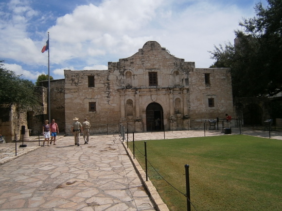
After breakfast, installing the Walmart wiper (lest there be more rain today), and draping the not-quite-dry-yet clothes over the seats of the car, we leave and drive a short distance on the frontage road to the intersection with Alamo Street. Approaching downtown, there is a detour for construction, so I give up my dreams of following a pre-planned script to "Alamo Parking", turn south on Broadway, and pull into the (as it turns out, somewhat expensive) parking lot at Travis. Right across from a big antique store in a great old antique building. Which we aren't going to have time to look into. Walking the two-block distance to the Alamo, we pass the Hotel Gibbs (www.hotelgibbs.com) with a historical marker about Samuel Maverick, a famous Texas Original upon whose land the Gibbs now rises. "We coulda stayed here!". And then on to the no-traffic Alamo block. The building to the west of the Alamo has lots of touristy attractions, the San Antonio Visitors Center, and the Buckhorn Saloon, billed as "the oldest saloon in Texas" (although now that I look closer, what I saw was probably just a tourist promo spot for the actual Buckhorn Saloon which is about a block west of here and turns out to be a museum as well: www.buckhornmuseum.com).
We are here primarily because Jerri understood that the Alamo was a National Park with a stamp; this turns out to not be the case; it is a State of Texas historical site, and is managed by a preservation organization (www.thealamo.org). There is a booth outside with a queue; nothing attracts a tourist's attention like a queue, so we join it. This is where we select the Audio Tour option (the timed-entry option is free, and Jerri already signed us up for the next spot). The audio tour is pretty well structured, with a little gadget like an audio recorder with a keypad, and a map with numbered circles for the code to punch into the device to get the narration for that location. If we had looked at the map before scampering up to the door for our "timed entry", we would have noticed that the first two locations are outside the facade.
The guide at the door tells us that this is a church, and men are expected to remove their hats. I think this is a charming throwback for this contemporary age, so I comply even though I note that most of the other male tourists keep their ball caps on. The inside looks like any number of Spanish mission churches we've been in, and the audio tour informs us that the building has actually had four stages of existence: Mission Church, Fortress, U.S. Army Warehouse, and Texas Shrine. The universally recognized facade of the building must have been restored by the Army, or the citizens of the new Republic after the war, because during the battle, the front of the church had been largely removed and an earthen ramp built up inside the building for a platform for cannon.
At the altar end of the church building is the shrine part - the list of names of the fallen heroes. We leave the building into the grounds outside and are told of the acequias, or irrigation canals, that bring the water here from the reason for the city: the headwaters of the San Antonio River. We are also told that "Alamo" means "Cottonwood", and that the "Alameda" was a feature of Spanish frontier towns, an avenue of cottonwood trees - something to remember when we get back to Tucson and our own cottonwood-free Alameda. There is a small area for reenactments (we don't see any of those), a cactus garden, a heritage pecan tree, and a covered walkway lined with an iron fence that incorporates many of the cannon used during the battle, to preserve them. I think of the 2nd Amendment, and how the Texas heroes managed to pull off the Revolution because they were armed on a parity with the government forces. Not so true anymore.
At the end of the tour is the exhibit hall. There are many interesting artifacts, particularly David Crockett's rifle and Stephen Austin's ring, which he gave to a little girl when he realized that he was not going to survive this siege to marry his fiancee. The exhibit served the more important function of putting the Alamo and the Texas Revolution in context. The designers were conscious of the inclination for historically-ignorant or misinformed young people (especially) to think the Revolution was a bunch of white Americans who infiltrated a Mexican state and then fought a war to "steal" it away from the rightful owners. No. The Americans (and Europeans, and many others) were invited by Mexico to settle a wild territory. These settlers were pleased to call themselves Mexican citizens and abide by the terms of their invitation and the Mexican Constitution of 1824. It wasn't until Santa Ana and the party favoring central control of the entire country from Mexico City took power and effectively abolished the Constitution of 1824 that Texas - and several other Mexican states - objected, and acted to reinstate the Constitution, first using legal or persuasive means but ultimately by armed revolt. It wasn't until after Santa Ana and the centralists had been seen to put down the revolts in the other states that the Texians (as they called themselves) realized that their only hope ("Liberty or Death") was a war of separation. I really appreciated the intent of the exhibit designers to be honest with the history. Reminds me a lot of our own current dispute between the centralists and the states-rights people.
At the exit of the exhibit hall is the drop chute for the audio gizmos. No chance to pick up those external narrations. Then on to the gift shop, where we pay $35 for the photo taken at the door. Ouch, but if it helps support the Alamo, then okay. On the way off the site, Jerri stops a deputy or trooper and asks about the national park thing. Of course, he doesn't know, but directs us across the street to the visitors' center. Well, we don't think we have time for that, so we'll pick up the info for our next visit. For posterity: www.nps.gov/saan.
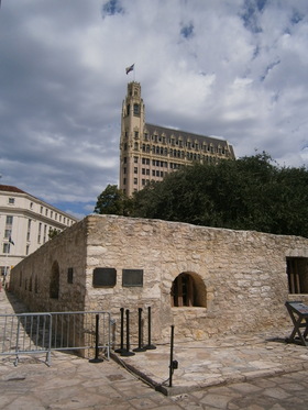 One aspect of downtown San Antonio is the integration of the historic with the modern city, like this high-rise looming over the Alamo complex.
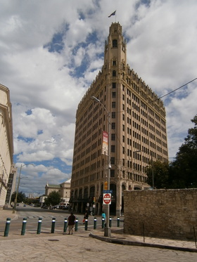 Which is a very impressive structure that turns out to be a Doubletree hotel
www.hilton.com/en/hotels/satemdt-the-emily-morgan-san-antonio
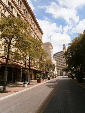 Rather than merely retrace our walk to the Alamo, I lead Jerri down this delightful tree-lined street with the gorgeous old multi-story buildings on either side. There happens to be a Jimmy John's sandwich shop over the doorstep marked "WOOLWORTH" in mosaic tiles. We take our lunch with us.
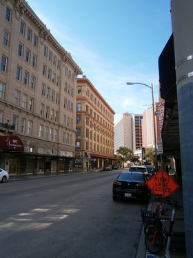 A streetscape. Probably San Antonio has different flavors in different districts, but right here, I think they achieve the integration of the historic with the new better than Denver. Plus, there is a closeness that Denver and especially Phoenix don't have.
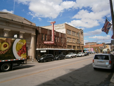 Our parking lot is at the end of this block. The antique store is the tall building. Next to the Hat store. Next to the classic building with the columns. How eclectic!
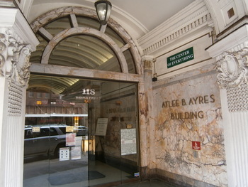 And beautiful. We pass a marble-lined entry to a building - labeled in true bragadocious Texas style, "The Center of Everything".
San Antonio is an old and beautiful and interesting city. Most people have heard of the Alamo, and a lot of people know about the River Walk (www.thesanantonioriverwalk.com). We noticed an observation tower driving into the downtown area from our hotel (www.toweroftheamericas.com). Not far from the Alamo is the old city plaza with the Cathedral of San Fernando, the Spanish Governor's Palace, and the old Market Square. Did I mention the Buckhorn Saloon and Museum? And the San Antonio Missions National Park? There's just so much to do and see in San Antonio that it simply demands a return visit for a week or so.
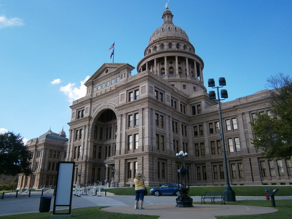
Getting out of downtown San Antonio is an adventure. To start with, I figure I will just follow the traffic down Travis, and as expected, there is a sign pointing to I-35. But there aren't any follow-up signs, and we have gone under I-35 with no sight of on-ramps. Then we discover the GPS gadget has decided to not accept touch-screen input. In the end, I just skirt along the south edge of I-35 until we get back to Alamo Street where we started, and then there is a sign and an on-ramp. Traffic isn't bad on I-35, and we sail along out of the city, out into the "country" (never really loosing the urbanization along this major route), and enter the Austin environs. Before long, it is ridiculous bumper-to-bumper stop-and-go for miles. Creeping along, we can see the dome of the Capitol off to the left. Jerri's cellphone GPS is saying to take the 11th Street exit, and I'm about to take it when she points ahead to the sign for the "Texas Capitol" exit. After a few wrong turns, we park in a structure conveniently right next to the Capitol grounds.
We are directed to the main entrance on the north side, and have to pass through a metal detector. This is different from the other capitol buildings we've visited lately. Inside, we note a tremendous density of heavily-armed state troopers. We don't understand this, but upon later reflection (and a suggestion from Uncle David), it's likely due to Texas' recent controversial abortion law.
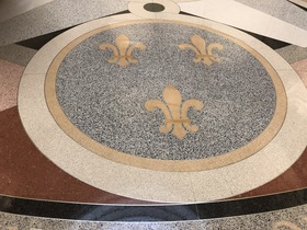
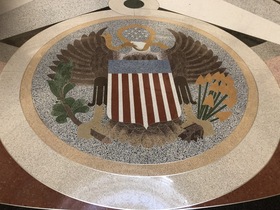
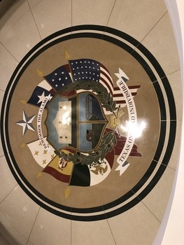
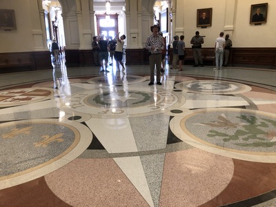 The first impression is the huge rotunda. I was expecting the usual State Seal inlaid in the floor; instead, there's the governmental history of Texas:
Originally, Spain claimed most of the New World, but France wasn't going to take that lying down. As we will learn later, France had some presence on the Texas Coast
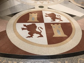
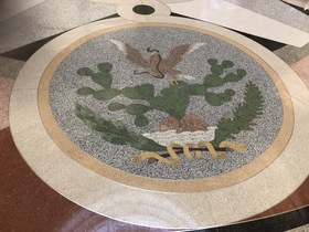
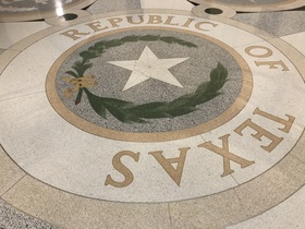
Of course, after throwing off the Spanish yoke, Mexico controlled the claims in North America until the Texas Revolution, which produced the Republic of Texas.
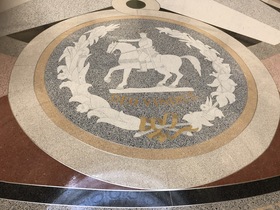
Briefly, the state was in the Confederacy. Now, Texas is solidly in the Union (at least, for now).
Looking up, the view is impressive. We will be told later that the Texas Capitol is larger than the United State Capitol, and the Statue of Liberty could be set up inside the Rotunda.
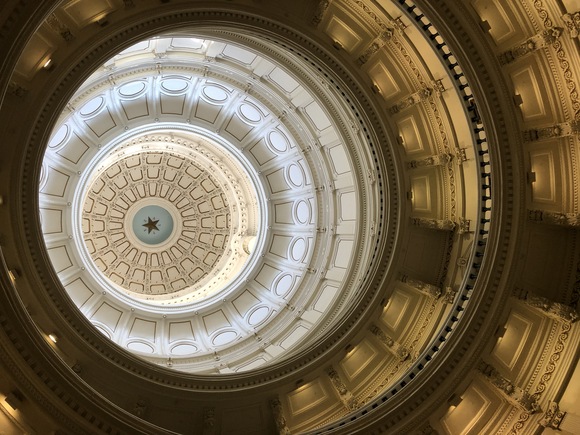
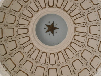 And way at the top is the Lone Star. Coincidentally, the star has five points, and "Texas" has five letters.
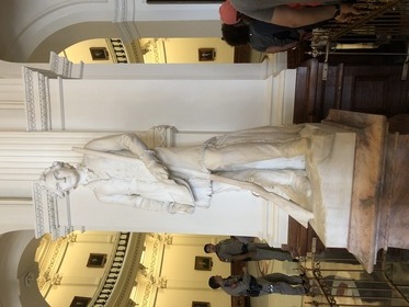
About now, I start enquiring about the passport stamp. I get directed into the Treasurer Office just off the South Lobby; the lady there has an embossing stamp, but she says "the real one is in the Capitol Visitors Center at the southeast corner of the grounds". It closes at 5, and it is now 3. While we are standing there conferring, a young man with a lapel pin asks us if we want to get in on the free guided tour. He is with the state preservation organization, and soon there is a gathering about him and the time for the tour arrives. We have time for this. He starts by pointing out the features in the South Lobby.
 Sam Houston was the general of the revolutionary army and the first president of the Republic. After joining the Union, he became a senator and then the governor. He had previously been governor of Tennessee, and therefore the only person to have been governor of two states - but didn't finish either term. The blanket draped over his shoulder symbolizes his status as an adopted member of the Cherokee tribe.
 Stephen Austin was an agent of the Mexican governor authorized for drawing settlers to the Mexican territory. He was the force behind so many American settlers coming into the region.
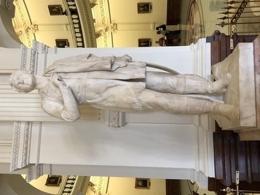
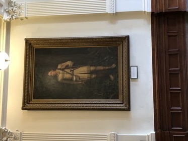 And David Crockett, hero of the Alamo.
Out into the Rotunda, the guide shows us all the portraits of the governors lining the facing walls on all the floors. He points out a pair of portraits on the second floor: Governor "Pa" Ferguson, impeached and removed from office for misappropriation of funds, which made him ineligible for reelection, but he got around that by putting forward his wife "Ma", who was elected as the first female governor of Texas.
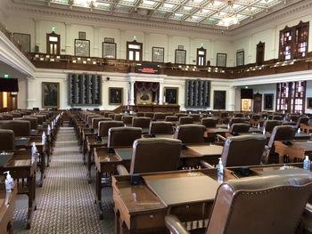
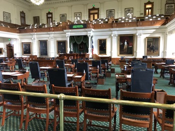 Upstairs, he shows us the Texas Senate chambers. The usual features for voting and telephones that were added to the historic wooden desks. And some of the portraits on the walls: Sam Rayburn was a senator for so long that when he died it was said "part of the capitol collapsed with him". Lyndon Baines Johnson later became the only native-born Texan president of the United States.
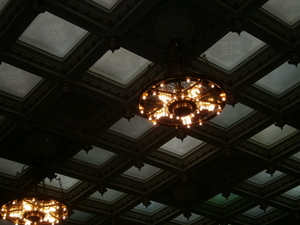 Lamps hanging from the ceiling. Have I ever mentioned how passionate Texans are about their Lone Star? I also note there is no skylight in here; all the other capitol buildings we've been in have skylights in the chambers.
 Then the House Chamber. The guide is extraordinarly moved as he points out the flag hanging behind the Speaker's podium: The actual original San Jacinto Battle Flag!
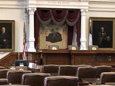 The building we are standing in is the fourth Texas Capitol, the previous ones having either been outgrown and replaced or burned to the ground. This precious artifact survived the fire because it wasn't there; an officer at the battle had taken it home and put it in his attic, and much later when his descendants unrolled it, they realized what they had.
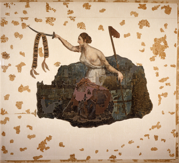 It was hard to make out how this was a flag. It seems that rather than sewing shapes together, the flag was a silk sheet and the "artist" had painted Lady Liberty. Not sure if the other things on the flag were intentional or consequences of its history since the battle.
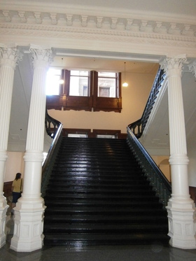 Some capitol buildings are all stone, and the Wyoming Capitol is mostly carved wood. This building is a combination of both. Also, it's typical for the "Grand Staircases" to the next level up to come directly from the rotunda, but in this case, they are tucked away in the wings. Lots of windows, very bright and airy, and the white stone (or iron work) contrasts with the dark wood of the staircase and bannisters.
While I'm trying to get this photo right, the tour has move around the corner, and they're not there when we go looking. Coming back to the staircase, I notice a door on the back side, and sure enough, there's another stair to the lower level. We see the tour way up ahead, but (a) we want to make sure we can get to the Capitol Visitors' Center before it closes at 5:00 and (b) Jerri sees the Capitol Gift Shop. At the desk, Jerri enquires about the passport stamp. Yes, they have one, but "the real one is in the Capitol Visitors Center at the southeast corner of the grounds". After looking around for a bit and making some purchases (and noticing that the other members of the tour group are coming in, so the tour didn't last very long after we lost it), we depart looking for a way out.
 There's an opening looking down on this Texas insignia embedded on the floor of the next level down. So, there are four floor above, and two basements beneath. Wow.
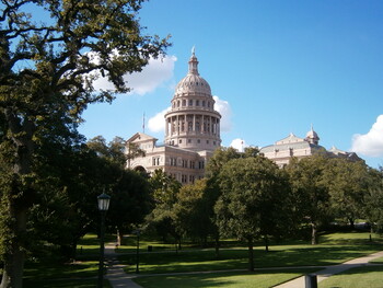 The Capitol rising from the trees of the lush grounds. Grey squirrels are running around everywhere. So are the armed state troopers.
It's a short walk to the Capitol Visitors' Center and the the Real Stamp. We don't have time to look at much, but there is a small room dedicated to the story of O. Henry, the famous short story author. I had no idea he was a Texas product. This was the pen name for William Porter, who at one point went to prison for a crime of embezzlement he probably did not commit, but he messed up by becoming suspicious when he ran away to South America. He wanted to preserve his anonymity for the sake of his daughter. The O. Henry room is right next to the Capitol Visitors' Center Gift Shop, so we have to go in there, too. I notice that in addition to the Capitol stuff and the Texas stuff, there is a lot of "Keep Austin Weird" merchandise and stuff for Austin's music scene. We leave just after all the office workers leave and before they lock the doors.
Now we have time to see some more of the grounds before leaving for Dallas. There are some women with poster displays set up on the sidewalk out on the sidewalk outside the grounds; they are yelling something but I can't make it out - Taliban out of Afghanistan? Opposed to the Texas abortion law? Don't really want to know.
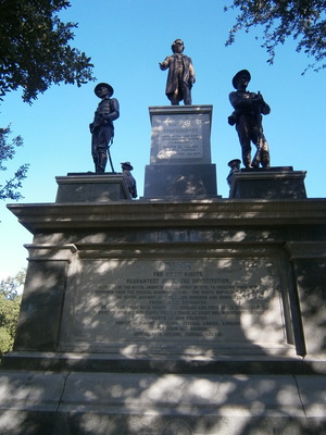 The Memorial to the Confederate Dead at the State Capitol. Wonder how long before the wokesters demand its removal. Hopefully Texas won't give in.
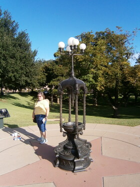 Another thing we learn is that the capitol grounds included an artesian spring, which was developed after the construction of the building (which originally relied on rainwater cisterns) to supply water to the Capitol and the grounds. This is an ornate iron drinking fountain originally supplied from the spring. It doesn't work now. Actually, because of the stupid virus terror, all the drinking fountains inside the building had been disabled.
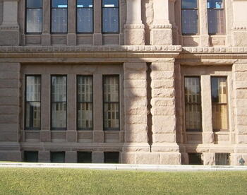 While we're standing here, I note that all the sun-facing windows of the Capitol are equipped with wooden louvres.
Back at the parking garage, I'm used to a pay station that takes your upon-entry ticket, but can't find any. Then I notice all the cars leaving through what appears to be a manned fee booth. I try to drive up there, but the signs in the garage are confusing. Okay, finally out, and headed back to I-35, where we rejoin the slow creeping mass of automobiles. After finally getting out of the Austin area and the traffic lightens up some, I realize it's going to be quite some time to Dallas. Then I spot a "Smoothie King" sign and suggest a treat and a bathroom break to Jerri, who agrees.
Feeling refreshed and sipping our smoothies, we continue on. As expected, it's dark and late and we're not even near Dallas yet. By the time we get to Waxahachie (don't you just love that name?), it's 9:00, and I'm thinking of Kerrville when the only thing open was the fast-food drive-throughs. I'm tired of sandwiches and trying to eat while driving, so I'm looking for a sit-down place. At Red Oak, we get off the interstate at a Denny's. Open 24 hours. The meal is fine, even though we're sitting in a booth and a couple in the adjacent booth are conducting a speakerphone teleconference with some other people.
Since the GPS gadget is still being annoying, Jerri navigates us up I-35, then Highway 20, and then up 360 into Arlington and/or Grand Prairie. We pass Six Flags on the left. I spot a Best Western, but the GPS is still telling us to drive on, and after a while we figure, yes, that was the place, and I have to do a U-turn and go back. The hotel has some radical lighting effects in the lobby; a fluid panel with bubbles lit by changing colors, and sort of a disco theme in the "business center". Upon unloading the car for the next few days' stay, I observe that the Fort Davis clothes are now quite dry.
Saturday October 2
The next morning starts with a disappointment. The hotel had advertised breakfast, but the previous evening, while scouting for the guest laundry, I had discovered the breakfast room in an obviously deactivated state. The desk clerk hands me two bagged breakfasts - packaged muffins, yogurt, fruit cup - not even as good as at Chisos.
I have been a supporter of the Institute for Creation Research (www.icr.org) for many years, and I have been keenly interested in the museum they have built, the Discovery Center (discoverycenter.icr.org), and have been looking for an opportunity to come to the Dallas area and experience it myself. Saturday is set aside for this visit.
The challenge about getting around in Dallas as a tourist is avoiding the toll roads. Fortunately, the internet trip planning services allow you to specify this condition, so I'm able to get from Arlington to northwest Dallas without paying for the privilege.
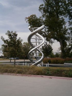 In twenty minutes, we see the landmark double-helix sculpture that I've been looking for. Today is Saturday, and I was expecting the parking lot to be more occupied than it is, but it's early yet.
It's a for-pay museum, of course, and there are three options: Planetarium, Exhibit Hall, and Combo. We get Combo tickets that include the first planetarium show. While we wait for the entry time, we start looking at the exhibits - a wall of artwork depicting human progress from ancient times (such as the Seven Wonders of the Ancient World) up through the Reformation. Then there is a "show" of the animated portraits of six great Christian founders of Western Science - Newton, Kepler, Boyle, Pasteur, Joule, and Faraday, but we just catch the tail end of it as the previous quanta of visitors are admitted by the volunteer to the next step of the hall. After chatting with the volunteer briefly, it is time for the planetarium show.
One of the best parts of my teen years was being at an affluent high school that had an actual working planetarium - and an astronomy science teacher who was quite enthused about her subject. Doubtless the basic reason why I chose Astronomy and Physics as my major at University of Arizona. So I always sit down in a planetarium with some sense of nostalgia. The show was about the solar system and observed characteristics that defy a long-ages naturalistic origin. Each of the nine planets is unique and bear signs of being young: Geologic activity such as volcanoes and magnetic fields for small worlds like Mercury, the Moon, and the satellites of Jupiter and Saturn that could not have persisted for billions of years. Venus and Uranus rotating the wrong way, and Uranus' rotation axis is tipped all the way over in line with its orbital plane; these curious aspects are in opposition to the prevailing theories of the naturalistic formation of the solar system. And then there are the comets, which decay every time they pass the sun and therefore couldn't be of any extreme age. The show was quite good, and just the right length. There are two other shows, but you pretty much have to commit to being here the entire day.
Then we go back to the exhibit hall, and stand through the entire "show" of the animated paintings talking to each other. I think it's a bit too long. The next "show" is a wide-screen animation of the six days of creation. I especially liked the expression of awe on Adam's face as he looked at the world he had been placed in (which really fit in with our frame of mind, having listened to the audiobook Perelandra by C. S. Lewis in the car on the way from Tucson). The show drives home the point, "and God saw that it was good".
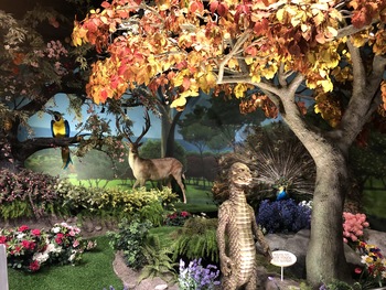 From there, the path goes into an animatronic reconstruction of the Garden of Eden. With a creepy anthropomorphic "serpent" that talks.
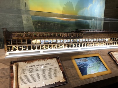 Next is an terrific ark model, presumably to scale for the little animal models inside. This is a good way to get an impression of the huge size of the ark. I notice the little animals are from store-bought toy assortments, and I'm not really surprised.
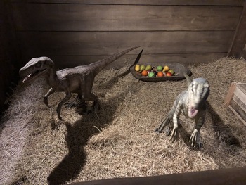 The walk-through scale model of the interior of the ark has pens for animals, such as the pair of small dinosaurs. This drives home the point that dinosaurs were certainly part of the assemblage of animals preserved from the Flood. There were also potted citrus trees in storage racks, suggesting how food plants might have been preserved as well, and metal lamps nailed up on the posts, to reinforce the Biblical concept that metallurgy was a pre-Flood technical accomplishment.
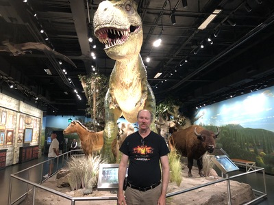 Stepping into the next room, you are accosted by a giant roaring animatronic T-Rex type dinosaur. While we were in the room, a family with some young boys entered, and the boys shouted with fear as the dinosaur roared at them. On the wall is a history of "dragons" from different parts of the world, drawing the connection between the dragon legends and the descendants of dinosaurs preserved on the ark.
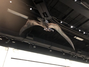 This pteradon clutching a fish circulates the room on a ceiling track.
An explanation of the importance of the Mt. St. Helens eruption was in here. Then a volunteer directed us into a (refrigerated) theatre for two videos about the Ice Age, and the creation-science concept of HEAT (Hot oceans, Evaporation, Aerosols, Time) that can explain the Ice Age as a consequence of the Flood. Some other useful points from these videos: The Ice Age produced ice and snow on only 30% of the earth's surface; there are hints of snow, ice, and frost in Job, uncharacteristic of the Middle East in the present; land bridges, and an ice bridge to England, provided access by men and animals; and animals adapted to the cold environments include saber-tooth cats, wooly mammoths, and the giant ground sloth (which grew to 12 feet tall!).
The next area was an exhibit about DNA and some of the amazing associated nanomachinery of the cell. Also an exhibit about dinosaur soft tissue and Carbon-14 in fossils and diamonds, things that argue against the secular/naturalist millions-of-years. This was the end of the "science" part of the museum; an involved diorama of the Life of Jesus led to a moving video of the Life, Crucifixion, Resurrection, and eventual Return of Christ - an appropriate gospel cap to the creationist mission. Like a Disneyland ride, the Exhibit Hall exits to the Gift Shop. Outside is a memorial wall for the founder, Dr. Henry Morris. The Gift Shop offers some of Morris' books, including the foundational Genesis Flood.
It was a very good museum, well worth the visit. I believe it was geared more to children in the ages of late elementary school to middle school. The clerk at the welcome desk told us that if we looked at everything, it would take most of the day. Instead of written placards at all the exhibits, the museum made extensive use of touch-screen displays, and I can see children going through all the possible menu choices of all the available displays, and if this was "looking at everything", then neither Jerri nor I had the patience for that. As a result, we had achieved a satisfying experience at the Discovery Center and we were walking out the door before lunch-time.
Out in the parking lot, I take note of some picnic tables under ramadas, but there was no cafe or food services at the museum, and no obvious food places nearby. This continued to be true as we drove down Royal Lane to I-35E, except for some Korean places. It's hard to choose a lunch place on the interstate; by the time you see something, you're already past any convenient exit. I see a "Golden Chick" place, Jerri is agreeable, and so I head off the next exit and backtrack half a mile. We ordered, but the staff staff had to be asked for the fries, then for catsup, then napkins; by the time we were done, we didn't even bother to ask for the "free ice cream".
The objective is to go into Dallas and have a look at the updated First Baptist property (https://www.firstdallas.org). We had visited some years ago, sort of a "religious tourism" experience, and I had been tracking them and observed their campus enhancement project. I'd like to see it for myself. As we approach from the north on I-35E, traffic once again becomes bumper-to-bumpter stop-and-go, and I am only too glad to take the Main Street exit and enter the downtown area through the famous Dealy Plaza. Right in front of us is the Old Red Museum (which we haven't seen yet), and down Main Street past Neimann-Marcus and turning north on Ervay (which of course, traffic prevents us from turning north, so I have to take a few right turns to be going in the right direction. We pass the church, turn onto Ross, and park in a metered spot behind First Baptist's parking garage. Yes, they have a parking garage. Jerri isn't interested so much, so I step out myself and return to the historic building and turn left.
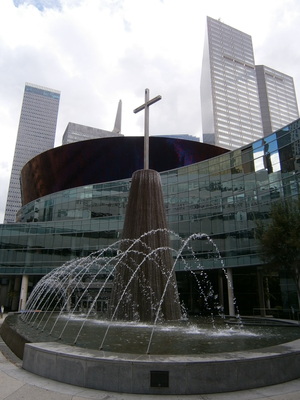 Well, it isn't as imposing as the website and the pictures make it out to be, but there it is - "Jeffress Plaza. Robert Jeffress is the current senior pastor.
Hmmm...
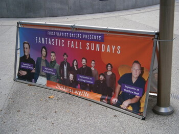 A banner advertises the artists to perform at the "worship services" over the next several weeks. Top-flight Christian entertainment. This is what "par for the course" looks like when you have gobs of club dues.
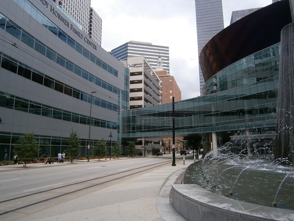
Across the street is a huge building occupied for some ministry associated with the church, and a "sky bridge" between the two buildings. This is an impression of the huge scale of the facility here in downtown Dallas.
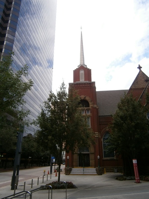 Back on Ervay, looking at the historic building. I think it's pretty neat that they kept the shell of the old building but use the entirety of the interior for the auditorium, which allows the huge "rosette" windows and the stained-glass to illuminate the services. It's a beautiful effect.
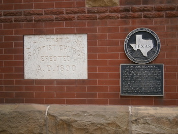 But maybe they had to keep the shell of the historic building, since it is a registered historical landmark. The church building was put up almost ten years after First Baptist Tucson (which was erected on the year of the gunfight at the O.K. Corral in Tombstone).
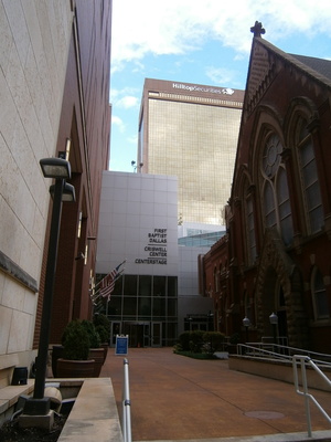 Looking up past the north end of the historic building at the Criswell Center. W. A. Criswell was a famous pastor and SBC president, and probably drove much of the growth of the church. Hence they honored him with his name on a building. But after his death, I'm sure. Unlike "Jeffress Plaza".
Well, that's enough religious tourism for this trip. I return to the car, and it's not too hard to get back on the interstate, and then to Highway 30. It's a long drive on 30 back to Arlington, and on the way, it starts to rain, heavily. I'm gratified that I put on the new wiper and that it works okay. Then we drive out of the rainy patch, and in a little while the traffic backs up unexpectedly. I'm going a little too fast and a little too close to the car ahead and I know I can't just slam on the brakes on a wet road. Thank God I narrowly avoid a collision by swerving into the adjacent exit lane. I have plenty of time to recover my breath in the long line of cars waiting for a traffic light at the upcoming construction site at Route 161. Fortunately, I can just go straight when my turn at the light comes and get back on I-30.
We have plenty of time for a windfall destination. We had been seeing big billboards with "The Biggest Christmas Store in Texas". Jerri looked up the Arlington address, and she navigated me there with her cellphone GPS.
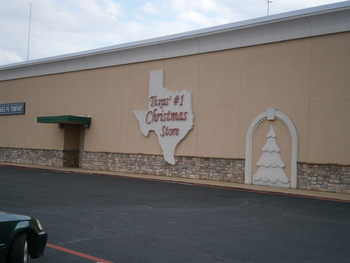 Well, it says it's Texas' Number One Christmas Store, but is that just more Texan bragginess?
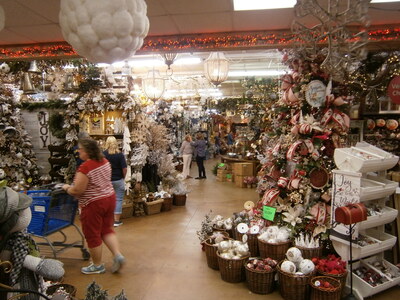 Mmmm Nope. It really is impressive. There are goodies on the shelves only before seen in catalogs. Jerri is good, though, and restrains herself. But then, it isn't Hallmark.
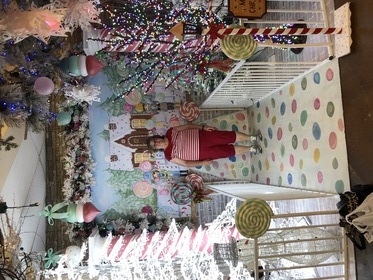 After checking out, Jerri poses in Christmas Alley.
Wow, we've done a lot today. But we're not done yet! Heading east toward 360, we stop at a Kroger's (yes, the parent company for Tucson's Fry's stores is in Dallas) for laundry supplies. Then we stop at a CVS drugstore, and the pharmacist competently manages to fill one of Jerri's prescriptions from our home store in Tucson. Then we return to the hotel, and it's time to reset the suitcase via the hotel guest laundry. We've brought most of the detergents and softeners with us, so I can fetch those out of the car and then trade some bills at the hotel desk for quarters. Then, while Jerri watches the machines, I go out and drive back to a Kentucky Fried Chicken place nearby. Our second dose of chicken today, eaten in the laundry room with the machines running, and occasionally dropping the greasy stuff on the tile floor.
Sunday October 3
It was a late night with the laundry, it will be a light day today, so we aren't in a hurry to get up. The first thing that happens today is a call from the desk to ask if we need a late checkout. Well, this is an unpleasant surprise. I ask if we don't have the room for another night, and after a brief check she finds the other reservation. Whew.
The plan for today is to meet with some old First Southern Baptist Tucson friends, Joel and Nancy Sparkman. They will be doing their church thing, and then we will meet them for lunch at 12:30. That's too soon for me to bother with breakfast, but Jerri wants a breakfast so I go down and fetch the boring breakfast bag from the front desk. We need to leave before 12; it's already late when we leave the room, and then we have to settle the new registration at the desk (which fortunately does not involve a room change). After an uneventful drive to Hickory Creek way north of Fort Worth, we find Joel, Nancy, and their son Luke at Palio's Pizza Cafe. Personal pizzas, anchovies are on the menu, so I can indulge! After the meal and some chat, we arrange to follow them out to their home in Ponder. However, there is an accident at the junction at the interstate; a car took the turn too fast and flipped - Nancy says she and Luke watched it happen! A lot of concerned people get out of their cars and run over to help the occupants escape, and almost immediately the Corinth police appear to manage the situation. Nobody appears to be injured, and there's nothing for us to do but maneuver around the traffic problem and get on the interstate.
Soon we are at their nice home on a huge lot (big enough to raise some cattle, or at least goats... probably not in their homeowner terms), way out from everything else. Joel has a standalone garage (the builders refer to it as a "barn", but Joel hates that label) that he has configured as a lab, and shows me many things he has built to teach physics (originally to his own children, but now he is teaching physics at a Christian High School), such as a golf ball cannon, an inclined ramp, optically-triggered timers, a vector addition demo tool with spring gauges, and many other amazing things. I also get to look at his progress in automating a home machine mill. Jerri and Nancy are chatting, and after a couple of hours I get a text from her that it's time to go. After some concluding family status discussion. we say goodbye for now and depart with new driving advice to Hurst. We are stuck behind a pick-up truck at the intersection with the local route because the traffic light is synchronized to the railroad gate on the opposite side, and the road drops off too much for me to go around the silly truck to turn right. Finally, gratefully, the train passes, the light changes, and we are free to continue on down south, through a few other towns and past the monstrously huge Texas Motor Speedway near the intersection with Highway 114.
We arrive at Uncle David and Aunt Judy's home in Hurst at around 5:30. When I get out of the car, I notice some pain in my back halfway up from my waist. I hope it's not a kidney infection, I'm thinking, but it sure came on abruptly. I sit suffering for a while, interspersed with fruitless visits to the bathroom, and then David gets me a straight-backed chair and I just tough it out, sweating profusely. After a while, the discomfort eases. Don't know what all that was about; I could guess "kidney stone", but I've no reference for the sensation. All's well now (I hope). Then my cousin Doug shows up. We enjoy some conversation about family matters, including David and Judy's intention to attend Aunt Yvonne's 95th Birthday (and my dad's early 90th) on the designated date of December 18th. And also how Yvonne's senior church group in Pryor, Oklahoma is going to take a one-day road trip to Branson, Missouri, to see a matinee of the JESUS show. Sure sounds like a lot for some older church ladies. David says his church group is going to charter a tour bus and go to Branson for about a week and see the show. We've been to Branson; I like it a lot, and I mention that I had floated the idea, only halfway in jest, for us to spend Christmas in Branson, since we and our children will already be in the area (Pryor is a three-hour drive from Branson).
(www.bransonshows.com/activity/JESUSatSightSoundTheatresBranson.cfm)
Doug tells us about his troubles with silly Facebook censorship and how he is making stop-motion productions using LEGO figures. He has done the Beatle's Strawberry Fields reprise (parody?), with some concern about copyright, and wants to do Shakespeare's Caesar, maybe with Captain America playing the role of Cassius. I've seen part of his original production of a story featuring Batman, Captain (Peggy) Carter (from the recent Disney/Marvel What If? series), the Shadow, and Indiana Jones. I can't really tell if he is doing all the voiceovers himself, but I wouldn't be surprised. I'm impressed with the digital effects he is able to create; the mouths of the characters move in synchronization with their dialog - it's just like watching a big-budget LEGO Movie.
We also hear about problems Doug and Scott are having with their jobs in the current conditions, and how Scott has gotten a new job that allows him to remain in the Jackson, Mississippi, area. David has called in pizza, and we join them for dinner. Afterwards, we say our goodbyes for now (for about two months) and depart back to Arlington and our re-registered hotel room.
Monday October 4
The day will start by meeting Jerri's sister Marybeth and her husband Bob for breakfast in the town of Ennis. We pack up the van and leave, retracing our route of a few days ago. Which means going down I-35 to Waxahachie again, and then eastward to Ennis. Jerri points out from the GPS that we could have stayed on route 20 until arriving at I-45 and then straight down to Ennis. My mistake. All the same, we get to the IHOP before Bob and Marybeth, and we pass by the Texas Motorplex, which has signs along the highway warning of "Event" traffic (must have been the weekend), and through the interesting town of Ennis. Over breakfast, I get some clarification: Bob and Marybeth are on their way back from Midland and the birthday celebration of their youngest grandchild, JoJo. The birthday party was a "Home Depot" party. I had been imagining that Home Depot stores in Texas have event rooms like Golf N Stuff and Chuck E Cheese places do in Tucson, but no; JoJo is a budding Maker, and her mother Jennifer had planned a Home Depot-themed party in which the guests constructed projects (and yes, even Home Depots in Tucson have Saturday-morning youth project events to encourage the next generation of Makers - and Home Depot customers). Ennis happens to be a convenient place on the route from Midland to Commerce in order to avoid the Dallas-Fort Worth megalopolis. After breakfast we say goodbye (for now) and continue down I-45 toward Houston and Galveston.
![]() I need to mention something at this point. Out of San Antonio, we started to see these giant "Buc-EE's" places. I mean, Texas giant. Since the billboards promoted food, I assumed these were enormous drive-in restaurants like Sonic, but no, they are gas stations more like Love's. With food, "the cleanest restrooms on the road", and Buc-EE's merchandise. Bob and Marybeth correct my understanding and tell me this is a phenomenon that started in the Lake Jackson / Clute area and has now spread all over and into adjacent states. There's a big one on our I-45 route in Madisonville.
I need to mention something at this point. Out of San Antonio, we started to see these giant "Buc-EE's" places. I mean, Texas giant. Since the billboards promoted food, I assumed these were enormous drive-in restaurants like Sonic, but no, they are gas stations more like Love's. With food, "the cleanest restrooms on the road", and Buc-EE's merchandise. Bob and Marybeth correct my understanding and tell me this is a phenomenon that started in the Lake Jackson / Clute area and has now spread all over and into adjacent states. There's a big one on our I-45 route in Madisonville.
(buc-ees.com)
Along the way, per Marybeth's recommendation, we stop at the Cooper Farms shop (cooperpeaches.com), a repurposed gas station at Fairfield, locally famous for their peach ice cream. We had already seen the billboards along the route. An assortment of candy reminiscent of The Purple Penguin back home, a variety of sodas a la Pops (pops66.com), preserves, fresh fruit, peach and pecan pies, and Cooper Farms merchandise. We load up on stuff and two large (too large) cups of peach ice cream.
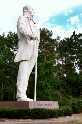 As we pass through the town of Huntsville (yes, just like Huntsville, Alabama, but this Huntsville is "famous" for the prison rather than the space and rocket business), I spot a giant statue of Sam Houston on the side of the road. Possibly oriented so he is looking toward the south and his namesake city.
(www.huntsvilletexas.com/148/Sam-Houston-Statue-Visitor-Center)
And yes, we pass through Madisonville, and yes, there's the giant Buc-EE's appealing from the east side of the road, but we want to get to Galveston while there's still light. It's lunchtime as we enter the Houston area, and I notice something: Most towns by the interstate have a few exits, three to seven or so, and most but not all exits have signs advertising gasoline, lodging, and food opportunities. Large cities for which the interstate is a major artery have lots of exits for every major street, but what I see in Houston are these business-promoting signs at every single exit. And so, we stop for lunch at Wendy's (this trip will be known as the Wendy's trip, versus the previous Burger King trip and the Subway trip). After a few more miles, traffic consgestion is mounting; the gas gauge shows 1/4 tank, so I might be able to make it through, but I'm thinking it would be the pits to get stuck in a freeway standstill for a long bit of time and run out of gas, so I pull off and refuel.
Houston is a Big City, and has a beautiful skyline.
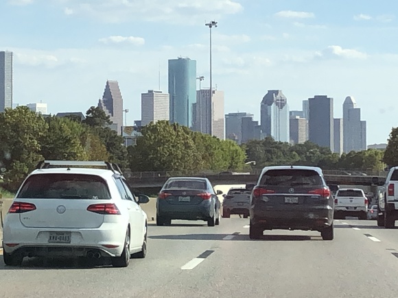
There is also an aquarium just off I-45 on the north side of downtown, and goodness knows what else. Probably worth a visit all on its own.
I'm glad I got gasoline; the downtown traffic isn't unexpectedly bad (not by Austin standards), but I-45 goes through downtown Houston - traffic is dense and fast and the lanes come and go, and trying to stay in the through-lane for I-45 (it technically goes straight to Galveston, but the path through Houston is confusing) is hairy and demands all my attention. I didn't want to be sweating the gas gauge at the same time. Eventually we leave the Houston area only to encounter road construction.
But traffic moves right along, and soon we arrive at Galveston. I-45 turns into Broadway, and we drive down through the center of the city looking at the sights, such as Bishop's Palace and other huge fancy mansions. At the east end of the island, Broadway frays out and we can just follow the signs to the ferry.
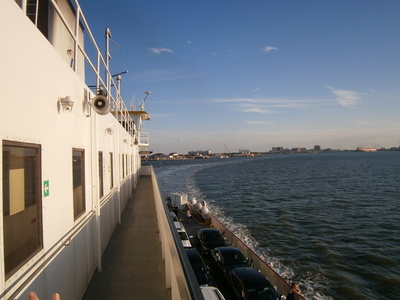 It's not as big and fancy as the ferries in Washington, but we don't have that far to go. And apparently, since it is considered part of a state highway, the ferry is free. As a consequence, there isn't anything up-stairs other than restrooms, a few benches, and the exterior viewing deck. Here we are up on the deck over the parked cars looking back at Galveston.
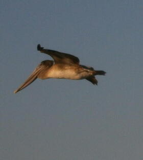 A flock of pelicans fly past. We haven't seen pelicans since our California lighthouse trip.
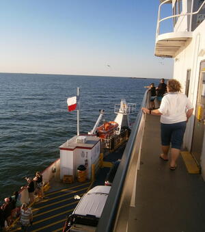 Looking forward. The Texas flag flutters at the bow.
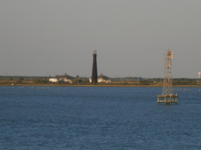 I had been concerned about our ability to locate the lighthouse after we get to Bolivar. It seems I was concerned of nothing.
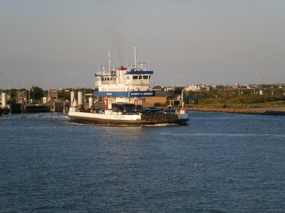 The companion ferry passes to starboard just as our vessel approaches the Bolivar landing.
There's more to Bolivar than just the lighthouse; there's a town here and some lodging. I had thought it might be better to stay here than touristy Galveston, but it turns out I'm glad we didn't.
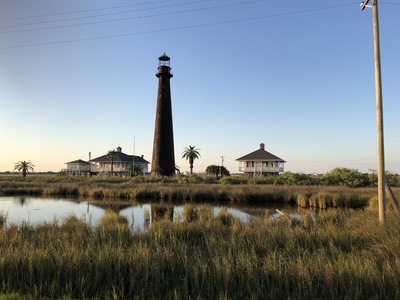 The Point Bolivar Lighthouse is impressive. It's also privately owned and not managed by the Coast Guard, so we can't go in for a closer look, much less go up inside.
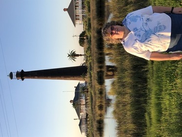 The "Official" photo of Jerri at the Point Bolivar Lighthouse, so she can get her stamp by mail.
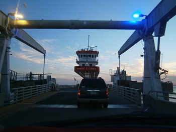 Well, that's all we wanted to do on Bolivar, so we just turn right around and go back to the ferry dock. After about twenty minutes, the ferry has docked, unloaded the eastbound traffic, and we can then drive aboard.
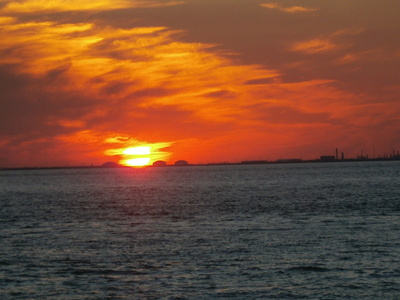 We got to Bolivar at the last possible time for good light. The sun sets over Galveston Bay.
On the return ferry, we happen to notice a young Hispanic family we saw on the trip over, so we aren't the only ones doing a "joy ride" on the ferry. After getting off the ferry, the hotel is right around the corner on the end of the island. As we check in, we learn about a problem with double reservations - Jerri had made the reservations on-line, needed to make a correction, thought that she had cancelled the extra reservation, but it turns out that the system can't really cancel reservations; you have to call the property directly to cancel. Renee the desk clerk was very helpful to resolve the problem, and we had a nice chat - she's from Italy, came to the U.S. very young, lived for a while in Pennsylvania and then moved to TX, met her husband in Galveston, and has worked at this hotel for the past 19 years and now she is preparing to retire. She gives us a good recommendation for a restaurant - The Original. After a bit of adventure trying to find it (it's on the north side of the island, not south of Broadway), we find it is a nice Mexican place; not Tex-Mex (or, as I've been corrected, "Jalisco" style) and not exactly Sonoran either. After dinner we return to our upgraded suite (with the whirlpool bathtub which we don't use).
Tuesday October 5
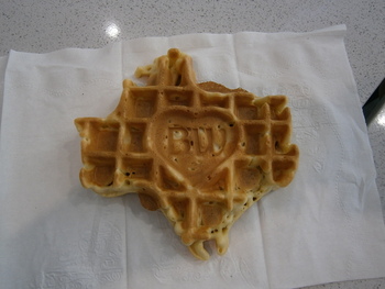 The hotel has a real breakfast. We are entertained by a young family with two active little boys and a black bird on the patio that wanted our attention. Yes, it was a real breakfast with real do-it-yourself waffles, and yes, the waffles are Texas-shaped.
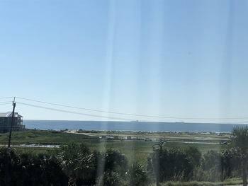 Before leaving the room, Jerri got some pictures of what the Gulf looks like from the window.
Having already done the Bolivar lighthouse, the day is committed to getting to Port Lavaca, some distance down the coast, but you can't really come to Galveston and not look around. Per the tourist brochure, there are two options: The historic part of town on the north side of the island with the fancy old houses and the upscale shops, pretty much where were were last night at The Original in the dark, or Seawall and the Gulf Coast and the beaches. Jerri picks the latter. We depart the hotel and attempt to enter Stewart Beach for beachcoming, but it's $12. Not that desperate. Then we cross the street to Walgreen's for drinking water and other stuff. After this, we can proceed to turn left at the intersection onto Seawall, and immediately there is free beach access. Well, free after paying for parking, and the only way to do this is the use of a stupid paybyphone website/app. Jerri goes on down to the water while I fight with registering with a cellphone app.
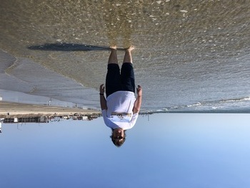 Our first encounter with the gulf in October. The weather is wonderful, the water is warm, and the beach is practically deserted. After picking up our first handful of tiny shells and taking some photos, we can return to the car and try to remove as much sand from our feet as possible before putting the socks back on (which is the major reason I'm not personally a big "beach" fan).
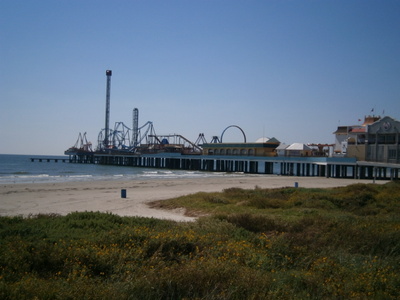 Another mile or so up Seawall, and we have come to the serious "tourist" area. After finding a parking spot (having paid for two hours (the minimum) and entered the license plate number, you can just park anywhere with the same "Galveston" parking code), we can walk along the actual seawall. Just to the west is Pleasure Pier. None of the rides appear to be running, and there weren't many people coming or going from the gate. It's obviously the off-season. Which is actually pretty darn nice.
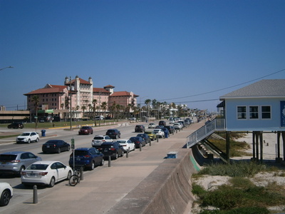 Yes, it's a tourist area, with big hotels and traffic. Probably much, much busier during the peak season. The bue building is Murdoch's, a purveyor of sea shells and tourist goods. There's apparently a back-story for Murdoch's, which seems to have some local history.
At this point, we've done as much Galveston as we have time for. As I've said many times before, it deserves a longer, better look. But probably in the off-season! There's a set of public Porta-Potty's at the curb - no paper. Then we can leave Galveston and embark on a series of local FM routes generally trending southwest. I divert from the route into Lake Jackson to check out Buc-EEs #1. I'm disappointed - it's pretty much just a small 7-Eleven. I can't really have expected more, since Lake Jackson is off any major routes that could justify a Giant Buc-EE's. This is, after all, #1, where it all started, and I should be content (for now) with that. And... the pump there also won't take the credit card. We continue through Lake Jackson and stop for hamburgers from Wendy's - which also won't take the card (fortunately I've got an alternate). And also gives us no catsup for the fries. More FM routes and state highways. At one point, the GPS has us going across Highway 35 onto a one-lane farm road for miles and miles before returning back to Highway 35. I'm sure there was a good reason for this, but we both think of the time at Yosemite when the GPS tried to send us up a rocky dirt road with a "No Outlet" sign.
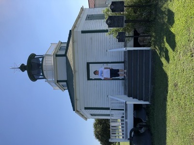 I have been driving furiously to get to Port Lavaca before the museum closes at 4:30. We get there before the time, but there's nothing resembling the picture of the museum from the visitors' website. Halfmoon Reef Lighthouse is outside the Bauer Community Center, and so the best we can do now is get a photo.
The Community Center is apparently closed, but we don't give up quite yet and discover that the side door is unlocked. Inside, we meet the custondian who gives us a map from the Visitors Center and tells us where the Museum is. We drive over there - yes, just like the picture, in the downtown area, right behind the DPS building and next to other Calhoun County buildings. It's right at 4:30, and we luck out because the door is still unlocked. The docent, an older lady in a walker, tells us some background on the Halfmoon Reef Lighthouse (there's a model of the lighthouse on the counter that she says came from Ace Hardware) and gives us the stamp for Matagorda Lighthouse. We don't want to keep her after hours, so we resolve to come back tomorrow to see the Matagorda lens, as well as return to the Community Center to get the Halfmoon Reef stamp.
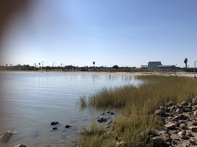 Returning to the Community Center as the easiest way to get back on Highway 35 to find the hotel, on a whim, we pop into Lighthouse Beach Park. Which appears to be largely an RV campground. However, the beach is entirely deserted except for seagulls, We walk out to a point by the closed-up fishing jetty and take photos. I notice what appears to be oyster shells down by the water... next to a dead seagull. Then we walk back along the beach picking up yet more shells. Two fellows arrive in a truck and unload kayaks and fishing poles; they are dragging them over the sand to the beach as we leave.
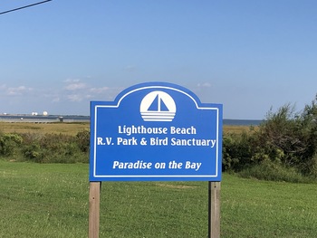 As we leave the park, Jerri gets a photo as a remembrance of where we were.
The Hotel is Right There. In the parking lot are several mud-covered work trucks and large men. After planning to arise early to do all of tomorrow's stuff, I see what dinner opportunities are in the vicinity: Mexican, steak, and an Italian restaurant. Jerri selects the Italian and so we go there, over on Main Street. It is run by two sisters, and the food is not bad, but there's too much to allow for dessert. After dinner, I continue down Main Street - we see the other Mexican and the steak places, a couple of seafood restaurants, all of them as small and quaint as the Italian place; a hardware store, a preschool, a craft shop, Port Lavaca's sad theater, and many empty storefronts. Back at the hotel, we consider using the pool at the hotel but observe two large men with their beers poolside and decide against it.
Oh, and I have gotten a call from USAA. They put a stop on my card because of the stupid parking cellphone app that looked like a fraudulent charge. There, fixed now.
Wednesday October 6
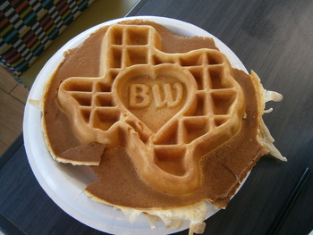 Today is an early morning, so we can do everything planned for today as well as what we didn't do yesterday. This hotel also has a real breakfast. With the ubiquitous Best Western Texas-shaped waffles. We are all by ourselves; it looks like the large men and their muddy trucks have mostly all left for their work assignments today. I notice the hotel staff helping themselves after all guests served (which is pretty much just us).
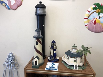 The first stop after packing up and checking out is to return to the Bauer Community Center, where in the Chamber of Commerce office we find a nice lady with a thick Texas accent. After getting the Halfmoon Reef stamp, we ask about having the lighthouse opened so we can see inside, as suggested by the musuem lady last afternoon. She says that the lighthouse is not open because the Historical Preservation people haven't fixed the A/C, and it's been closed for about three years and it may be moldy inside. But the lighthouse is owned by city and managed by the historical people - sounds like bureaucracy wars to me. On a little table by her desk is model of the Matagorda lighthouse (and another Ace Hardware halfmoon Reef model). She tells us that yes, we would have to contract a skipper in Port O'Connor to take us to the Matagorda Island dock, and yes, it's a three-mile hike to the lighthouse, and yes, there are snakes and other critters in the grass. Nope, not gonna do that. She also tells us that the Matagorda Lighthouse is decaying - cast-iron plates are rotting and falling off.
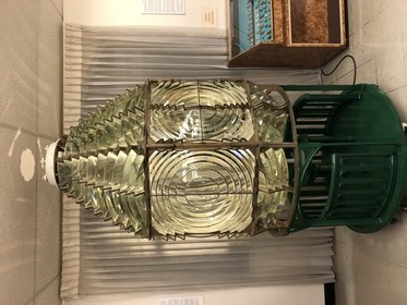 Then we return to the museum. There's a different lady there this morning, and she takes us right to the third-order lens for the Matagorda lighthouse. She then offers us a guided tour of the museum. We learn many things:
- LaSalle landed his French colonists here by mistake, instead of at the mouth of the Mississippi 400 miles away. The French behavior angered the aggressive Karankawas, who pretty much wiped out the colony. One of the four ships sank in the channel here, and was excavated with more than a million artifacts, many of which are on display here in the Calhoun County Museum.
- The Karankawas were worse than the Comanche, and also cannibals (she says that all the Texas tribes except the Comanche were cannibals). They were very tall and imposing. The Camanche went on the warpath following an indiscrete handling of a hostage situation and raided as far as the coast. I knew the Comanche were a Plains people that operated in West Texas; I had no idea they got this far east and south, all the way to the coast.
- The port city of Indianola was built up to be the Number One Texas seaport. After a hurricane leveled it, they rebuilt the town, but after a second hurricane destroyed the place (of which a piano there on exhibit survived), the city was abandoned.
- A riverboat captain named Richard King was operating in these waters and saved up his money from his profitable operation. He bought land for a ranch in the interior - which became the famous King Ranch.
- The teams of Port Lavaca, or Calhoun High School, are the Fighting Sandcrabs.
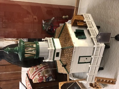 There's lots of things in the museum of especially regional interest or specifically to the town of Port Lavaca. Here's a nicer hand-made model of the lighthouse. Note the outhouse on the deck. She told us that the Halfmoon Reef Lighthouse was so isolated that the Lighthouse Service bent the rules and allowed a married couple to operate it. They had a number of children, and one of the daughters walked in her sleep - that's a bad thing on a lighthouse, so they solved that problem by tying a string from her ankle to her sister's toe. Some years ago, the last son from that family came to visit Port Lavaca and the lighthouse, and told many other stories.
calhouncountymuseum.org
Well, that was fun, even if it took longer than expected. We depart and drive to Rockport, which is not far away. There we stop at the Texas Maritime Museum (www.texasmaritimemuseum.org). Why? Because the US Lighthouse Society has the museum as a stamp location. Possibly due to the big fake lighthouse. But the lady at the desk blinks at us and says no, they've never had a stamp. I am somewhat surprised that the USLHS has them listed as a stamp location and we seem to be the first lighthouse fans to come here and ask. Well, we're here, we might as well look around.
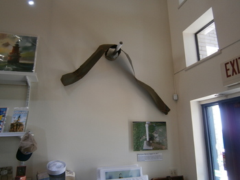 The lady points out a bit of twisted sheet steel hung up in the gift shop/entry way, and tells us that was what was left of the museum roof after Hurricane Harvey came ashore some years ago. Most of the houses in Rockport got new roofs after that.
The main part of the exhibit here was a reprise of the Port Lavaca museum stories about LaSalle, including a beautiful large model ship and some navigation instruments and bits of French cannons. I suppose the LaSalle episode in the Central Texas Coast region is the basis for the claim of French dominion at the Capitol. That's pretty thin.
The best part for me was an introduction to something I had never heard of before - the Texas Navy. When the problems with Mexico started, the leaders of the Revolution realized they needed a sea presence, and commissioned acquisition of four vessels. We've all heard about Goliad and the Alamo and San Jacinto, but it seems a major, even critcal role was played by the Texas Navy capturing cargo ships and diverting supplies to Houston's army and away from Santa Ana's.
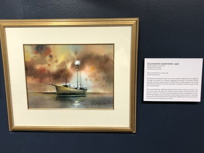 There is a series of paintings of the Texas lighthouses, quite a few more than we knew about. There were even a couple of Lightships, such as the Galveston.
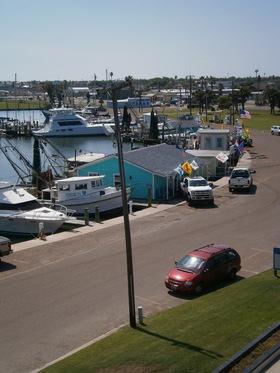 The "lighthouse" is just a fun observation deck. Mostly of the marina, lined with little bait shacks. There's our trusty steed.
It's not a big marina, but it is a pretty nice one.
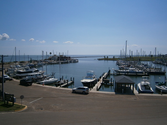
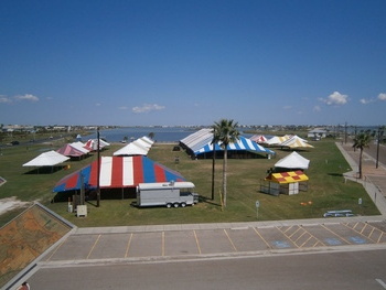 When we drove into Rockport, there was a banner stretched across the road advertising Seafair. They are getting set up for it to start this weekend, but I guess we will just have to miss it.
www.rockport-fulton.org/Seafair-Home
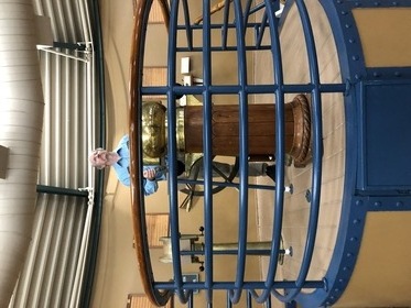 Here's a salty dog at the wheel.
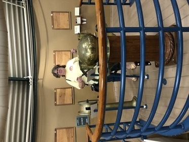 Not to be outdone, a cutie takes the wheel.
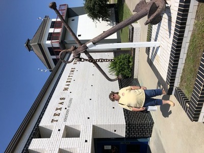 That was fun, even if it didn't result in a stamp. Here's the "official" proof-of-presence photo against the time that Jerri finds out from the Lighthouse Society what the deal was for the TMM stamp.
Mapquest said it would take less than an hour to get from Rockport to Corpus Christi. For some reason, the GPS takes us on a route of much longer than that. In fact, it takes us by Portland, quite a ways north of CC and where our hotel is. I take note of the hotel and the amount of road construction all along this stretch of Highway 35. After Portland, it's about another ten miles to CC, and then about another fifteen to Padre Island, and then about another ten to the our destination: Padre Island National Seashore (PINS), where Jerri expects to pick up another stamp. I flash our new Interagency Pass at the fee booth and get waved right through. It's a little ways yet to the Visitors' Center. Jerri gets her stamp and looks at the merchandise, and I get involved in a conversation with the talkative volunteer - he was a chemical engineer for several Corpus Christi-based companies, then retired, and now he substitute-teaches and volunteers. He's got information about the turtles - Padre Island is where a lot of Gulf-based sea turtle herds place their eggs - and all the training volunteers must take to recover these eggs. Then we go down to the beach and collect shells, see little jellyfish washed up (the visitors' center had posted advice to deal with jellyfish stings with vinegar), and watch the little sand crabs skitter to their holes. After picking up her next handful of shells, Jerri and I sit at a beach-side picnic table and watch fish jumping in the surf.
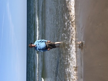 David puts his feet in the gulf. The water is pretty warm for October, and shallow for a long way out.
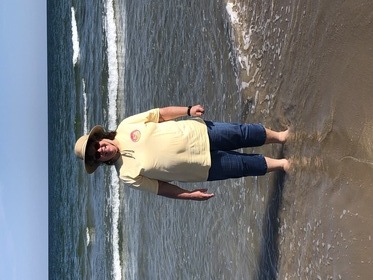 Jerri takes a break from beachcombing. There's not very many people out on the beach today. Again... this is the Off-Season. Pretty nice.
The Visitors' Center has a bathhouse with showers, so we can wash the sand off our feet before putting our shoes back on. There's an observation deck reached by a flight of stairs (with lots of amazingly large blobs of seagull poop). The view is worth the climb.
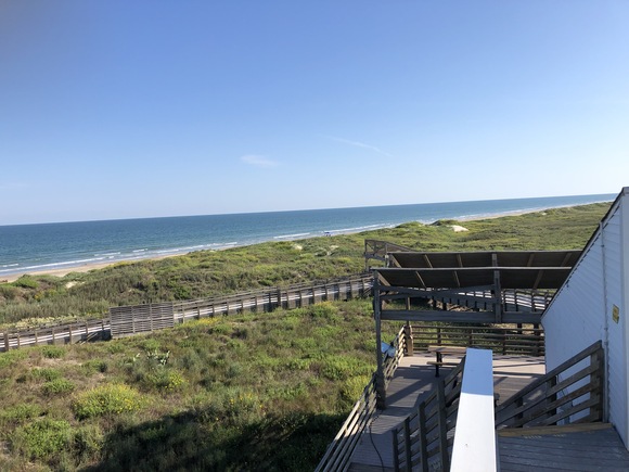
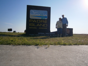 On our way out, I can use the tripod I had packed but couldn't find until recently and take our official "yes we were here" photo.
Most of PINS is remote roads, beachside camps, and four-wheel-drive tracks. I would not have expected this to be a major recreation destination, but at the small "town" on the Island just before the road to the park there are touristy shops.
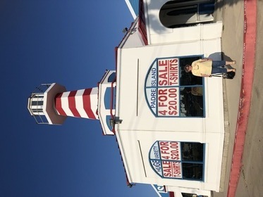 Like this one with the fake lighthouse.
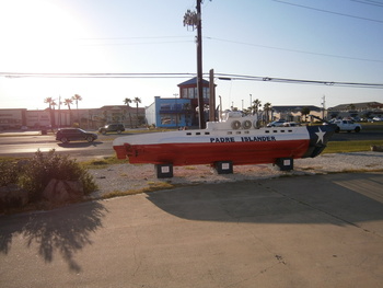 And a mini-sub with a Texas Flag paint job.
As we were driving in from CC, there were road signs for a naval air station out here. The yakky visitors' center volunteer said it wasn't very large, but even so, that means sailors and Marines looking for places to relax. I'm sure a lot of them have national park passes.
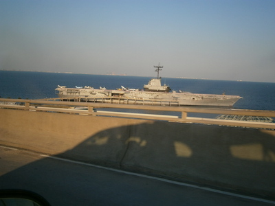 Returning to our hotel, from the bridge over the waterway, I can see the USS Lexington aircraft carrier, now retired and open for visitors. With more time in Texas and an opportunity to visit the largest city on the coast, it would be good to see the Lexington and the other attractions of Corpus Christi.
There's not a lot of dining near the hotels at the highway, but I find an authentic steakhouse not too far away - the Texas A1. There are lots of apparently single men dining here - refinery workers? The volunteer at PINS told me that Portland was a new/growing place where major companies were building their chemical plants. After dinner we stop by a H-E-B store for water; it appears to be a large discount/bulk grocery store similar to a Walmart Marketplace - more than a Fry's, less than a Costco.
Thursday October 7
We've got to rise early this morning. The lighthouse at Port Aransas cannot be seen except from the water, and I've signed us on a harbor tour that leaves at eleven but they want you there an hour early to check in. Mapquest says it's a 40-minute drive, but there's a ferry from the mainland to Mustang Island where Port Aransas is. I can't get a good estimate of the time for the ferry; the reported times range from fifteen minutes (via the recommended Twitter feed) at 6 in the morning to more than an hour in summer, holidays, and weekends. Today isn't any of those days, but I don't want to take the chance. We get up at 6.
Breakfast is Texas waffles again. It's an easy trip back up Highway 35 to Highway 361, which goes all the way (via the ferry) to the island. The route gotes through the little town of Ingleside, and it's a good thing Jerri noticed the 361 turn-right sign, because nothing about this route was in the Mapquest directions. There are many bridges over water, and I notice people set up and even camped out on the sandy and marshy places for fishing. Then we arrive at Port Aransas.
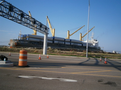 Which it seems is really a working port. A giant freighter is unloading these big cylinders. I suspect these are parts of the power-generating wind turbines that are being constructed on the coast. We have passed several large "Oversize Load" trailer trucks carrying wind turbine components.
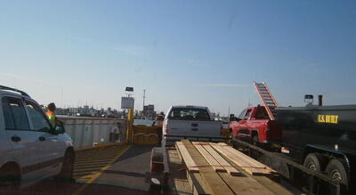 Turns out the fifteen minute estimate was closest. We have to stay in our car for the transit because it's so short. There are two ferry routes in Texas, and we have now been on both.
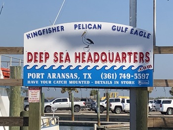 The tour office shares a counter in a bait shop on the corner just after getting off ferry. I sign in and get parking directions, and then Jerri and I can look around the touristy shop. We get there around 9:40, but the trip is at 11:00. So we sit in the patio area (there are many wooden tables and benches; overflow for the "you catch'em, we'll cook'em" place next door) watching the bait shop lady loading bait into the buckets of fishermen, while small black birds hang around the big tubs on the patio trying to steal bait (and sometimes succeeding). A police patrol boat goes slowly by, sporting three firefighting water nozzles. There's a silly "pirate cruise" party boat right next to us.
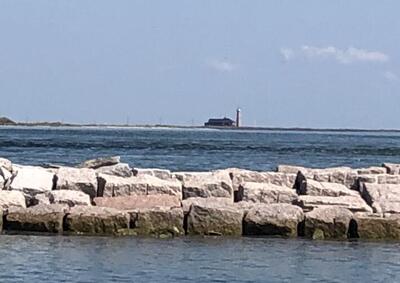 At ten til 11, "Captain Dan" comes out of the bait shop leading a party of friends or relatives that appear to include a just-married couple, very loud and boisterous. Also in the tour is an Indian family with a young son and a daughter of maybe 8 who carries what appears to be a Jasmine doll. After the Scarlet Lady departs the dock, our tour guide, Clarissa, gives us the rules and a demonstration of life vests. As the boat turned out of the marina, we can spot the lighthouse way over on Harbor Island.
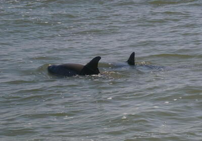 Out in the harbor, we quickly see pods of 3-5 dophins, mostly mothers and their calves.
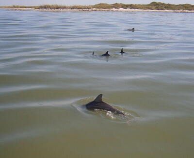 I was afraid it would be a "if you're lucky" thing like whale-watching boat tours, but the dophins are everywhere.
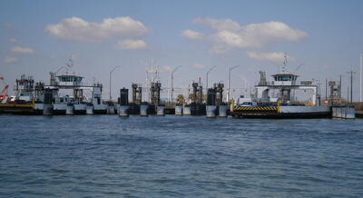 After a while of getting a good look at all the dolpins splashing around, Captain Dan turns the Scarlet Lady and travels into the commercial lanes. Our course goes through the ferry route; this is the mainland side landing.
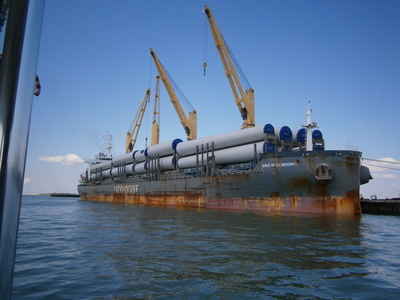 And into the port. Here's the other side of that big, possibly German-owned freighter.
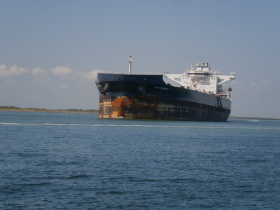 The object is to catch a giant ship coming in or going out. Here comes a big one, possibly a tanker, having just unloaded and riding high in the water.
Clarissa explains that the dolphins have discovered that the bow wave can boost them as they swim in front of the ship. Kind of a thrill ride for the intelligent marine animals.
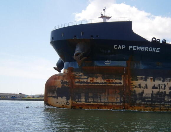
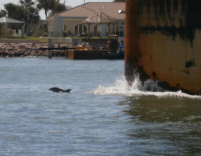 They're at it the entire time the Cap Pembroke steams by.
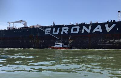 Then we get to witness an aspect of harbor operation: The regular posted captains of these freight vessels are fine with getting the ship across the ocean, but they aren't familiar with the twists and turns of a particular harbor. Therefore the ship takes on a pilot with personal knowledge of the harbor to direct the steering of the ship. After the ship is out of the harbor and has a clear shot at the open sea, the pilot can leave the ship. So a small boat pulls up to the ship, the pilot walks down the stair and then climbs the ladder and drops to the boat, which then pulls away. We get to watch all this happening. Interestingly, the men operating the ship are not dressed as you would think commercial sailors would be, but are wearing coveralls and hard-hats.
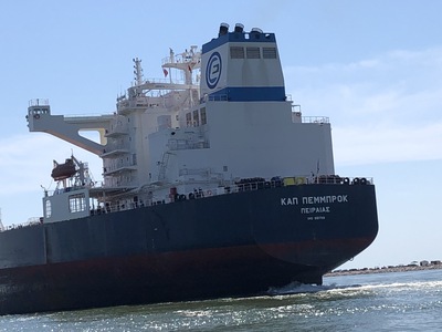 As the ship continues to steam by, I get a look at the stern. It's Greek to me.
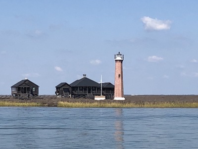 The boat then motors between the jetties on San Jose and Mustang Islands and past San Jose Island. Clarissa explains that the island is privately owned by a Texas oil tycoon, but by Texas law the beaches are public and so people can catch boats over and fish off the jetty. We see some of those fishermen. The Lydia Ann Lighthouse is the next destination. It was disabled and then damaged by the Confederates in an attempt to prevent the Union from benefitting from it. This includes them having removed and buried the lens, which was never found. The owner of the H-E-B chain bought the lighthouse and restored it, and now it is a site for events, but the lighthouse still operates as a navigation aid - the only one of the Texas lighthouses still in service.
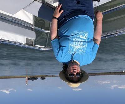 The "official" photo of Jerri as close to the Lydia Ann / Port Aransas lighthouse as she can get.
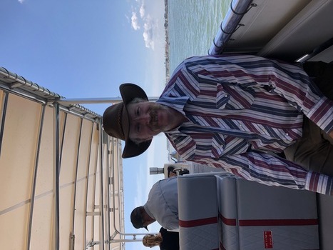 David is enjoying this harbor cruise.
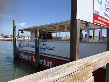 After the boat returns to the marina, Jerri gets a photo of the Scarlet Lady. That was a fun experience.
We then follow the directions to the museum provided by the woman at the bait shop counter. It isn't open quite yet, so then we proceed to MacDaddy's for lunch - the ticket stub from the cruise gets a 10% discount - and enjoy decent BBQ brisket and sausage while watching a silly animated halloween show on the TV. Now the museum should be open, so we return, and one of the women does a guided tour. Port Aransas, formerly Tarpon, exists due to sport fishing. Tarpon are game fish, not worth anything as food. Nowadays, the tarpon are mostly fished out. They make a big thing about FDR coming to fish. They are also strongly promoting Farley Boat Works, formerly makers of wooden boats, especially motor boats. Farley still operates, but essentially as a do-it-yourself shop with the expert boatmakers passing on the art. Aransas was a port, but after two hurricanes flattened it, some company executives lobbied Congress to move the port to Corpus Christi.
scarletladydolphincruise.com
portaransasmuseum.org
portaransasmuseum.org/visit-farley-boat-works
macdaddysfamilykitchen.com
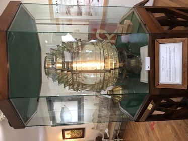 The replacement lens for the Lydia Ann was previously at the community center; when the men moved it to the new museum, it was so heavy that the men rolled it! Needless to say, this damaged some of the the glass prisms.
Having gotten her stamp at the museum, we are now cleared for the next destination. But first, we go in search of postcards and other tourist paraphernalia.
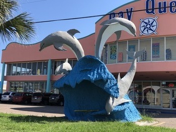 We saw this tourist shop from the bait shop. Cool dolphin sculpture, but no postcards. The Port Aransas Visitors Center was next door, but when we dropped in, they didn't have any postcards, either, but kindly suggested the Islander shop.
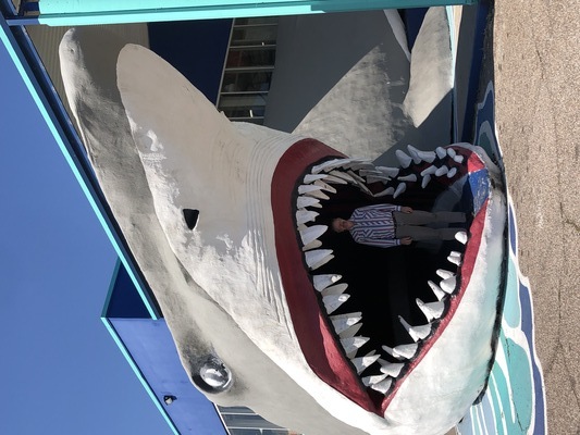 Which we happen to come upon on our way out of town. Yes, they did have postcards. They also have this cool shark sculpture which also serves as a foot ramp to the door. Mostly for kids, doubtless, like this big kid here.
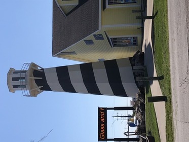 And, yes, it has a fake lighthouse as well. I tell Jerri that these Texas gulf tourist shops are pretty much the same as the Florida gulf tourist shops that I saw at Destin when I was doing a job at Eglin AFB several years back.
The rest of the day is spent on the 3 1/2 hour drive from Port Aransas to Brownsville. After coming upon US 77, it goes all the way into Brownsville, almost to the Port, and then it's a 7-mile highway through empty country to Port Isabel. We pass the lighthouse that we will see tomorrow and cross a bridge to South Padre Island. By the time we get to the hotel, it's dark. On the way to our dinner objective, we stop at another tourist mega-store. I'm intrigued that at the Port Aransas stores, they had a huge variety of beach towels but none with any declaration of Port Aransas. Lots of Port Aransas shirts and hats and such, but no Port Aransas towels. This store has lots of "South Padre Island" beach towels. But no postcard. The clerk tells us that nobody uses postcards anymore, when it's so easy to click your cellphone camera and send it via text. Our dinner destination is Backbeard's (www.blackbeardsspi.com), for a large dinner following a large lunch. After dessert, I ask the waiter if he knew any places that might sell postcards. After some thinking, he suggested the Dollar General or the IGA grocery store. We check out the Dollar General since it's on the way back to the hotel - no luck.
Friday October 8
Today is Day One of our long drive home, and there's stuff to do before we leave. Breakfast at this hotel is at least real breakfast, even though it's a staff lady behind the table who takes a pre-cooked omelette and two sausages out of the chafing dishes instead of us doing this, and puts them in a takeout box. Then we can get the rest of our breakfast with our own little hands. After we pack up and leave, we check out another tourist place - same as all of them. Jerri notices the grocery store. Bingo! Postcards!.
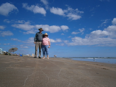 South Padre has a nice aspect in that between nearly all the buildings on the gulf side of the island there is a no-fee public parking lot and a bridge over the marsh to the beach. Here we are on our one-and-only frameable photo of us on the Texas Coast at South Padre Island!
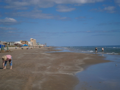 Jerri spends a little time looking for more shells. The sand here is very fine. There are many people in the water but nothing like in-season. Visiting in the off-season is pretty nice.
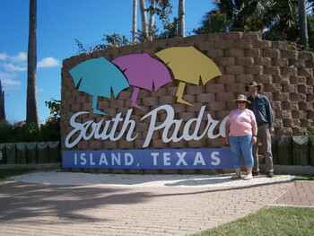 It takes a little bit of doing, but we get to the welcome sign we saw last night as we arrived on the island.
Immediately after coming off the bridge from South Padre Island into Port Isabel, the lighthouse and the chamber-of-commerce / visitor center are right there. The lady staffing the chamber-of-commerce is not very engaging, unlike the Port Lavaca chamber-of-commerce lady, but she tells us what we need to know. There's a little museum of exhibit here that tells some of the background of the Point Isabel lighthouse. It saw service intermittently until the mid-20th Century when radio navigation aids and GPS made lighthouses obsolete. In the 1940s, the locals didn't seem to care much for the lighthouse; when a storm damaged the crown, they dragged it off with a tow chain. Now, it is the center of their community.
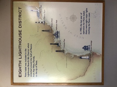 The little museum includes a map of the Texas lighthouses. We've been to or seen artifacts from all of them except for two, the Brazos Santiago and the Brazos River lights, which no longer exist. The Sabine Pass Lighthouse is technically in Louisiana; we may pick up that one and the Alabama and Florida lighthouses on a future Southeast trip.
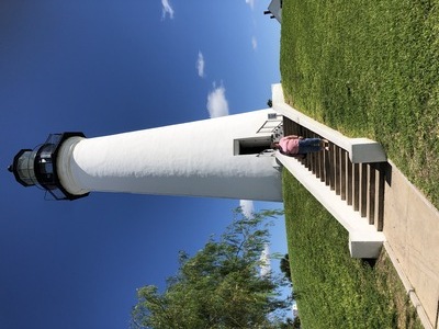 "Official" I-was-here photo. It's a beautiful photogenic building relative to the others we've seen. And you can go up to the top! For a $10 donation.
View from the rail back to South Padre Island.
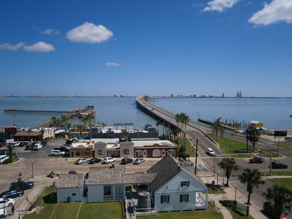
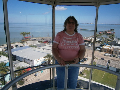 Jerri in the lamp chamber. It's rather warm and stuffy up here. Lovely view all around the town of Port Isabel. We can see the Port Isabel Museum from up here, where we are promised postcards, but we really don't have time for that.
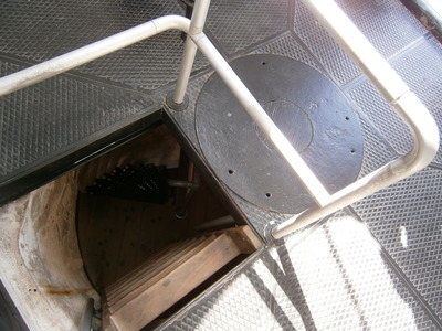 The iron spiral staircase ends on a landing, and a vertical wooden ladder with no handholds ascends another six or seven feet to the Machinery Room. Then a ship's ladder ascends to the Lens Chamber. The round port to the right is where the weight that ran the lens rotating clockwork descended down through the central pillar for the staircase. Jerri went up the stairs and ladder just fine, but was somewhat more cautious coming down.
There is a crowd of small artsy shops around the lighthouse. Jerri visits one and finds her postcards (and some other stuff). I notice some stuffed llamas; haven't ever seen that before. Then we walk across the street to an ice cream shop and get some cones and some chocolate-pecan fudge (and see saltwater taffy there, but we don't get any). Once again, the gas gauge reads almost empty, so I fill the tank on the way out. Our route takes us west on Highway 100 (through Los Fresnos, with a rodeo arena right by the highway and a water tank proclaiming the town "Home of Freddy Fender"), then north on I-69 / US-77 (past the giant H. Yturria Ranch, texoso66.com/2017/05/04/yturria-ranch, on the right side of the road). Then the GPS gadget takes us off the expected path of 77 to San Antonio and then I-10 to Fort Stockton: at Kingsville (headquarters of the famous King Ranch, and there's a King Ranch Museum in town - king-ranch.com). we get sent west on Highway 141, then north on US-281 to Alice, where we pick up route 44 to the west. This takes us through the town of San Diego, and if I had reacted faster we could have had lunch in San Diego, Texas! Such copycats; we had crossed the Colorado River days ago on the coast. Then the town of Freer, and we picked up lunch at a DQ where Jerri stumbled on the curb and fell, thankfully with no injury.
At Encinal I stop for gas, and when I open the door the the fill port I discover the gas cap is missing! Hmm, I fueled up this morning at Port Isabel, what did I do with the gas cap. Oh, yes, I put it on the roof of the car - and there it is! Stuck under the luggage rack after cruising across Texas! Then we are sent north on US-83 - how miserable: a two-lane highway with big trucks and lots of road construction, including a segment of one-lane and pilot cars. That soaks up some valuable time. Then we come to Carrizo Springs, seat of Dimmit County and home of the Wildcats (woah, how original), where we get sent west on US-277. I wonder what's up when we pass a sign for "Int'l Bridge" and Jerri gets a "Welcome to Mexico" text message from T-Mobile, but when I review the route on the map, I realize we were just skirting the border! I should also mention that the roads west were increasingly infested with Texas State Trooper cruisers, and looking back on it, I understand now that this was all part of the unfortunate response to our president's ill-advised border policy. Then I pass a sign for Laughlin AFB just before Del Rio and get put on a US-90 bypass of Del Rio. Approaching the ramp on the other side of the town, a state trooper car makes a U-turn off the shoulder, roars up behind me, and flashes me with his white lights. I think I've had it, but when I get to a place where I can pull off the road and take my lumps, he roars past - he just wanted me to get out of his way! Whew!
On US-90 between Langry and Dryden it gets dark. I almost hit a deer while passing a big truck, and moments later I see another deer off the side of road, her eyes glowing green in the headlights, After this I'm stressing to pay attention and look for deer. It's a L-O-N-G drive on 90 from Del Rio to Sanderson; a windey road, big trucks, two-lane. It's late and we start looking for a dinner place, but all the little towns are shut down. Finally we arrive at Sanderson... which is also almost entirely shut down, but on the other side of town there is a highway road services station where we can get gasoline and some frozen deli things for dinner. Then US-285 north to Fort Stockton - more long, windey, two-lane highway with slow trucks and infrequent passing lanes. At long last we arrive at Fort Stockton, and driving through town at 10:00 there are food trucks, a DQ, and a grocery store still open. Guess we didn't need to get this deli stuff. We get to our last hotel, where I notice the dining/breakfast room has a bar; you don't usually see that at Best Western type hotels. There's also a feral cat in the parking lot; sad, especially when an older woman walking a big dog allows her dog to chase the cat. In our room, we can microwave our dinner, and that's when Jerri discovers her pizza is not microwave-cooked - but we do it anyways.
Saturday October 9
After the exhausting long drive in the dark of yesterday, and considering that our eight-hour drive home from Fort Stockton is effectively six hours because we will pick up some time-zone advantage, we sleep in "late" (i.e., to 8:00). Breakfast is another staff-served affair except that everything except hot water was served across the barrier. There's just no consistency; it's all very silly and emotional.
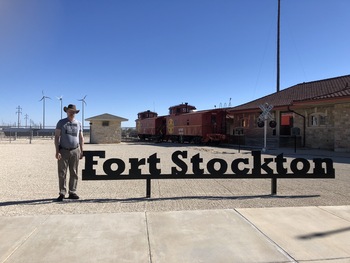 After packing up and checking out, I want to go down Main Street to the Visitor Center and check on something. A young woman with a cat-ear headband gives us a "driving tour" pamphlet. I'm only interested in Comanche Springs - many years ago, my family went off the road in Fort Stockton to see the reason for the Fort, but as I remember it, it was a big dry hole with a deeper pit where the spring used to be, and a historical placard explaining it all. I don't remember anything else being around.
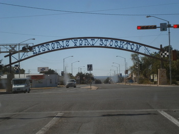 There's a lot of stuff in this "driving tour" map. Clearly, Fort Stockton is trying for the tourism dollars. Someday it might be worth an afternoon, since Fort Stockton is on the way to everything else in Texas (except the Big Bend National Park). On the way down, I note the Pecos County Courthouse and a little museum... but mostly a whole bunch of empty storefronts and nearly empty sidewalks. Not unlike Port Lavaca.
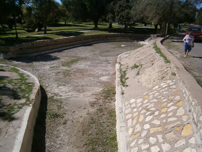 Where the map took us was a park (was it Fort Stockton's major municipal park? Only park?), there was a dry hole all right, but not a not a deeper hole (unless it's under the cap), and lined with stone. This is nothing at all like what I remembered. The park has ramadas, barbeque grills, playground toys, young families pushing stollers - and a disc golf course! I don't think the planners were thinking clearly on this.
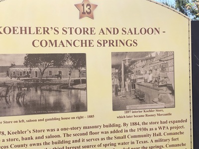 The dry spring is called the Blue Hole, and it is in front of a historical building. I sure don't remember any buildings around the dry spring I saw with my family years before. After I got back, I asked my dad, and he remembers it differently than this also. I wonder if there isn't some other part of Comanche Springs in or around Fort Stockton. But the young woman at the Visitors' Center wasn't aware of any.
Now we can leave FS and take a long uneventful drive to El Paso, where we get a nice sit-down lunch and then get gasoline at a station with an ice cream counter. As we continue on out of Texas and into New Mexico and through Las Cruces, I see about six flatbed trucks with copper ingots heading east. That's always nice for a Zonie to see. Leaving the great state of Texas, it occurs to me that, after Port Lavaca, we never saw another Buc-EE's. A consequence of the silly border-hugging route on two-lane local highways from the coast to Fort Stockton. Oh, well, maybe next time.
During the uneventful drive across New Mexico, we can see many "The Thing" signs. Back in Arizona, we get to Benson right at sunset. There are so many bug splats on the windscreen catching the directly-incident sunlight that I'm effecitvely blind, and I have to carefully follow the taillights of some cars off the road at the next exit to a Love's stop (which occupies both sides of the street) and clean off the windscreen. We continue on into Tucson - no hold-up in traffic at the Houghton overpass construction zone in either direction at 6:00pm on a Saturday. After our two-week Texas vacation trip, we arrive safely home to our cats who are happy to see us.