Archives:
- Ten State Tour
- Gadsden Hotel
Cochise Co. - David's Sardinia trip
- Downtown Huntsville
- Pima County Fair '07
- Phoenix Trip '07
- Space & Rocket Center
- California Desert
- Saguaro Monument
- Rodeo Days '08
- Butterflies
- David's Sweden trip
- South and Midwest
Grand Tour
Pt 1 Pt 2 Pt 3
Pt 4 Pt 5 Pt 6
Pt 7 Pt 8 Pt 9 - David's Germany trip
- Biosphere 2
- Tucson Rodeo 09
- Sabino Canyon
- Rose Canyon Camping
- Southern California
- North Texas
- Labour Day '09
- Tucson Presidio '09
- Phoenix Trip '09
- David's Utah Trip '10
- David's Dallas Trip '10
- Colorado Trip '10
- North Arizona '10
- NmTxOkAr '10
- Portland & Maryland '10
- Las Vegas '10
- Dillinger Days '10
- Rodeo Days '11
- Penn, Maryland, WV
- Faith's SCUBA trip
- Mount Lemmon '11
- Los Angeles '11
- Phoenix '11
- Flagstaff '11
- Alberta, CA
- Glendale '11
- Pinnacle Peak '11
- Arizona Centennial
- 2012 Tour - Missouri
Pt 1 Pt 2 Pt 3 - Barrio Viejo Home Tour '13
- Apache Trail '13
- AZ Route 66 '13
- Tucson Walking Tour '13
- Veteran's Day Parade '13
- Lake Havasu '14
- Charity in France '14
- Colorado '15
- Medicine Hat/ Calgary '15
- LA & San Diego '16
- Phoenix Mystery Castle
- Sequoia & Yosemite
- Route 66: NM, TX, OK, KS
- NM, CO, WY, NB in '17
- Phoenix Summer '17
- July 4th '17 in Colorado
- Orlando '17
- Consumer Electronics Show '19
- Denver/Brown Palace '19
- Pacific NW '19 p1
- Pacific NW '19 p2
- Pacific NW '19 p3
- Colorado '20
- July 4th '21 in Colorado
- Texas Lighthouses '20
Ormand Family Activity
To read about our October 2021 Texas Lighthouse Tour, go here.
To read about our July 2021 Independence Day celebration, go here.
November 2021: California Lighthouse Tour - Part 5
Friday November 5: Eureka
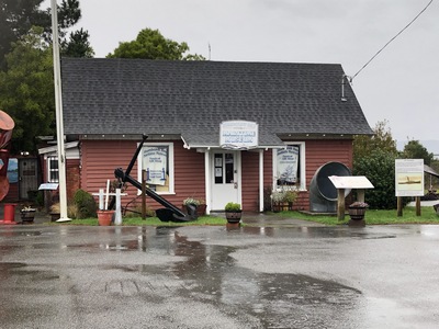
Today is an easy day. We wake to light rain. One of the nice parts of this hotel is the great breakfast buffet in the pool area with the tiki torches and the South Pacific motif, but in these stupid wuhan-paranoia days, the hotel breakfast is grab-n-go bags. We have time for better; we get our umbrellas and walk to Kristina's next to the hotel on the west side. Joe's Special is a mess of scrambled eggs, spinach, ground beef, and mushrooms - it may be "traditional" for Kristina's... I eat it, but, well... Eureka includes three islands (four, really) off the coast; Woodley Island, where the Table Bluff lighthouse is (as a marina harbor marker), Tuluwat Island (nothing there), and Samoa. The Humboldt Maritime Museum is on Samoa. Highway 255 splits off 101 and connects the three islands. When we get there, the museum is closed, even though the sign says it's supposed to be open. Then ensues a hunt for answers, and at the end of it, we go back to Eureka to wait for a call. We just started looking through the Clarke History Museum (in the former neo-classical Eureka Bank Building) when we get the call - Don will meet us there in 15 minutes.
 Don is an interesting old fellow whose full beard prevents his mask from fitting. He gives us a tour: Humboldt Bay was a nexus for ship-building on the California Coast. Bendixson was the best, and then there was Rolf - former San Francisco mayor, former California governor, and not very ethical. Steam schooners moved lumber and passengers in elegant Victorian style (the main room is dominated by a big wooden model). Ferries moved workers around the Bay area. The Coast Guard has always had a presence here, with cutters stationed at the port (the exhibit included a Lyle gun used to throw lifesaving lines over distressed vessels). This was a big whaling location (and the exhibit includes harpoons, some with explosive heads, and we are told there is a harpoon gun outside in the rain) until it was shut down by local anti-smell ordnances.
And then there was the story of H-3 submarine which ran aground, and when the USS Milwaukee tried to tow it off she was wrecked. Afterwards, H-3 was moved across the sandbar by a private salvage contractor using log rollers and refloated on the other side. Great museum, Don says he is the last docent (Jerri says the lady on the phone identified as a docent), and he is not sure what will happen if no young people join.
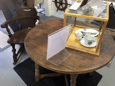 There have been many wrecks in the bay. The table, chair, and table service are jetsam from the steamer SS Bear.
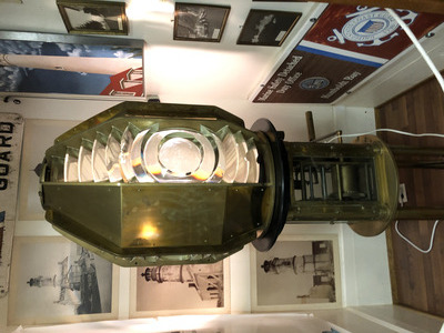 What we came here for: the fourth-order lens from the Table Bluff lighthouse. Jerri gets her stamp.
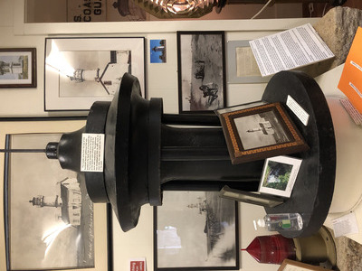 It seems there was a Humboldt Bay Lighthouse as well, long since destroyed. The iron cap or ventilator was found years later, buried in the sand.
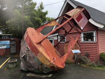 There are many items outside - in the rain. Like this enormous bell buoy. I really should have looked around for the harpoon gun.
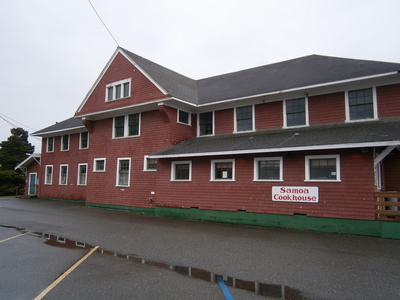 When we're done with Don and the Maritime Museum, it's lunchtime. The Samoa Cookhouse is right here, and we just can't pass that up. The story inside the cookhouse is that way back in the early days of Eureka, a man built "baths" on the island - swimming pools of heated bay water - and people came to swim and picnic. Then a group attempted to promote it as a resort. The Samoa Islands in the South Pacific had recently been made a U.S. Protectorate, so the resort owners renamed the island "Samoa" because it was "tropical" and "exotic". Eventually the resort failed, the island was taken over by the timber business, but the "Samoa" name stuck. The Cookhouse served the loggers working for the timber company, and it is (one of?) the last "company cookhouse" style operations still running. Lunch is therefore served "family style": a kettle of soup (vegetable beef) to ladle into your bowl; likewise salad. I thought that was it, soup and salad, great meal. Then a plate of fried chicken arrived. Then bowls of gravy, mashed potatoes, and corn and peas. Too Much! And dessert afterwards. Vanilla pudding or brownie. I said "half and half", but he brought us a cup each of vanilla pudding and a cup each of brownie. TOO MUCH.
 On the way back to the mainland, one last stop and photo at the sad Table Bluff lighthouse remnant.
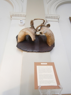 We then returned to downtown Eureka to finish the Clarke History Museum. Like many local museums, they tend to collect weird stuff like the taxidermied heads of two deer who died with their antlers still interlocked.
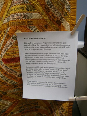 One of the special exhibits was about crazy quilts. Especially the cigar silk trend. Cigar makers would wrap the cigars in silk, and when they discovered that women were using these silk wrappers to make quilts, they started marketing wrappers to appeal to the quilters.
The museum included the story of Chinese being forced out of town, the Chinese Exclusion Act, and Chinese people who narrowly escaped lynching. There was a Victorian room (era antiques, tea gowns and morning dresses), a room of old guns and swords (Odd Fellows had a ceremonial sword!) (several Japanese samurai swords brought back after the war) (exactly the sort of things of local interest that would be displayed by a community museum).
There was an entire room about Northern California Indian tribes, their plank houses, and their mistreatment by settlers. Apparently there was a despicable event like the Camp Grant massacre of women and children. Even while we were there, an exhibit on immigrants from Mexican states was being set up by two girls chattering in Spanish - there seems to be a lot of Mexican influence here; restaurants, a taco food truck, Spanish overheard in the breakfast restaurant, etc.
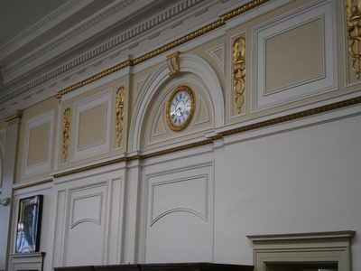 The museum retains some aspects of its previous use as a bank - the architectural features, the gilt, and the wall clock.
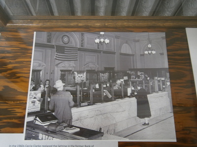 And a photo of the building when it was still a bank. Oh, look, there's the wall clock behind the tellers' counter!
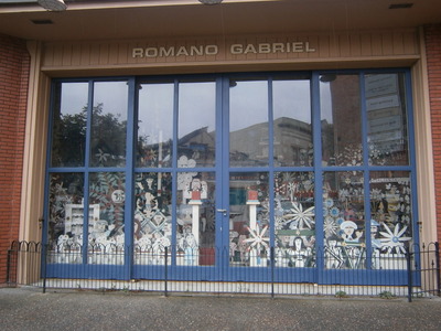 When we're done with the museum, we go out and walk around the downtown area. Romano Gabriel was a local character who created his art from the memories of his native Italy. The community has collected his art into a storefront gallery.
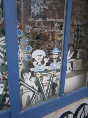 Very homespun, very tasteful, and very Italian.
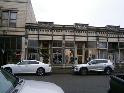 Downtown Eureka is really a very attractive and walkable place. By this time it's a bit late, and we can look through a nice bookstore before it closes. Then it's back to the hotel.
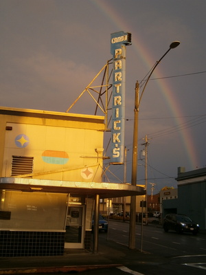 While Jerri rests, I go back out to explore more of downtown Eureka, and look for the Tiny Doors. My boss' name is "Patrick", I take this picture with the rainbow behind it and send it to him before noticing the unusual spelling of the name. It's still a neon sign treasure. I wonder if it still works.
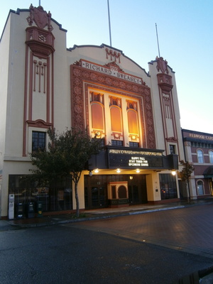
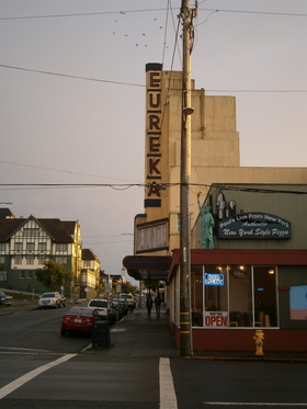 This was probably their old cinema. It would be nice if the community decided to restore it like the Fox. Oh, wait, it looks like there is such a project: eureka-theater.org. I wish them well.
 So I found out about the Tiny Doors from the Eureka tourist site. There are seven tiny doors hidden around downtown. The method I used was to pull up the Google Map of the tiny doors and use the indication of my position to play "warm/cold". The first one was comparitively easy; it actually looks like a door
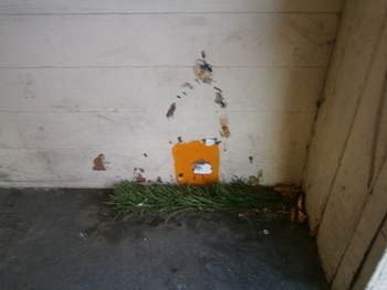 The second was a a bit harder, I wouldn't have realized what I was looking at except for the little patch of artificial grass glued down. The tiny doors are the local "thing", like the scarecrows of Cambria and the "stompers" of Oakland.
visiteureka.com/hidden-gems
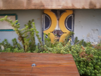
 This one was tough. If it didn't say what it was, I would never have guessed.
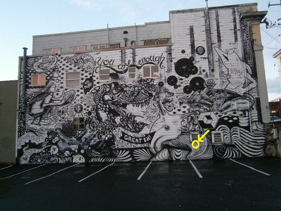 Plus, it was a part of this huge, busy mural. The arrow points to where the tiny door is located.
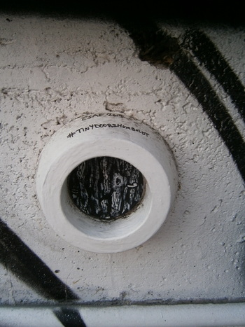
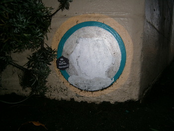 Number Four also said what it was. Again, there's nothing door-like about this round blob.
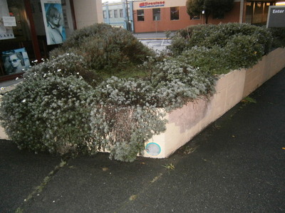 And it was well hidden under this planter. If I didn't have the cellphone cheater and happened to note this discolored spot on the planter, I never would have guessed.
There's three more out there, but I've enjoyed looking for these, it's getting dark, and Jerri is waiting alone.
 Walking back to the hotel, I pass this very impressive auditorium. There's lots of appealing stuff in Eureka. I'm thinking this would be my favorite California city, like Astoria would be my favorite Oregon city.
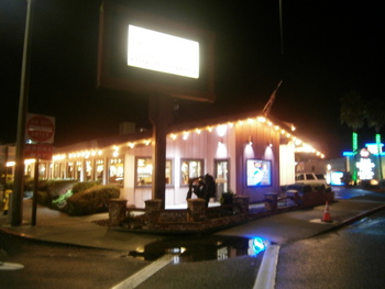 Once again, I am sent over to Wendy's to get a light dinner. After the belly-buster lunch, I'm okay with a light dinner. On the way back, I think I should really take a photo of Kristina's. Kristina the sister-in-law, Kristina the Long Beach cruise boat, Kristina's the Eureka restaurant - it all fits together.
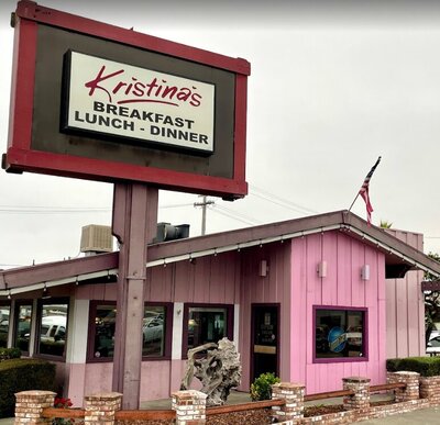 Except of course the night photo doesn't do it justice, so I will include a Google street view photo for maximum effect.
Saturday November 6: Trinity Head Lighthouse
The day has finally come. The Trinidad Head Lighthouse will be open from 10 to 12 today. I would like to get to Trinidad by 9:30, and it takes 30 minutes to get there. Breakfast is a bag, as I observed yesterday, but you load your own bag in the breakfast nook - what is mostly there are the cold cereal bowl things that nobody else is taking. Before we leave, we call the Trindidad museum to verify that the lighthouse is indeed open. Patty answers, and assures us that on the first Saturday of the month, the lighthouse is open, rain or shine.
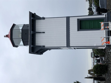
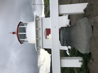 We've been here before. A quick drive up the coast, exit into Trindidad and take the streets that descend to the beach where we park the car with all the others. The "memorial" lighthouse is here, just like it was last time.
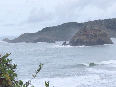
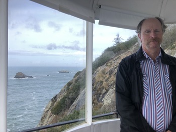
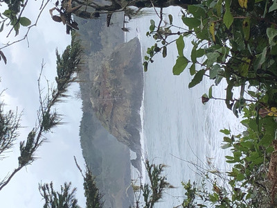 And this time we know where we are going on the Head. The road goes up on the north side of the rock. Through a gap in the vegetation we can look through and see the bay below the city. The big impressive rock island is Pewetole, we are told later.
 A little higher up, and there is a flat spot with some benches for hikers to enjoy a better view of the bay and the boisterous surf.
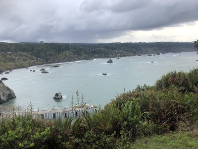 Then the road switches back and wraps around to the south side of the rock. From here we can see Trinidad Harbor. The last time we were here (more in the summertime), there were a lot of small boats moored here. All sailed away now. Last time we were here, I could hear the doleful clanging of a bell buoy from down in the sea. I can still hear it this time, just not as frequently. The sea must be calmer today.
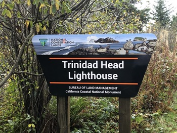 At the end of the road is the chain-link fence gate and the sign. Last time the gate was closed. This time it's open.
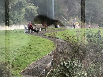
Through the gate is a gravel path through a broad, flat grassy area with some benches. On one of those benches is a lady with some binders of photos. This is indeed Patty. We chat a bit and look at her pictures. The lighthouse was installed in 1871 in response to shipwrecks, most notably the "Brother Jonathan" with more than 200 people lost; searchers were picking bodies off the coast a long ways south. There was nothing unusual with the lighthouse, and it operated until it was decommissioned by the Cost Guard, wich had demolished the keepers' houses to build personnel quarters, and then demolished those, too. That's what used to occupy this lawn.
We depart from Patty and go down to the lighthouse. There are two fellows managing a small crowd of visitors. They don't know much, but they are trying. Jerri tells them about the problem with the vegetation we encountered when we were here last, that obscures the view of the lighthouse from the observation platform up by the cross on the top of the rock; they are aware of the problem.
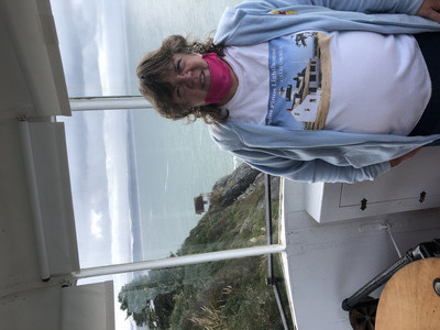 Our turn comes to go up inside the lighthouse. It's a ship's ladder. At the top is a small lens chamber, with a small round table where the lens used to be and a binocular chained to the table. Jerri gets her photo. Looking south, the fog bell house hanging on the cliff is vislble.
 Behind me, to the north, are some of those rocks this lighthouse was intended to warn against.
 Closer view of the fog bell house. I suppose that a bell was sufficient for this location, rather than foghorns or a steam whistle, and that's why there's not more infrastructure on this rock, and that's why the fog warning was replaced by the bell buoy I heard on the south side, in the harbor. We learn later that sometimes the automatic mechanism for the bell ringer went out, and the keeper had to enlist family members to ring the bell manually until they could get the clockwork fixed. We also learn that the bell hung in front of the "memorial" lighthouse down on the beach is the original bell from the fog bell house!
 Also visible from the lens chamber is the lawn (the lighthouse is on a shelf on the rock below the level of where the keeper's house was, so the lens chamber is level with the lawn). There's Patty sitting on the bench with her binders.
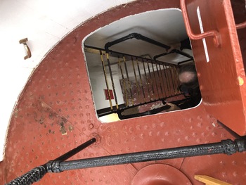 Jerri takes a photo of the top of my bare little head as I climb back down through the hatch and the ship's ladder.
There is a card in the tower windowsill that explains that once, when the lighthouse was operating, a 200-foot wave broke over lighthouse and the shock (not the water) extinguished the lamp, but the keeper had it going again in 30 minutes.
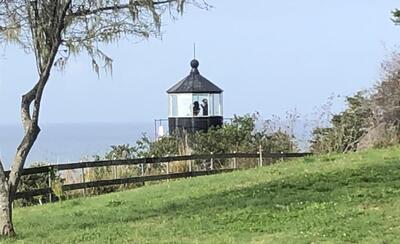
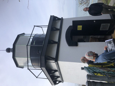 This is what the lighthouse looks like from the outside. Very much like its reproduction in the "memorial" on the beach, except for the dark iron platform and supports. The lighthouse was a popular attraction today, and here are some of the visitors looking at the literature. The young fellow's wife and two small daughters are there. Jerri tells the older one (about 3 years old) that she liked her sparkly shoes, and the little girl tells her, "they make her go fast".
 Returning back to the lawn from the lighthouse and looking back. Reminds me a bit of Cape Meares in Oregon (Pacific NW '19 p2, see p. 34).
 On the way back down the rock, I get a good view of the other big rock in the harbor, which supports the pier. This is "Little Head".
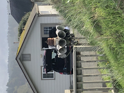 As the road comes off the rock above the beach, there is a home here with an unusual lawn ornament. I'm wondering if this used to be a tsunami warning siren.
Two more stops. Up the street from the beach, at the address provided by the Lighthouse Society, is a bed & breakfast place. Jerri rings the bell and a businesslike teen appears, and gives her two good stamps for her book. Then we go back into town to the museum. It doesn't open for an hour, so we've got some time to soak up. We start by crossing the street to the Murphy's grocery store for water.
The signature of this vacation trip is trouble with credit cards. After I got the problem settled at Cambria, I got another fraud alert about a charge made by "Mealjournal". When I called USAA, they said they already disallowed that charge, which was obviously a scam based on the meal preparation service model currently popular. We had tried one of those services, "Blue Apron", and that apparently exposed us to this fraud. While the agent was explaining this to me, he told me I could get the USAA app and keep the card blocked and unblock it only when I was about to make a charge. This concept is fine unless you're somewhere like Trinidad that doesn't get good cell service. I spend some time in the check-out line fighting with the app trying to unblock my silly credit card; ultimately, we have to dig out cash to pay for the groceries.
We hang out in some tourist gift shops until 12:30 when the museum opens. We meet Martha, who doesn't know where the stamps are and she can only find one - good thing Jerri already got stamp #2 at the B&B. Martha understands that the little house just above the beach is the Hallmark house. Hallmark built the first pier in the harbor. She looks at my photo and agrees that the horns look like a tsunami siren, but she doesn't know where any active ones are since she doesn't live here. The museum is small - logging, railroads, a huge trestle over Strawberry Creek, photos of people waiting for wagons to take them up to the lighthouse to view the "Great White Fleet" steaming past. There is even a fungus exhibit (I saw lots of mushrooms along the path to the lighthouse) and an extensive collection of Indian artifacts.
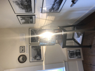 Martha tells us this is the back-up fourth-order lens for Trinidad Head. The original, primary lens is packed away. There are plans to fix up the "memorial" lighthouse to Coast Guard standards and install the original there - so people can see it more often than once a month.
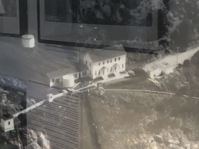 In this "lighthouse" room is a photo of the compound in its day. That's a big house. I'm guessing the little path or stair running off to the right is going to the fog bell house.
We are DONE with Trinidad Head! Jerri has got her stamps and we saw both the lighthouse and its (well, its backup) lens. Yay! We head south out of Trinidad to the junction with 299 and start east. With the travel advisories about the wildfires, we have decided to avoid the main route, down 299 to Redding, and take highway 96 up north. 96 follows the Trinity River for a long ways. There seems to be a lot of going-down and not much going-up; if we were at sea level and we're driving into the mountains, why is there not more going-up? (I'm sweating the brakes.) Through the town of Hoopa, which is apparently an Indian town. They have a casino. We drive through a few more small Indian towns.
96 is two-lane road, with no shoulder and few passing lanes, and it winds around mountain curves and blind turns. At one point when Jerri is driving, we see a large rock that had fallen off the hillside, right in the middle of the road. Unwilling to swerve into the oncoming lane when she can't see what might be there, Jerri drives over it - C-R-U-N-K! I am terrified that we have poked a hole in the oil pan or broken a brake line or gas line or something. After a while with no apparent ill effects (temp is not rising, the brakes and steering still working, gas gauge reading fine), we stop and I look under car. I see nothing amiss, nothing dripping except maybe A/C condensation. Tentative "whew".
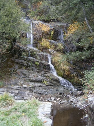 We switch, I drive - we're mostly done with the up/down business. At some point the Trinity forked with the Klamath River, and 96 follows the Klamath. The road hugs the canyon side above the river; there's a lot of back and forth but only a few 35MPH-rated curves. It rains on and off, and at one point the stupid Dodge wipers screw up again and I have to pull over and fix them. We stop to look at little mountain waterfall
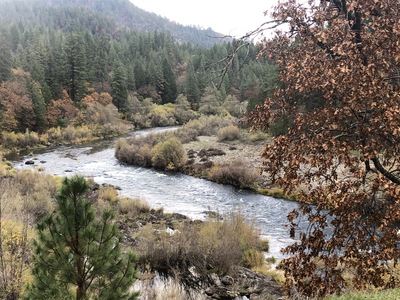
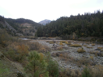 Some time later, we stop for a "rest area" with an actual restroom (well, a single-seat latrine) and get a good view of the Klamath.
 A bit further down, we stop for fall leaves photos.
Eventually we get to Hamburg, and shortly after to the 263 turnoff. This descends to Yreka (apparently pronounced "WyeReeKah", a local Indian word referring to Mount Shasta, and has nothing to do with "Eureka"), and we get to see Shasta peeking over the clouds to the east. Get to I-5, and it's a half-hour to the town of Mount Shasta. Our hotel is the Best Western Tree House, connected with the retaurant named Cooper. The historical notes on the menu say that Mr. Cooper was a sawmill operator and woodworker who switched to the hospitailty business; he built this hotel. This explains all the stained wood in here, the carved stair bannisters, the rough furniture, the cedar butcher block tables, and the plank panelling everywhere. It's a nice dinner, starting with walnut/cranberry salad, followed by ginger sesame chicken with au-gratin potatoes and stewed squash and peppers, and finished with chocolate mousse cake. Later, while we review possible plans for tomorrow, other than just looking at the mountain (which is why we're here), the literature indicates that everything else is hiking, which we're not doing, or exploring silly spiritual stuff about Mt. Shasta - it's sacred to the local Indians (what big mountain isn't?), there's supposed to be energy vortices, influence on your chakras. There's even some nonsense about a hidden Lemurian city. I think we'll just stick to looking at the mountain.
Sunday November 7: Mount Shasta
Today, we're not in a hurry; sleep late and get a nice wuhan-free sit-down breakfast at Cooper's: California Benedict and giant pancakes. As we leave the hotel, we notice the Black Bear Diner near the hotel - didn't BBD start in Mount Shasta? Is that #1? Yes! Too bad we didn't notice that until now...
The first part of the plan is to see the mountain from on the mountain. We get gas and go up through town toward Everitt Memorial Hwy, aka Hwy A10. I note a monument at the corner of Lake and Mt Shasta Blvd, at the police station/city offices building: "Mount Shasta, Place of Pure Water", and it's a drinking fountain. Up A10, up the side of the mountain, to John Everitt Memorial Vista Point. Unfortunately, the Vista is entirely tree-bound. Thinking about this, we would have to go way up to the tree-line in order to see the mountain unobstructed, and that wasn't going to happen. There are apparently no up-close vista points like those for Mt. Rainier. Phoo. But at least we can say we were actually on Mount Shasta.
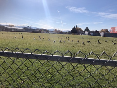 We go back down and through the town, stopping at Mount Shasta High School (the Bears - of course) to see if we can get a better view of the mountain, but no. Instead, Jerri notices a big flock of wild geese on the high school playing field.
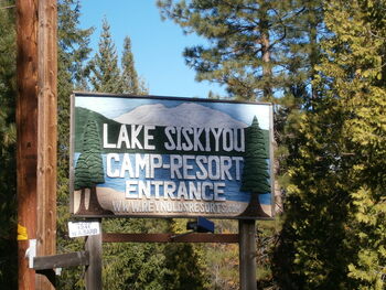
The second part of the plan is to try what Google says it the best photo location, on the beach of Lake Siskyou. We cross the interstate (taking note of a mseum and the old stage stop) and continue south around Lake Siskiyou. It appears "the beach" is within Lake Siskiyou Camp Resort. At the south end, we enter the resort - there's an entry booth, a sign says $2/person; that's not too bad, but there's nobody inside and there's no drop box. So we just continue on in. All the entrances to side facilities - including beach - are blocked with huge logs. There's nobody around. It could be (probably is) that the season is over, but the condition of the facilities suggests abandonment.
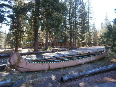 At the end of road is a boat ramp and docks (and a working flush toilet restroom that is not locked). There are two family groups here taking photos and sticking their feet in the water. By the side of the parking lot is this big fake canoe "Spirit of Lake Siskiyou".
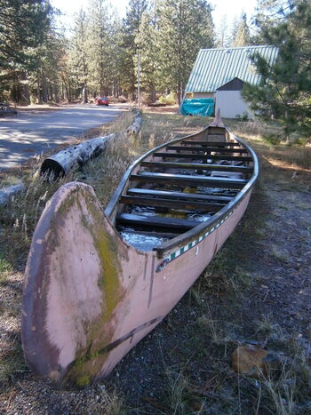 It's full of water. Maybe it's fake, it's way too big to handle without a trailer. I should have checked closer.
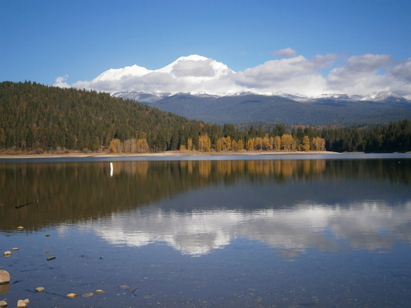
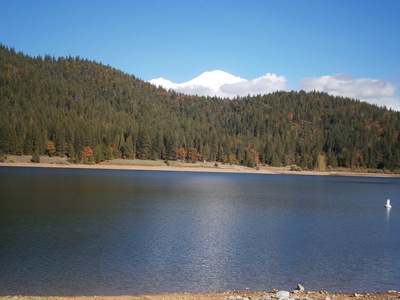
From this lake there's a decent but not great view of the mountain. We're still hunting for the Google "best photo" spot. I go back on the road, stop at the beach entrance, and park just off the road. We walk in to the beach, past parking lots and "No Trespassing" signs. There are buoy anchors dragged up on the beach, a fire grill is sitting down in the water, and the hand-painted signs on the decaying wood buildings and shacks are flaking off. Sure looks abandoned. At least, it's not a commercial operation, more of a family business type of thing. But here is that great view of Mount Shasta that we were promised.
 Jerri picks shells off the eroded beach - freshwater mussels? I think about Arizona's concern about invasive quagga mussels.
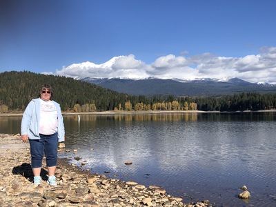
 We return to our car and then drive back to the end of the road to visit the nice restroom before starting the long drive. Since we're here, we snap some more photos. The clouds have blown away from the summit. The lake isn't as nice and quiet and reflective as at the "best photo" beach.
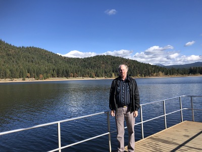 I'm on a little floating dock, with the lake and the mountain behind me.
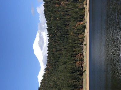 Probably the best, clearest shot of the peak of Mount Shasta as we're going to get.
 As we leave the "resort", I'm still puzzled by the condition of the place. We got what we came for - great views and photos of Mount Shasta - but this seems like it ought to be a nice camp. It has a good website that gives no indication that it is abandoned.
lakesiskiyouresort.com
We now start what is supposed to be a 4-hour drive to Reno. Just south of the town of Mount Shasta on I-5 is the turn-off to CA-89, the "Volcanic Legacy Scenic Byway". I think that the "scenic" part must just be the trees. I stop at a "Vista Point" once, but we can't see anything but trees (same as at the John Everitt Memorial Vista).
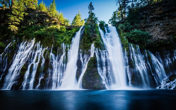
I had picked up a tourist rag at the Tree House hotel in Mount Shasta. It had an article about the McArthur-Burney Falls Memorial State Park with gorgeous waterfalls. We pass the entrance to the park on Highway 89; if we had enough time, I definitely would have stopped. It turns out that the falls are visible from just inside the entrance; it wouldn't have affected our travel time at all. Oh, well. There's just so much to see and do in the world.
At Four Corners, we switch from 89 back to 299. The object is to avoid the reported road closures due to fires and rock slides in Lassen National Park. We pass through McArthur, which I thought might be a potential lunch spot - nope, small and run-down. Then we get to Nubieber, which is essentially a ghost town. Just beyond is Bieber, a little more active, and stop at the Old Mill Grill for lunch. Hamburgers (Hatch chili) and home-cooked potoato chips. When we were almost finished, one of the ladies came out to work on her laptop there, and she starts talking with us about being there for six years. Most traffic here is to and from the parks; she disagrees with my impression that the Lassen Volcano National Park is pretty much destroyed by wildfires, and thinks we could go to the visitors' center to get the stamp (but it's too late for our plans now). She starts getting into a discussion of mask policies and some of their customers' outragious objections, like the man shouting that the mask aggravated his COPD breathing problems and then was observed outside smoking. At that, it's time to get back on the road.
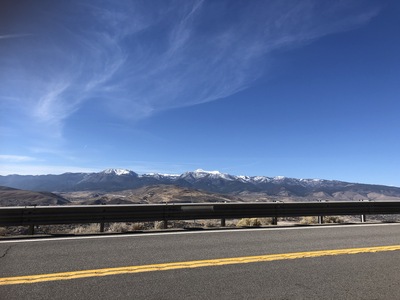 A few miles beyond Beiber is the cut-off from 299 to 139. It's a long trek down 139 to Susanville. While on this road, the trees have yielded to farmland, and I can get a shot of the snow-covered Cascades in the distance.
It's getting dark. 139 connect to US 395 at Susanville, and it's a long drive in the dark. I didn't see where we crossed the border, but I do see a "Bordertown", like a travel plaza; turns out it is on the border and includes a casino. Arriving in Reno, the GPS directs us to a ratty La Quinta. After unloading the car, Jerri locates an Italian place on the GPS. We go there, but it is closed and dark, so instead we go to the Mexican place we passed on the way, about a half-mile back. I'm not that hungry, so I get albondigas soup and an a-la-carte chile relleno, thinking it will be smallish. It comes on a plate with as much food as Jerri's taco entree.
Monday November 8: Virginia City
Arise at 7:30, try to be on the road by 9:30, but it's after 10 before we get away. Sad, sad breakfast of a muffin and a yogurt cup - all they have. Our objective this morning is Virginia City, site of the famous Comstock Lode, and Nevada's silver bonanza. After looking at the map, I know I want to get off the freeway at Virginia Street and catch a state highway to Virginia City; I don't look closely enough to realize the highway intersects Virginia Street at three places. Get off freeway at first Virginia Street exit, and wonder where the state highway is, Jerri's GPS takes us down Virginia Street to where we get back on the interstate. The next Virginia Street exit has highway 341 and signs pointing to Virginia City. 341 climbs up into hills SE of Reno, winding back and forth around the hills. After a long while of this, we come out over Virginia City from the north.
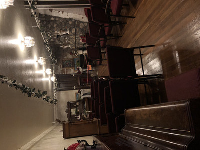
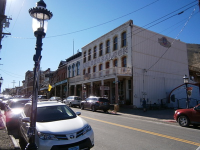
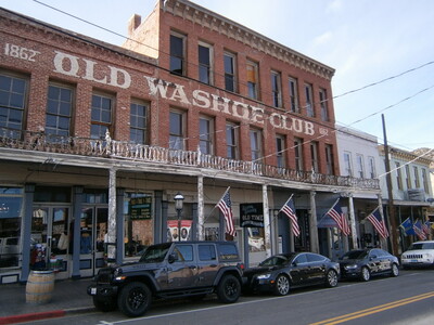
We start at the Visitor Center where an old local boy gives us a map and some recommendations. We commence walking north on the boardwalk, stopping in a few places. I don't know how original or how touristified Virginia City has become, but the storefronts look legit, many with bronze historical markers on the brick parts, and there's a variety of things to do and see - unlike Cripple Creek where most places are casinos. There are many saloons, and many of these have slot machines, but it's pretty subdued.
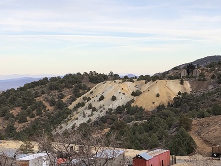
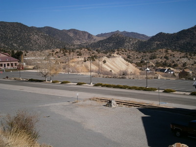 Mine tailings on the other side of an inconvenient parking lot. Virginia City is a lot like Cripple Creek, built on a hillside; the main north-south streets are relatively flat, but the east-west streets are on steep hillside grades. The preliminary assessment indicated no public parking, and most cars are curb-parked along main street - C Street - but then I notice a few "Public Parking" signs pointing downhill. Not exactly a nice Solvang-style parking lot, but I leave the car on the side of D St. and we walk back up the hill.
 The Silver Queen Saloon is one of the major attractions of Virginia City. Of course we go in here.
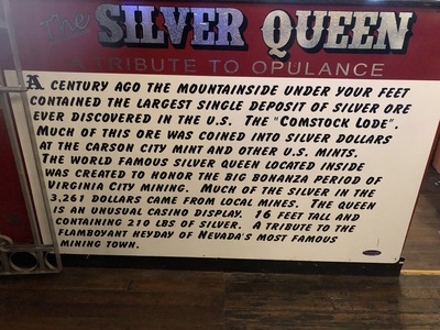
 And here it is, the Silver Queen herself. Her dress is made of 3261 Morgan silver dollars minted in Carson City from silver mined right here in Virginia City. The Combination Shaft is the deepest shaft in town - 3261 feet deep.
 Yep. Nevada. The Silver Queen Saloon has a wedding chapel for hire, so you can trivialize your marriage with a gimmick wedding.
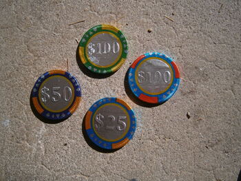 We stop at a candy store, where we get $70 worth of candy at inflated prices, obviously, and have to pay in cash because the USAA app won't unblock my card and they don't take Discover. This cellphone block/unblock thing is proving to be more trouble than it's worth, not much difference than them just having cancelled the card. What else would chocolate coins be in Nevada, but poker chips?
We visit a couple of antique (i.e. Junk) shops, a Christmas shop, some tourist silly stuff shops, and stop at a cafe for sandwiches for lunch. I'm seated on the deck in the back looking down at D Street. I can see our car from here. I can also see a white Jeep car stopping with steam billowing out from under the hood. Uh-oh.
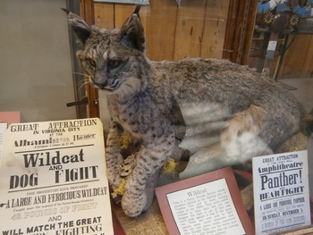 Another big attraction is the "The Way It Was" Museum. There's obviously an emphasis on mining technology and the boom-town lifestyle in the 19th Century, including entertainment events such as staging a fight between a dog and this (now stuffed) wildcat.
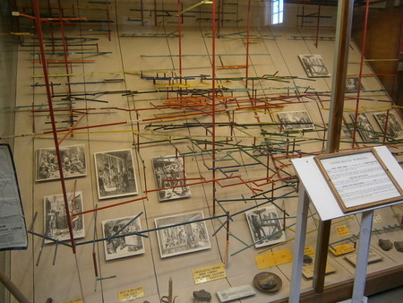 There are many 19th Century claims maps on the wall, and this 3-D model of the mines and claims in the Comstock Lode. Very similar to what we saw at the Cripple Creek visitors' center. The long red trace through the middle of this mess was the 3.8-mile-long Sutro Tunnel, sponsored by Adolph Sutro, that didn't pay off the cost of its construction.
 Another taste of the shape of Virginia City. The Red Dog Saloon. There's no telling the extent to which the names of the saloons on the street now corresponded to what they were in the heyday of the town, or where.
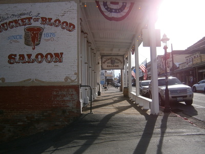 Like this one. I'm sure there were several "Bucket of Blood" saloons through the west. I'm just mostly familiar with the one in Holbrook, Arizona, scene of infamous murders and gunfights.
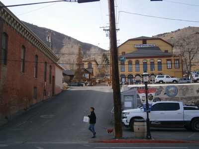 What a typical east-west street looks like. This is looking up from C Street to B Street. That's the Opera House, another attraction we would have visited if we had more time.
Something else that we definitely would have done if it were running: The Virginia and Truckee Railroad that operates a short-line excursion train.
www.virginiatruckee.com
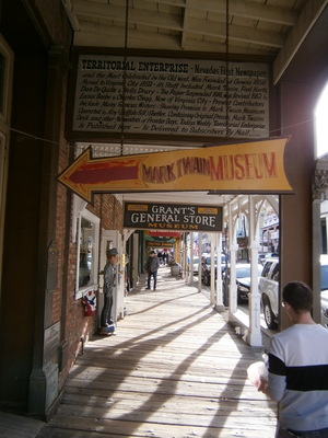 While walking back south looking at a few more shops, we come across the building of the newspaper - The Territorial Enterprise - where Samuel Clements became Mark Twain after he switched from prospecting to newspaper reporting and then to editing. We also come across a placard about firefighting equipment used in the town and how the firehouse burned down along with most of the city in the 1875 fire - but the city built back better.
 Another fine old establishment.
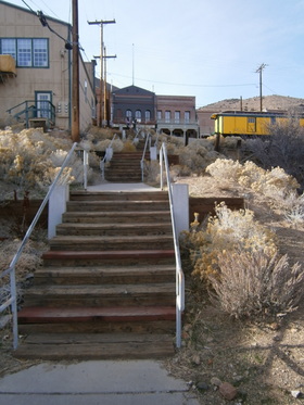 We climb down this long staircase to D Street. I fetch the car and pick up Jerri whom I left waiting here, and continue on to the Chollar mine tour.
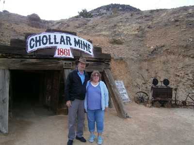 There we meet the owner who notices our license plate - he lived in Tucson for a while, and then he started the Goodenough Mine tour in Tombstone. This was very frustrating, because the out-of-town interests that run the Birdcage Theatre and the OK Corral shows don't want anything to change, and the city government will not plan for the future. I learn that, contrary to the popular story, that is, the mines in Tombstone stopped when they reached the water table and flooded, the truth is that the ore body in Tombstone is played out. This is not the same case as Virginia City - there's still silver down there, but the value of silver doesn't justify the effort and expense to extract it. furthermore, Virginia City (the entire town!) is a historic landmark, and so the real estate is more valuable than the metal.
As the tour starts, "Bill" presents the history and economic significance of the Chollar and the Comstock Lode. He is an Oregon native that has been prospecting and driving big rigs around. The tour story goes: Vrginia City was the largest city in the west after San Francisco, and San Francisco was built with a lot of the produce of the Virginia City mines. In today's value, the Comstock Lode produced more than $1 trillion. Between the Chollar and the Combination Shaft, the Comstock Fault was worked until two impediments became insurmountable. The first was getting the water out; it was lifted out by Cornish pumps, whose engines burned vast amounts of wood brought in by cutters all around the area, and this activity destroyed the forests and pretty much denuded the region. Secondly, temperatures - the water was hot, and the deeper the mine went, the hotter the temperature got, and miners could work only so long under these conditions before cycling out. The Sutro Tunnel was an attempt to ease the drainage problem (the water being pumped out was eroding the hillsides), and it did (and is still carrying water to nearby Dayton), but the grade of the ore that the drainage enabled to be extracted became not worth the effort.
 Our tour of six then enters mine - it's a straight drift, very low, and we (or at least I) have to bend way over to avoid hitting the roof beams. It's 400 feet in to the remaining stope, where Bill shows us a "winze" to follow the vein down at a slant, the ore bucket and winch used to draw it up and dump it into the cars (there are narrow gauge rails on the drift floor), and the bell signal used to communicate between the winch level and the bucket loading level far below.
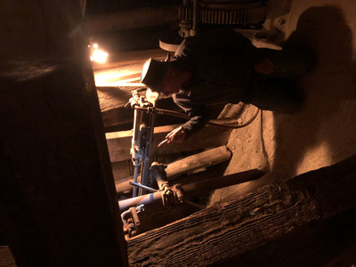 He then showed us a pair of air drills, and explained the meaning of the term "widowmaker" and the condition of silicosis. He explained how black powder blasting was done and how the charges were set to go off at intervals so they could be counted. Rats, not canaries, were useful for early detection of problems - the primary danger of old mines is bad air - the timbers and earth will absorb the oxygen, and you can run out of air, pass out, and suffocate before you know it. Lastly, he demonstrates working by the light by a candle, and how dark it gets if the candles get blown out by a gust - you would have to feel your way out. At this point, we leave back out the drift, bending low. Jerri still hits her head a couple of times. Afterward, we wonder why the Chollar tour didn't have hard hats like the Kathleen Mine (at Cripple Creek) and the Queen Mine (at Bisbee) do.
 Outside the mine, we can look across the valley at the head of the Combination Shaft.
We then drive back to C Street to use the restroom in the Storey County Sherriff's office, then walk back north to the Visitor Center and get some more postcards. We're done with Virginia City. and it's a short 16-mile trip to Carson City. Once again, the GPS leads us a silly, confusing, circuituous route to our hotel. Jerri finds an Italian place, it takes a while to get the food and it's good, but it's Too Much. It was an expensive meal, and most of it gets thrown away.
Tuesday November 9: Nevada Capitol and Lake Tahoe
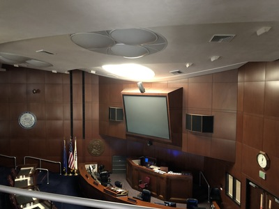
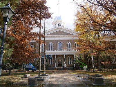 More sad breakfast bags, more light morning rain and wet asphalt. Carson City is laid out such that most of the good stuff is along Carson Street - the Capitol and state buildings, the State Museum, the Railroad Museum, the Nugget and Cactus Jack casinos, and our hotel. So it's a straight run down to the abundant free parking south of the government plaza. I guess the legislature is not in session and that's why parking is so abundant. The Capitol is being tricked out for the holidays, with light strings on the fence and green garlands around the columns. No metal detectors or guards, the Capitol policeman at the desk has the stamp, and he tells us the Battle Born Hall is in the Senate chamber upstairs. So up the wood staircase (one of two) we go.
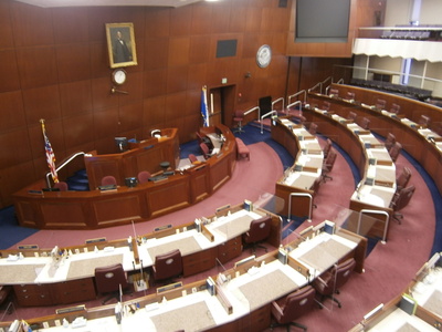
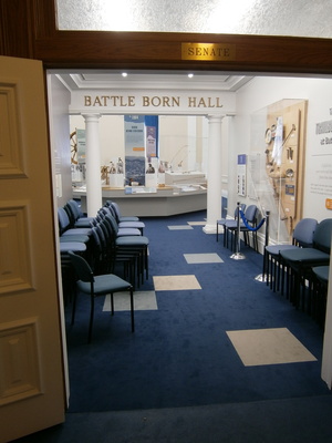 The Senate chamber is committed to the museum, it's a pretty good thumbnail sketch of Nevada's history. The Comstock lode is treated and the gaming industry, and Nevada's speedy entry to the Union during the Civil War (hence "Battle Born") by transmitting the candidate state constitution by telegraph.
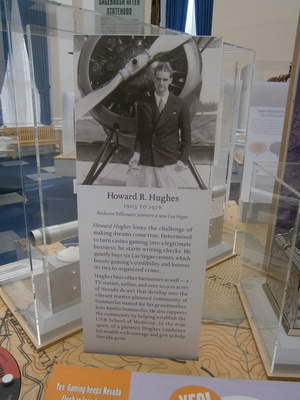 Uncle Howie played a significant role in Nevada, not least by being a real estate speculator in Las Vegas.
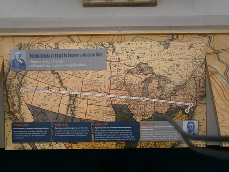 Nevada sent their proposed consititution to the U.S. Congress for consideration for statehood - by telegraph. That's a lot of Morse code to tap in and then listen to on the other end.
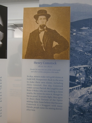 Comstock was a pretty shady character. He didn't seem to actually do anything to justify naming the biggest silver strike ever after him.
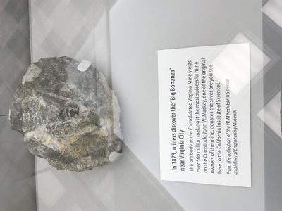 A big chunk of Comstock silver ore.
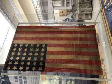 A rare 36-star United States flag, after Nevada was admitted to the Union.
 In the other wing is the Assembly chanber which is apparently now used as a conference and public address room. There were some uniformed persons in here when we peeked in the door, but they very graciously stepped out for us to look around.
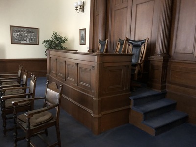 The Supreme Court chamber is also upstairs, a very small affair with a dais with three seats and a conference table in front. Obviously the Nevada Capitol is not a key facility, rather like the Arizona Capitol, but still retains some functions, as the governor's office is here, as well as the Lt. Governor, Secretary of State, and the Treasurer. Otherwise a museum.
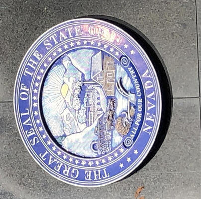 The desk officer says the Capitol doesn't have a gift shop, but the legislative building does, and a better one at the State Museum. We go there first; it's two or three blocks north of the Capitol - but it's closed on Tuesdays! Back we go, I verify that the legislative building is indeed open and the gift shop is there, and then fetch Jerri in. This state seal is afixed to the wall of the legislative building. The lady running the scanners (it's an official building, so there are metal detectors here) is friendly and helpful, and tells us we are free to go upstairs to the galleries. We go to the gift shop first and Jerri gets her postcards. The shop attendant (who has kin in the Phoenix area but has not yet been to Tucson) tells us the legislature is in session every other year, unless a special session is called for, such as toward the end of this week, driven by the redistricting activity from the recent census.
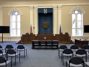
 After that we go upstairs and look at the real Senate chamber - very spartan, no paintings or historical artifacts, no skylights, just the desks, the podium up front, and the big screens that probably display the voting results. The gallery is also fairly small, compared to other Capitols we've visited.
 In the other wing is the Assembly chamber - pretty much the same except more desks and apparently a skylight.
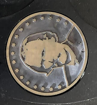 Outside, I notice that there are medallions with Kit Carson's image embedded in the concrete walkway.
Now we're done with the Capitol. The intent is to go south on Carson Street which becomes Business 395 and intersects US-50 to Tahoe. Except traffic is at a standstill a half-mile from the intersection. Eventually we creep up to it to find a terrible crash scene and the police detouring cars away. Nobody is going up 50 that way. We follow the stream of cars through a neighborhood and eventually onto 395 going north. No getting on 50 this way either. Jerri uses the GPS to try to figure a different way to US-50, we join a long stream of cars with the same idea. As we finally approach the desired intersection, it is apparent that construction or some other official activity has blocked that way, too. After an hour of sitting in barely-moving traffic queues, I give up and break out of line and go back. Jerri guides us to a post office from which she can get stamps and mail a birthday card to our nephew, Daniel; while she's inside, I check out an alternate route. Looks like we can go up I-580 back toward Reno and take highway 431 to Tahoe. I fail to notice "Mt. Rose - Ski Tahoe" on the map. When Jerri gets back in the car, we leave northward to Williams Street and the junction with I-580. Just before getting on, I notice a "Port Sub" sandwich shop, so we stop for an eat-on-the-go lunch.
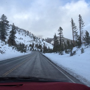
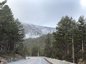 It's very gusty on I-580, I'm hoping it doesn't indicate something unpleasant. Reno is in sight when the 431 exit appears; one leg goes to Lake Tahoe, the other to Virginia City. The road goes up toward snowy mountains, but it's still four-lanes divided, and I'm thinking if it stays like this, we're fine. Then it becomes two-lane divided, and then just a two-lane highway, and starting to go into sharp curves up into the mountains. Up, up, up. Snow is getting closer and closer. I see the signs, "When flashing, 4WD or chains required" - not flashing, so good.
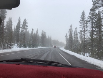
 Then we're in the snow all around, and low clouds driving through the forest. Still up, up.
 At last we reach the summit - Mount Rose, people are playing with toboggans and inner-tubes on a slope just off the road.
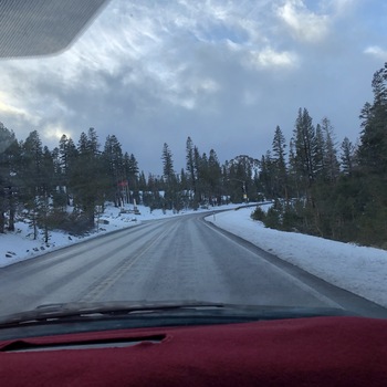
 Now it's going down. Shift to low gear and let it coast. And... now it's snowing on us. But only briefly. Before long, we leave the snow behind. We can catch glimpses of the big lake through the trees,
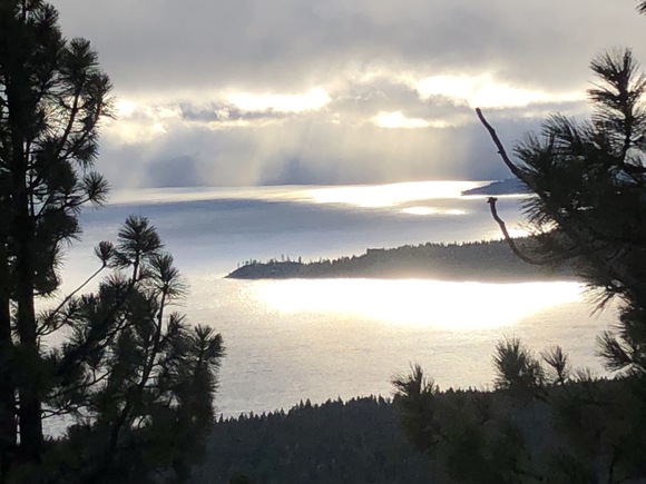
At a pull-off with a clear view, we stop to get our first good look at Lake Tahoe.
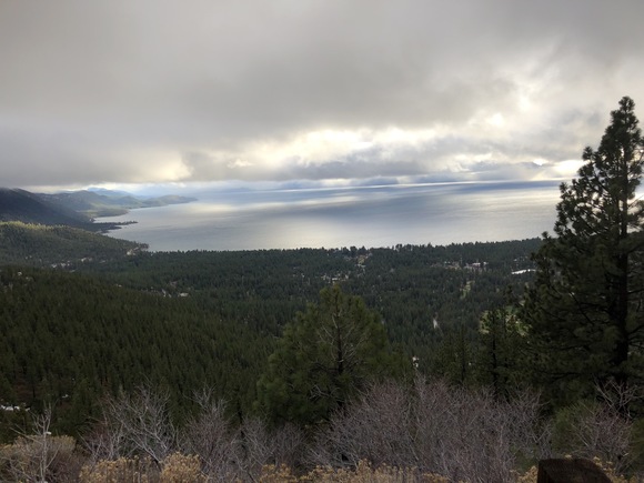
 Further down there's another pull-off and a clear view. Here's the east side of the lake...
... and here's the west side, with the late afternoon sun shining down into it.
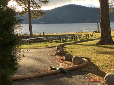 Down, down, down, and at last into Incline Village. There are lots of snow-country houses like in Flagstaff; there's lots of money here. We reach Highway 28 which runs along the lake shore in the NE corner. At one point I get off 28 and drive downhill, hoping to strike a beach - and I do! Its a nice beach with playground toys, picnic tables, a restroom, and a sandy beach.
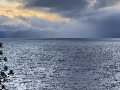
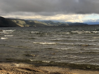 Choppy water washing up on the beach, all grey, none of that famous deep blue. It looks like there's a storm way out there in the southwest corner.
In about a mile we spot a Visitors' Center. Jerri does a little shopping and I look at the travel lit, especially a dining guide - it's my intention to have dinner on the shores of Lake Tahoe. The counter lady says it's about 12 miles to the US-50 intersection, about 12 miles from there to Carson City, and about 12 miles from 28 to South Tahoe.
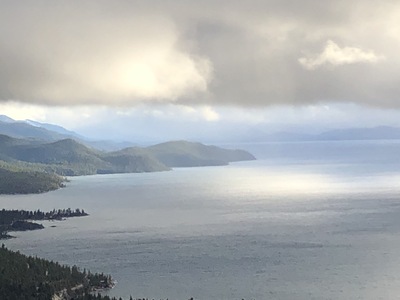
Back on the road, we stop at one more vista to see the lake before the light fades entirely.
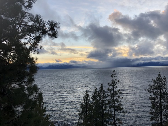
 It does look like a storm down there in the southwest.
12 miles is about 15 minutes, and then we get on (or just continue on) US-50 south. As we pass through Zephyr Cove, there's supposed to be another visitors' center here but if there is, we miss it. Presently we see a tall Harrah's building and know we're in South Tahoe. There's lots of lights and activity in the streets, so, resorts and casinos. But we don't stop to join in or look around, we just drive through following the GPS directions to the last visitors' center, and apparently find it but the building is dark and obviously closed. Oh, well. So then we just turn around and drive back through the town and spot a tourist place next to a CVS. Jerri gets her postcards, a T-shirt, and some drugstore stuff. Continue on back through town and the flashing lights casino district. For whatever reason, I'm not that interested in dining on the shores of Tahoe anymore. I guess I had something quieter in mind.
We return back up north on 50, and in a few minutes we get to the intersection with 28 and turn east on 50. It's a two-lane divided highway with tight but not scary mountain curves. We come out of the hills over Carson City - and see flashing red and blue lights at the 395 intersection. Fortunately, in the last stages of cleaning up after the wreck. Traffic is not impeded from turning left, we're soon on Carson Street and before long are back at the hotel. Jerri decides she needs to run two more loads of laundry to get through the next two days. It's a reasonably nice guest laundry, and after starting the first load, I go back down Carson Street looking for a dinner source I can bring back and eat with Jerri while watching the laundry machines.
Note: I had gotten a Tahoe map/brochure from the hotel lobby when I got the breakfast bags. The most interesting thing to do was the lake cruise - a Mississippi river-boat style craft. But after November 1, it's shut down for the winter and its less-interesting companion boat runs only on the weekends. More evidence that while travelling the off-season is nice, do it before the end of October.
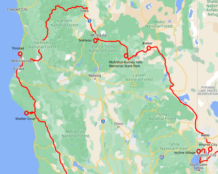 Here's where we've been the last few days: From Point Reyes to Shelter Cove on the terrible rainy, twisty road that probably ruined our brakes, then to Eureka and Trinidad. Then up and around north to Mount Shasta and our encounter with the big rock in the road. Then back down east past the fabulous but unseen McArthur-Burney falls, up to lunch and Bieber, and then the long drive down to Reno. Finishing up with Virginia City, the Nevada Capitol at Carson City, and Lake Tahoe.
Wednesday November 10: Long Drive through Nevada
It's a nine-hour drive today. I want to be away by 9:00, and we manage to leave by around 8:30. The GPS takes us on US-50 east out of Carson City; this seems weird since we want to go south, but I'll go with it. This takes us through Dayton, where gold was first discovered in Nevada and which is the endpoint for the Sutro tunnel (thesutrotunnel.org). After about thirty miles, we pick up US-95 going south.
Impression: Nevada is desolate. Little towns like Yerington and Schurz and Mina, and go past the huge Walker Lake that appears to be artificial since there is no vegetation around it, but if there's a dam, its well-hidden (maybe it's an alkali lake?). I am surprised by Hawthorne and the vast munitions depot - roadside signs declare it to be "the world's largest ammo depot", and there's a NAVSEA billboard - I was expecting Army, but apparently it's Navy.
We stop at Tonopah for a grab-n-go Subway lunch and gas. This town is big enough to have a school with teams - the Tonopah Muckers. The mining legacy is a tourist draw, there is a big courthouse (maybe the county seat?) and a Best Western hotel! Just down the road from Tonopah is Goldfield, a registered National Historic Site, but it seems to be some oddball tourist photo-op places and maybe shops and a formerly nice Goldfield Hotel (maybe six stories and made of stone), now empty and sad.
US-85 is a two-lane highway with no passing lanes, so both Jerri and I are passing big-rig trucks via the oncoming lane - scary. Then we arrive at Beatty (the billboard proclaims "Good... Better... Beatty!") and the Amargosa Valley with some features familiar to me from coming this way before, en route to Death Valley. Then we enter Las Vegas - and encounter bad traffic due to construction on 95 where it passes north of downtown - bumper-to-bumper creeping along, worse than yesterday because it's three lanes of this misery. Also: It was coolish this morning in Carson City. Well, in Las Vegas, it isn't coolish anymore, the A/C isn't working very well, and the chocolate-covered almonds I got at the Murphy's in Trinidad are melting. I open the windows because it's cooler outside than inside. Eventually we get past the merge choke-point and traffic gets back up to speed. We finally make it out of the Las Vegas area, indicated by lots of towers carrying power cables away from Hoover Dam. Jerri wanted to stop at the dam and get her National Park stamp, but it's already 5 and they closed up before 4 - we'll have to do this again later when we come back to do more Las Vegas stuff. We arrive in Kingman right on schedule at 6:30; that's enough time for a leisurely dinner at Cracker Barrel - even though the place is a madhouse for Kingman on a Wednesday evening!
 After getting back to the hotel, I slip out to get some gasoline so we don't have to do it tomorrow. A shop across the street appears to be offering free lingerie.
Thursday November 11: Return Home
The return from Kingman to Tucson is not noteworthy except for two things:
- Coming down US-93 from Kingman through Wickenburg, instead of getting off US-60 at the much-faster 303 loop, I take Grand Avenue to Glendale - so we can visit Cerreta's Chocolate!
- After leaving Phoenix on I-10, I started feeling weird in my gut, which became more anxious as the traffic got heavier and slower. I barely made it to the restrooms at the Sacaton rest area. After that I was okay.
It was so nice getting back after this extended trip through California, and getting to see Lake Tahoe where my parents had gone almost-camping (they ducked out before getting snowed in by an early-season storm). And for Jerri to get so many lighthouse stamps. Especially Trinidad Head!