Archives:
- Ten State Tour
- Gadsden Hotel
Cochise Co. - David's Sardinia trip
- Downtown Huntsville
- Pima County Fair '07
- Phoenix Trip '07
- Space & Rocket Center
- California Desert
- Saguaro Monument
- Rodeo Days '08
- Butterflies
- David's Sweden trip
- South and Midwest
Grand Tour
Pt 1 Pt 2 Pt 3
Pt 4 Pt 5 Pt 6
Pt 7 Pt 8 Pt 9 - David's Germany trip
- Biosphere 2
- Tucson Rodeo 09
- Sabino Canyon
- Rose Canyon Camping
- Southern California
- North Texas
- Labour Day '09
- Tucson Presidio '09
- Phoenix Trip '09
- David's Utah Trip '10
- David's Dallas Trip '10
- Colorado Trip '10
- North Arizona '10
- NmTxOkAr '10
- Portland & Maryland '10
- Las Vegas '10
- Dillinger Days '10
- Rodeo Days '11
- Penn, Maryland, WV
- Faith's SCUBA trip
- Mount Lemmon '11
- Los Angeles '11
- Phoenix '11
- Flagstaff '11
- Alberta, CA
- Glendale '11
- Pinnacle Peak '11
- Arizona Centennial
- 2012 Tour - Missouri
Pt 1 Pt 2 Pt 3 - Barrio Viejo Home Tour '13
- Apache Trail '13
- AZ Route 66 '13
- Tucson Walking Tour '13
- Veteran's Day Parade '13
- Lake Havasu '14
- Charity in France '14
- Colorado '15
- Medicine Hat/ Calgary '15
- LA & San Diego '16
- Phoenix Mystery Castle
- Sequoia & Yosemite
- Route 66: NM, TX, OK, KS
- NM, CO, WY, NB in '17
- Phoenix Summer '17
- July 4th '17 in Colorado
- Orlando '17
- Consumer Electronics Show '19
- Denver/Brown Palace '19
- Pacific NW '19 p1
- Pacific NW '19 p2
- Pacific NW '19 p3
- Colorado '20
- July 4th '21 in Colorado
- Texas Lighthouses '20
Ormand Family Activity
To read about our October 2021 Texas Lighthouse Tour, go here.
To read about our July 2021 Independence Day celebration, go here.
November 2021: California Lighthouse Tour - Part 2
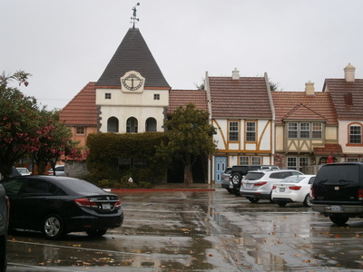
Monday October 25: Solvang
We wake up to rain - the talking heads on the television in the breakfast room are calling it a "Cyclone Bomb". En-route to breakfast room, I find the trolley that was hiding last night. It's a decent hotel breakfast, and we sit next to an open window, smelling and listening to the rain. I have to run to the car to retrieve our jackets and umbrellas (which were fortuitously in the car, since we didn't exactly plan for rain).
 As we enter the town, there's a fair bit of traffic and people walking around with umbrellas. It appears that Solvang gets their tourist attraction role and provides free public parking in discrete places; we Follow the signs and leave car in a lot a bit south of the main road, and then walk back up with the rain pattering on our umbrellas.
I'm not certain why we didn't just use this parking lot...
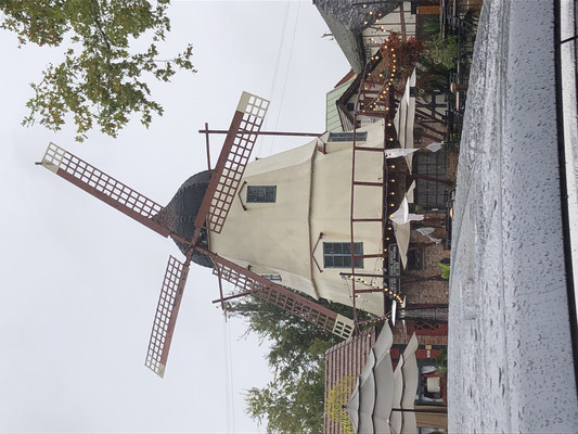 The big thing Solvang has, well, as part of their Danish colony thing, is windmills. I didn't realize windmills were a big Danish thing; maybe being next door to the Netherlands rubbed off on them. The first windmill we see is at brewery/beer garden. Next door is Paula's Pancake House; there's a line of people waiting in the rain. We step into the Pet Supply shop so Jerri can look at postcards - they don't seem to deal with cats but there's everything for dogs, hamsters, and birds.
 We then cross the street to the Jule Hus - a Christmas shop with different stuff. The shopkeeper may very well be a local of Danish descent; he helps us pronounce "Gaedelig Jul" and the name of the shop ("Yuleh Hoose").
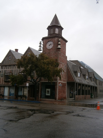 I had done a little bit of internet homework before we arrived this morning. A little further east and just south of Mission Road (aka Highway 246) facing a funny little triangular park is the Solvang Visitor Center where we get a booklet from the lady who has already circled the key attractions on the fold-out map. Now we can do our walking about in the rain to see stuff. Like this amazing clock tower with the bells on the outside. Of course we visit several shops, being especially on the lookout for a women's size Solvang tee-shirt, but they are hard to find. We can't help but notice that there are many shops that are closed today. The man at Jule Hus said it was because too many people don't want to work after the COVID "crisis".
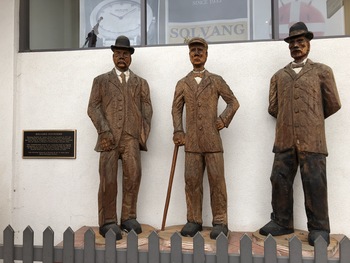 While we're wandering around, Jerri notices these wooden statues honoring the original founders of the Solvang colony.
One of the more interesting places we visited was the Swedish Candy Factory (really? "Swedish" in a Danish colony?) whose flagship product was polkagris - sort of a cross between stick candy and taffy. You break off a piece like a stick of hard candy, but as you suck on it, it becomes soft enough to chew and sticks to your teeth like taffy. Well, I thought it was interesting.
https://www.swedishcandyfactory.com
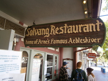 As the day passes, the rain stops and the sun comes out. It's unlikely from the blue skies that it's going to rain any more today, so I take the umbrellas and our purchases, walk briskly to the car and exchange it for our hats, and return to find Jerri coming out of a shop. It's lunchtime (past, really), and here's is the "Solvang Restaurant" right at hand, Sandwiches, red cabbage, potato salad, and we can't not try the specialty: "aebleskiver" - like a large, soft, fluffy donut hole, with raspberry jam. A few of these would be enough for breakfast.
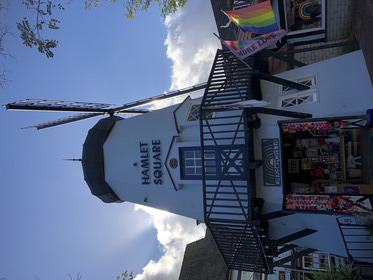
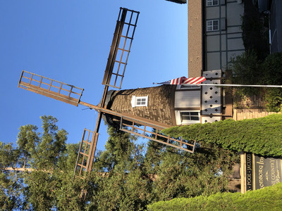
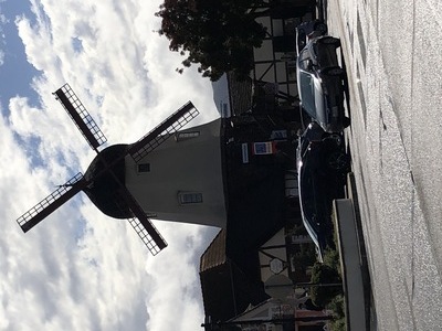 Nearby on the major north-south street (well, sort of north-south; it intersects Mission at an acute angle) is the biggest windmill we've seen. The interior is a touristy shop, so we get to go inside and under the blades. That don't turn. It's fake; so surprising.
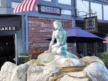 At the head of this street, Alisel, is the copy of the Little Mermaid statue in Copenhagen. I guess it was the Little Mermaid when she was in her human form, since this statue has legs. It's supposed to be a fountain, but the water isn't running, what a shame.
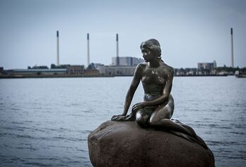 The original. They need to clean up their copy.
 It's coming up to 4:00, and most places are closing (which seems to me absurdly early for a tourist town). There are some things we want to see yet but we need the car. On the way back to the parking lot, we pass Windmill Number 3, which houses a toy store. Can't help but notice the homosexual "pride" flag fluttering over a toy store. Behind the toy store is a little court with an ice-cream shop; we go in there to look... already closed.
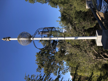 Back in our car, we proceed up Atterdag Road to see the "Wind Harp" noted on the map. Past the Solvange Elementary School, which is also a "feature" on the map (probably for historical purposes). And the Lutheran Church. I get that; Danes being culturally Lutheran. Past the Hans Christian Andersen Park and into an apartment complex. Where is this "wind harp" thing? What is a "wind harp"? The only thing that is unusual here that could even begin to fit the bill as "wind harp" is this bit of contemporary sculpture with a large wind-chime hanging inside of it. Well, that's a bit of a let-down.
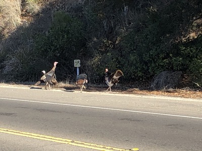 Eastward on Mission Drive to where the next windmill is supposed to be. Pretty sure we've gone too far, because we're well out of Solvang. But we are rewarded for the attempt by encountering a flock of wild turkeys hanging out on the side of the highway.
 Turning around and heading back in, we spot the windmill way down on the south side of the road. In an attempt to see if there is a road that goes over there, we turn south at the next intersection, and this road takes us to the mission church, Santa Ines. So the Solvang area was once the parish for a Spanish mission. With more time, we might have stopped to look inside, but... yes... it's already closed.
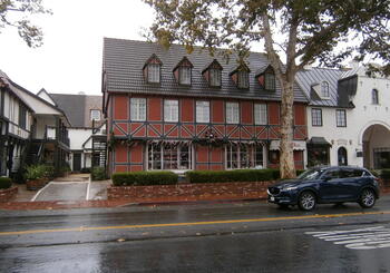
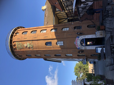 Back into town and down Alisal Road, we're looking for the "Round Tower" listed on the map. It's got to be right... here... in the block with the big windmill. So I park down the street a bit in front of one of the nice hotels (Solvang is stocked with nice hotels) and walk back to the block. Sure enough, the "Round Tower" is in there, even if it now contains "Tower Pizza".
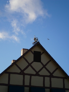 Walking back to the car to fetch it up and pick up Jerri, I see this house with a stork nest platform on it. I think this is a thing in northern Europe. I stand there for a little while to see if the birds are fake or if they move. If they move, I know they're real; if they don't, I can't tell. They don't move. Time to leave.
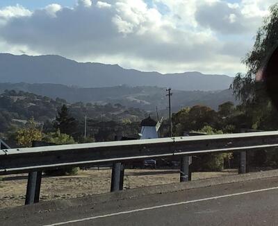
 Then we drive over to the west side of town where the last windmill is supposed to be. I drive up and down the neighborhood (not very many actual homes carry on the Danish style) and back and forth before we find this hotel with a windmill theme.
My intent is to dine on "Danish" fare this evening and reward the local economy. Jerri guides us to a "highly rated" restaurant near where we had parked earlier, but upon walking up to it, the "Peasant Feast" closed at 5:00. This is really strange to me. There are all these nice hotels in town, but there does not appear to be very many eating places (outside of numerous Danish bakeries - none of which we visited today); how do guests at these inns and hotels in Solvang eat when everything including restaurants closes before 6:00?
At the end of the day (which ends a bit early today), we've given Solvang a decent visit. They have a nice deal about free public parking and clean public restrooms. We did most everything except Danish bakeries and museums (the main one is Elverhoj, but we didn't look at it, being a bit out of the way on the south edge of town). So we return to Buellton and go into the AJ Spurs steakhouse (www.ajspurs.com) - it's a "family style" place in which most things are served for a group rather than individual servings. It starts with soup in a pot at the table, and a bowl of beans and salsa to add to it. A large salad follows and then a huge steak. A pan of "spuds" (deep-fried potato slices) and bowl of rice pilaf are placed on the table for all (well, both of us) to share. Too much. Ice cream or a root beer float come with meal. Too much. While we are waiting for our order, a large party of older men starts gathering in the side room, distracting the servers; is it Masons or Odd Fellows? There must be at least twenty in there.
Tuesday October 26: Santa Barbara
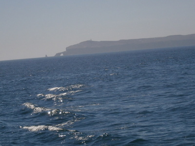
Next morning we are on the road by 11:00 for an easy trip down 101, the "Camino Real" marked by bells on crooked poles, like little streetlights. As we approach the sea, I can see ocean derricks and a big mass way out on the horizon that I can't believe is the Channel Islands - but turns out, it is.
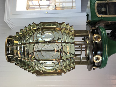
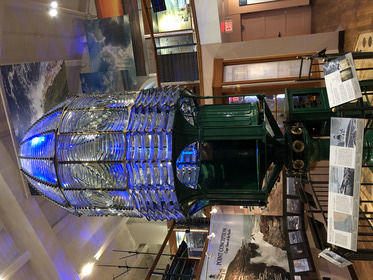 The objective is the Santa Barbara Maritime Museum, and why we're going there is this: The first-order lens for the now-departed Point Conception Lighthouse.
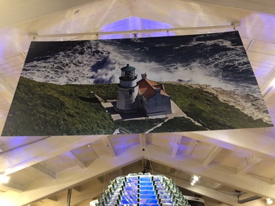 Which looked like that in its day.
The museum is pretty good. Quite the display for the Santa Barbara Yacht Club and the (Mussolini Cup (seems the long lived yacht club has won a lot of trophies over the ears; www.sbyc.org/club-trophies), and a monitor in a central place in the main hall showing a video loop about schooners racing in the Transpacific Cup. Seems the local Chumash indians sealed their canoes with tar from natural seeps in the area - a prelude to the much-later off-shore (and on-shore) petroleum industry.
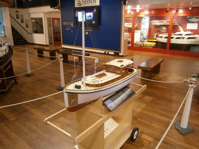 There is a number of these beautifully detailed radio-controlled model boats. The story for one of these is that the mischevious owner put a walkie-talkie inside and would come up behind fishermen in their boats and then ask about their license, and then defend itself with a working water cannon and a (bottle?) rocket launcher. Another has a working cargo boom.
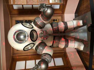
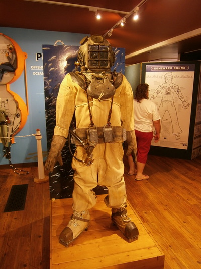 The real sustained story about Santa Barbara is the diving industry. Originally deep-sea divers harvested abalone, but then transitioned to working on the oil rigs. Santa Barbara is a hub for the development of all kinds of diving technology, like gas mixing, dive masks and helmets, and diving bells.
 Including this hard suit. Like a wearable submersible.
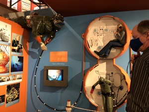 Advanced diving bell with a lower wet chamber and an upper dry chamber.
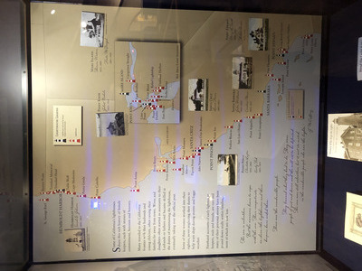 Nice display that shows all the historic and extant lighthouses along the California coast. There are a lot of them.
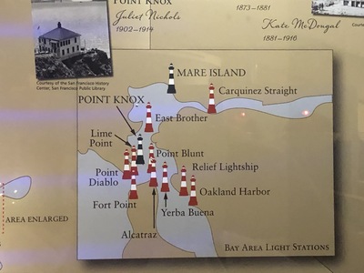 Detail of the bay-area lighthouses. I question the accuracy of this museum display. Never heard of Point Diablo (turns out is was never more than a remotely-operated beacon, and it lacks one of the three Angel Island lights (Point Blunt, Point Knox, and Point Stuart - which is still technically there, more so than Point Knox).
 I read Two Years Before the Mast by Richard Dana. It appears that the Santa Barbara area is where the trading vessel on which he worked and recorded his experiences was operating.
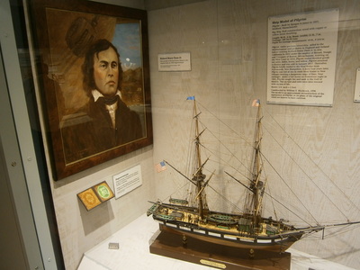
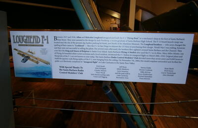 Something I would never have guessed: Santa Barbara was the home and base of operations for the Loughead brothers, who invited Jack Northrop to help them design their F-1 seaplane at the advent of WWI. Northrop would go on to start his own aerospace company, and Loughead Aircraft would eventually rename itself... Lockheed.
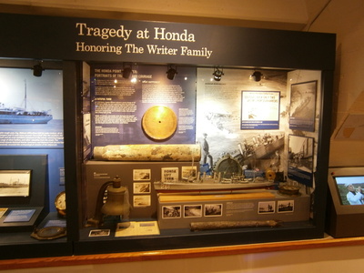 After WWI had ended, a squadron of seven US Navy destroyers committed a navigation error while steaming through the channel, and went aground at nearby Honda Point. This was the worst loss of navy vessels in peacetime, and it happened right near here.
Other interesting things we saw:
- Five cannon were found on a beach at low tide by a jogger in the recent past. They appear to be late British made, possibly jettisoned to lighten the ship. Well, we already knew the British claimed Astoria, I guess they got around down here, too.
- A display about "Heavy Weather" had actual film footage from various past nautical events. We watched a film segment of a giant bark, the "Peking", going round the Horn in 1929. I tried to play the Columbia River rescue film (like what we saw at the museum at Astoria), but it wouldn't play.
- There was a display of different kinds of surfboards. Okay, Santa Barbara, surfing, I get that. But then it mentioned the group of Hawaiian princes who introduced surfing to North America, and I thought, "wait a bit, Santa Cruz already claimed those guys".
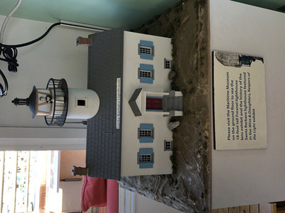 When we think we've seen it all and are on our way over to the gift shop, the lady at the front desk tells us about the observation deck on 4th floor. There's another desk for tourist info up there, and the man has a Channel island Nat'l Park stamp. I run back to the car to get Jerri's books. Downstairs in the museum, it said there was a Santa Barbara lighthouse but it fell over in an earthquake and was replaced by an acetylene lamp beacon. The man at the observation deck tells us that the Santa Barbara lighthouse still exists, and he has this model. The site is owned by the Coast Guard, and it is far enough along the coast that you can't really see it. He also tells us that Point Conception also still exists but you can't really see it, either.
 Outside the museum is a retired dual-chamber diving bell.
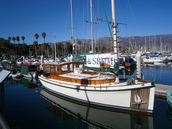 Outside the museum in the water is this perfectly beautiful wooden boat that is clearly part of the museum. I was thinking, I would definitely be up for a harbor cruise in this little thing. There's no evidence for cruises, but is apparently still in operating condition.
sbmm.org/curators-tour-of-the-classic-yacht-ranger
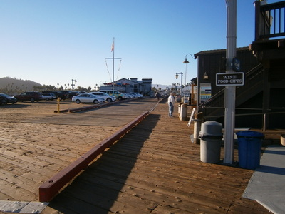
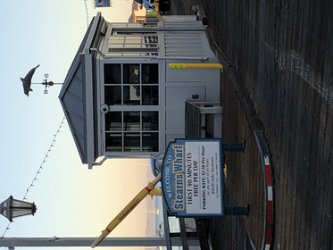
Another thing we learned in the museum, and especially from the observation deck overlooking the marina, is that the big dark mass at the other end of the marina is Stearn's Wharf, It was built in the 19th Century as a much-needed improvement for commercial freight and fishing, but it continues to operate now as a local attraction. With the idea that leaving the car where it is rather than risk not finding another parking spot (turns out to not be the case), we strike out on a 1/2-mile walk along the marina and the Santa Barbara waterfront.
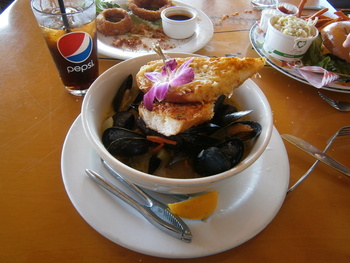 Lunch/dinner is at The Harbor. It's "sit where you like", but where we sat was not in the orbit pattern of the serving girls, so we didn't get attention until the manager noticed us. The food was good; here's my cioppino.
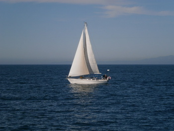
 While we're enjoying our lunch, we can look out the window at a sailing class under way. The instructor is in a motorboat trying to keep tabs on all his students.
 I can't think of a better way to spend an afternoon than "learning the ropes" (literally) on a small sailboat. Plus, these aren't what I'm used to, for in addition to the boomed mainsail, there's a little jib.
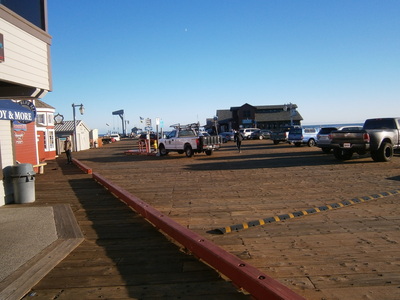
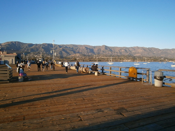
 When we're done with lunch, we can go out and look around. Here's Stearn's Wharf looking north. Oh, look, we could have parked right here!
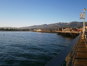
 Looking south. There's another restaurant down there, Moby Dick's. There's also supposed to be a "water taxi" that operates between the Wharf and the other end of the marina by the Maritime Museum, but it doesn't seem to be operating.
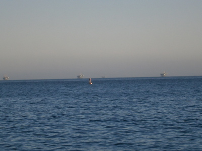 At the end of the pier, amid all the people fishing, you can look out and see the line of ocean derricks.
Looking north from the end of the pier is the city of Santa Barbara and the Santa Ynez mountains.
 After getting some postcards and seashells from a shop (and sharing the concerns of the lady who says that young people can't figure change without the cash register telling them), we get some ice-cream in waffle cones and sit looking westward over the harbor. The sailing class seems to be over. The day is ending, the shadows are lengthening, and we start our way back.
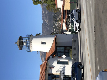 At the entrance to the wharf, across the street is a fake lighthouse.
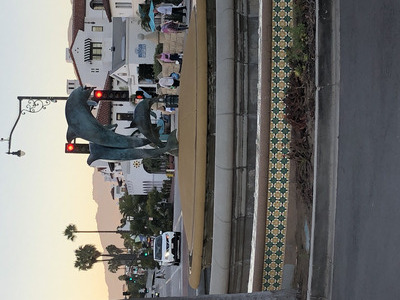 Nice fountain with dolphins playing.
 Where we've been. Yeah, I would have had to pay twice for parking. But that's okay; as we walk back, we watch a team of people pulling their outrigger canoe out of the water. Lots of people jogging or roller-skating or walking their dogs, and some groups setting up to play beach volleyball.
After getting back into the car car, we look around for a drugstore. Santa Barbara is a hipster place, where every street is one-way and there are no street signs; if you don't know where you're going, you're not going to find it. Finally we find the little nondescript CVS. They don't have any distilled water, but maybe the grocery store across the street would. Of course we see nothing resembling a grocery store anywhere nearby. The GPS takes us out of town toward Pismo Beach via Highway 154. It may be the more direct route to to Los Olivos (one of the Ynez Valley towns north of Solvang) and Santa Maria and Pismo, but it is a terrifying road in the dark; two lanes, a twisty hilly road, people driving too fast (it's posted 55MPH, but nobody is going less than 70MPH). I'm glad when we're back on 101. Arriving in the town of Pismo Beach and our hotel for the night, we find a grocery store at for the distilled water and a Subway place for dinner.
Wednesday October 27: San Luis and Avila Beach
The next morning, I reconnoiter the breakfast room - all the chairs are on the tables, doesn't look very open. When we're ready to check out, we go to this breakfast room and exchange our guest breakfast vouchers for two bags with one fake muffin and one cold fake breakfast burrito. I'm not eating this. Just a bit further down the road is a CoCos, and a chatty waitress who is fine with everyone else leaving California: she lived in Orange County and knows about ridiculous commutes and astronomical house prices, and now lives in nearby Arroyo Grande. She is married to a serviceman and has lived in Hawaii and Guam, and even lived in "the other California" (Colorado) for a little while.
The exit to Avila Beach is just a few miles up 101, and we go through all the way to Port Luis. After visiting the public restroom and a gift shop that is mostly liquor and camp supplies (there are lots of RVs along the beach), we return to the beach drive to wait for the lighthouse tour parking lot to open. The beach ramp is nearby, so we walk down to the sand and watch people playing with their dogs in the surf (the dog picks up a tennis ball that falls in the sea water, so it's salty as get-out, but the dog doesn't seem to notice) and turn over kelp fragments.
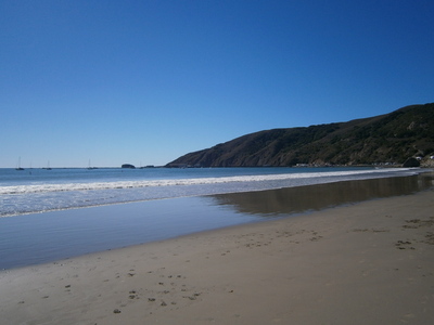 The beach looking westward toward San Luis.
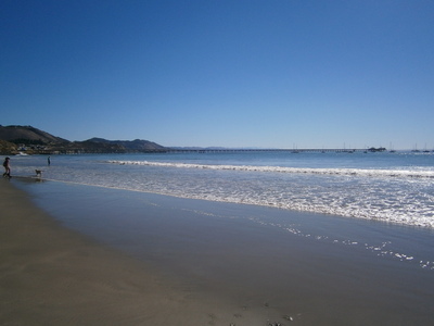 The beach looking eastward toward Avila.
The time arrives, so we drive over to tour lot where an old bearded fellow checks our name on his list and punches the access code into the electric gate control. After a few minutes standing around with the other tour members (all older folk), we all board the van, and driver Christina takes us out of the lot About a half- mile up the beach drive, the van turns into the entrance for Diablo Canyon PG&E (nuclear power plant!) where a gate guard lets us through to a single-lane narrow road that goes up along side of the hill. A forest of scrubby trees on one side and steep cliffs to the sea on the other. One of those times you just have to trust the driver and enjoy the ride. When the van gets to the lighthouse compound, the group is split into two, and our half is assigned to the lady docent for our guided tour.
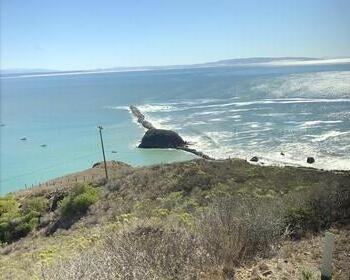 Looking down the hill, the San Luis breakwater is visible, and the different conditions of the surf on either side.
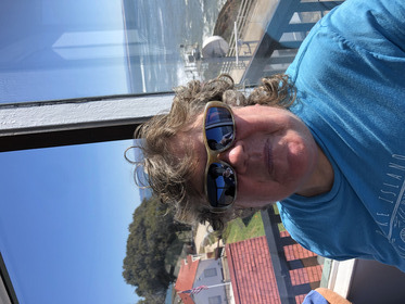 Point San Luis Lighthouse is in a family with Table Bluff in Humboldt Bay - a square tower, not very high, but this one is still attached to the keeper's house. Narrow stairs up and then a ship's ladder to the lens chamber, and here's Jerri getting her photo evidence.
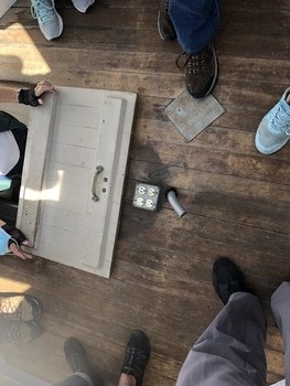 On the floor of the lantern chamber is an outlet obviously used for the replacement beacon. It is the hope of the SLLH preservation group to relocate the historic lamp up here. Also, no well for the weight to drop, so the keeper had to keep running up here every few hours to rewind it.
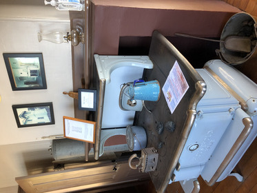 As seen elsewhere, the stove has an adjacent hot water reservoir. As we are shown around the house, they are very proud of their unique floor-to-ceiling sliding glass windows - very similar to what we have seen at the Rosson House in Heritage Square in Phoenix.
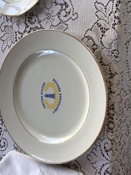 Table setting with the historic Lighthouse Service pattern. Only used when the inspector came by.
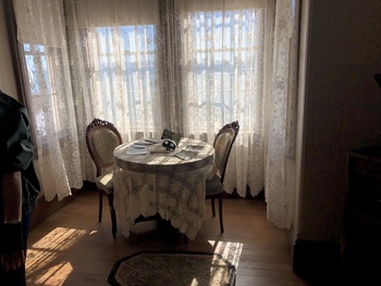 Sunny nook. The last keeper lived here up to 1946, a blended family in which the oldest girl went to school via horse. The other kids, and maybe Port Luis kids in general, might take the train to San Luis Obispo and stay with their relatives for the season to go to school.
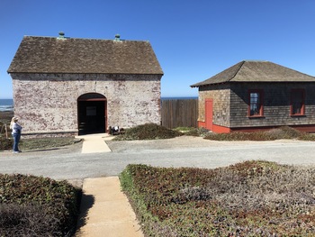
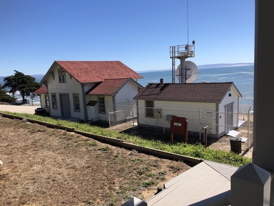 Looking out front door, the rightmost building is the modern Coast Guard beacon and the leftmost is the original Fog Signal building. The bare patch covers the big cisterns that caught rain water runoff for use by the steam whistle. Originally, the steam whistle was coal-fired. Later, kerosene was used to run a motor to operate an air compressor for fog horns.
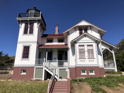 Beautiful little lighthouse and keeper's quarters. When the Coast Guard replaced the original lighthouse with the automated beacon, they were preparing to burn down the lighthouse but the community intervened.
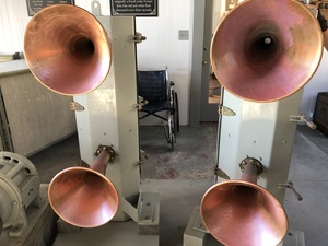 Examples of the fog horns in the Fot Signal building, now the museum and gift shop.
 San Luis ran this fourth-order lens with a kerosene lamp. That's not enough to warn ships off rocks, so the purpose of the beacon was more as a harbor marker. Port Luis was an actual port, shipping dairy products, beans and peas, and (so an old fellow who knew a lot about the region) asphalt dug out of a canyon to the south and sent to San Fran for making pavement. It seems a lot of turn-of-the-century San Francisco was paved with Port Luis asphalt. The beacon guided freighters into the harbor. It was the fog horn that warned passing ships of the nearness of the coast.
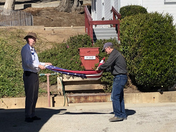 Something about paying extra for overstaying our limit has them pushing to get us on the van for a prompt departure. One of the last things to do was to take down and fold the flag, and I got to help.
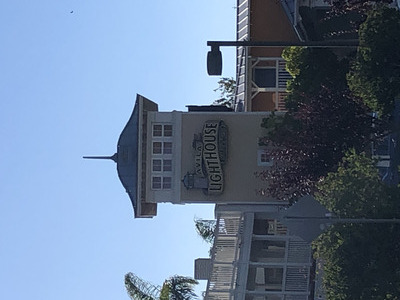
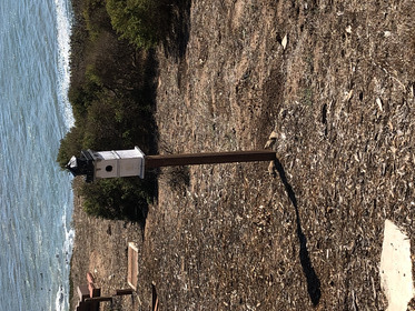 It's a mini Port San Luis Lighthouse!
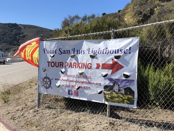 After the van returns to the pick-up lot, we can get in our car and depart back to Avila Beach. Here's the banner that marked the tour lot.
The little town has a paid public parking lot down the hill from Front Street, the main tourist district. Lunch and souvenirs are the goals. We had been told about a fancy French place, but the prices on the menu posted outside are a bit much, so we walk on to The Custom House and are seated right away. Turkey sandwich, fish sandwich, and clam chowder. Our waiter, Austin, is a dive instructor and surfer who is commenting on the decent waves following the weekend's weather. According to him, Pismo Beach is more for Cal Poly people, but they still have better waves. Morro Bay is good.
Further on along the waterfront street is another touristy shop. The owner, an older man (not much more than me) and a local boy and a water-man and a surfer, more or less confirms Austin's opinions, and explains that the wave action is more from the north, and Avila Beach is more sheltered from this (especially due to the breakwater) than Pismo and Morro Bay. He says Montana de Oro is much better. He can paddle over to the beach by the breakwater and walk up to the lighthouse. He has been on the tour many times, and says the last keeper was always in the bars in town but never his wife; she would have treats for the kids when they showed up at the lighthouse. (At this point, I'm starting to think, "but... the last keeper left in 1946? And you got treats from his wife at the lighthouse? How old are you?")
 After deciding we've had enough touristy shopping, we walk back along the seaward wall above the beach and watch the wetsuit-clad surfers. Going back to the car, Jerri notices another fake lighthouse.
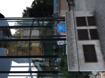 I get on 101 and drive north. I know Los Osos is on Highway 1, so I see a "Los Osos" exit and get on Los Osos Valley Road... which is not Highway 1. It takes a while getting to actual Los Osos and then Bay Blvd takes us to Highway 1. After that it is an easy and quick drive (mostly quick, until about 8 miles out and we get behind a pokey pickup pulling a trailer) to Cambria. Getting off the highway at Main Street, the road goes through the business part of Cambria - looks like a fun town. Toward the north end is the Piedras Blancas Lighthouse first-order lens.
 The huge lens is impressive, of course, but I'm not certain which is more impressive, the lens or the huge glass case out in the park to enclose it.
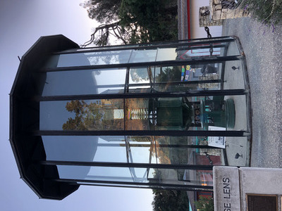
 The problem with the glass case is that without a polarizing filter, it's hard to get a photo of the lens. One more attempt, up close, with a view of the port by which the keepers entered to clean the glass prisms.
 The lens is located in Pinedorado, operated by the Lions. It looks like a local festival grounds, and there are booths (currently closed up) for food and other goods.
Since we're here, and the internet "guide book" mentions it, I figure we might as well stop for Cambria's other big attraction - Nit Wit Ridge.
 This is another of those uniquely American conglomerations hand-built by the landowner, very much like The Mystery Castle at South Mountain in Phoenix.
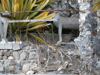 Very eclectic.
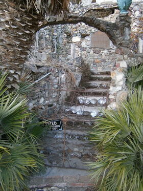 The sign posted out front indicates that the property is being cared for by a foundation that runs tours. Of course our visit comes out of season.
visitcambriaca.com/itinerary-element/nitt-witt-ridge
Now we continue on to nearby San Simeon, where there is a bunch of cheapo hotels serving Hearst Castle tourists. There are some people here, but the place is quiet and obviously struggling since the Castle has been closed for repairs for some time now. Tonight we have to do some laundry. The hotel desk clerk changes some bills for quarters and tells me that the restaurant adjacent to the hotel is open til 9. The machines don't take liquid softener, and the office doesn't have laundry supplies, so we have to take a quick run down the street to a liquor store/mini-mart for dryer sheets. At 8:30 I go to get takeout and find that the restaurant is already closed. Well, that's a bummer. So while Jerri monitors the machines, I take a buzz around, first to an unsatisfactory steak/seafood place, and then a "Mexican" restaurant on the other side of the highway. They have a different interpretation of enchiladas and tamales, and it's not all that great (maybe that's my Tucson-trained Sonoran-informed prejudice speaking). We dine while the laundry finishes, and then Jerri sorts through her travel treasures.
Thursday October 28: Piedras Blancas
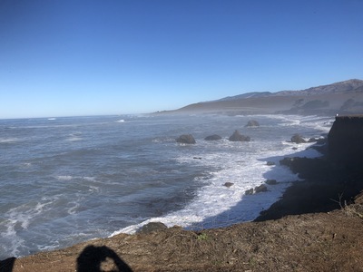 The Quality Inn gives us breakfast baggies again, only slightly better than the joke yesterday. I have received a fraud alert from USAA, because someone has placed large charges for Ebay against Jerri's card; this of course leads us to cancel her card. Now we're down to two. Quick drive further up Highway 1, past Elephant Seal Beach, past the lighthouse itself, to the abandoned Old Piedras Blancas Motel. There are a number of other cars and people here already. While we wait, we walk around and Jerri gets this photo of the wild Central California coast.
At 9:45 the BLM person arrives, calls roll, divides us into 2 groups, and then leads the convoy of cars back onto the highway, to and through the gate, and to the parking lot.
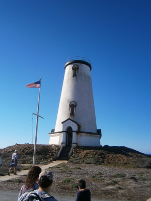 Our guide is David, who after giving us a brief history of the site, leads us up the path to the tower. He explains that the first building constructed on the site was a barracks for the work crew building the lighthouse. The tower follows a standard design, and all the material was delivered and much of it was prefabricated, so they had it up in a matter of weeks. The barracks was converted to a barn and then an auto shed... and now it's gone. He then lets us cycle into the tower in small groups to look around.
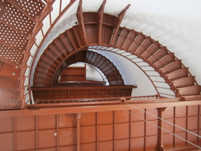 View up into tower and the familiar half-moon staircase. I note there is not a central guide for the weight for the clockwork, so it looks like it cannot go higher than the first landing. The weight is still there.
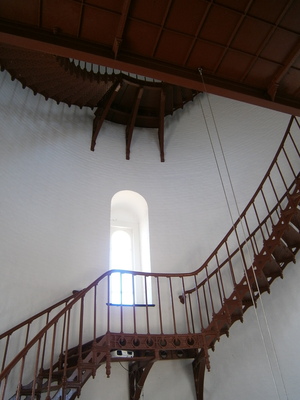 Tall, airy windows. The stair is closed off, of course, because it's not safe (and there's nothing to see up there anyways).
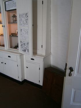 Nice tool cabinet, now serving as an exhibit display case. What's that dark little box on the floor next to it?
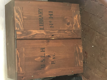 Why, yes, it's one of those portable rotating libraries of the US Lighthouse Service!
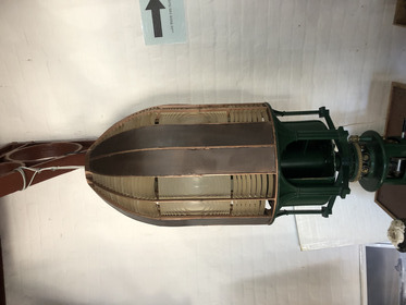 Model of the original First Order Fresnel lens used at the site. We of course have already seen the actual original lens.
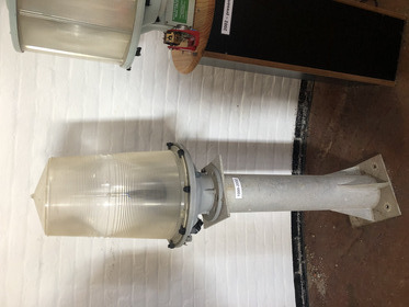 The original lens and kerosene lamp gave way to this electric beacon.
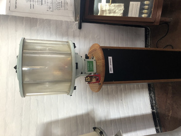 Which in turn gave way to this one. It wasn't clear whether the beacon at the top right now looked like this or the high-output LED stack we've seen elsewhere.
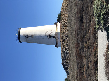
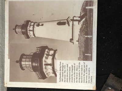 Originally, the Piedras Blancas lighthouse tower was a fine, handsome structure that looked a lot like Pigeon Point. California being what it is, earthquakes had damaged the tower and threatened to bring it all down, so the Coast Guard decided to remove the lens chamber and upper courses to lower the center-of-gravity, resulting in the sad, stumpy building we see now.
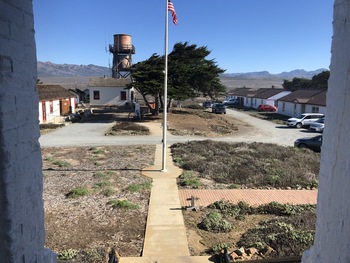 The most noticeable feature of the grounds, other than the tower itself, is the big, old, redwood water tower. David explained that the site originally was just the lighthouse, but the need for a fog signal became apparent. Installing a foghorn required an enhancement of the staff and their living quarters. The head keeper's house had flush toilets; the other dwellings did not. This led to tensions. To resolve the problem, the service installed flush toilets in all the buildings and put up this water tower to gravity-feed the water for the plumbing. The redwood tank doesn't hold water anymore, so the structure supports antennae for remote operation.
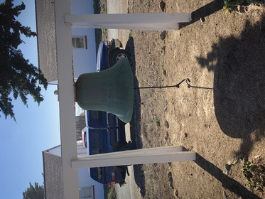 Like other lighthouses we've seen, there is a big bell that served as a backup for the foghorn.
The guided part of the tour is over, and we are free to wander around looking at stuff. While Jerri is in the gift shop, I chat with David - there are plans to restore ther upper courses of the tower with modern (lighter, stronger) materials and move the lens back from Cambria, but they have to deal with rusted-out iron door and window frames first. There's a nuance about funding: BLM owns the lighthouse and the grounds, so federal funding would apply, not the state as at other lighthousess like Point Arena, so it's not as much a money problem. It can get very windy here, dangerous to work on the lens. The double doors into the tower form an airlock to prevent wind gusts from extinguishing the lamp. Sometimes they had to rig a rope as a handhold from the keeper's house to the tower.
 View of back side of tower, facing the sea. David said he has seen a whale breach (that is, jumping all the way out of the water) from this point before, and advises everyone to keep an eye out for blow plumes.
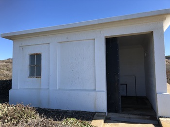 The oil storage shed. The site used two grades of kerosene, one for the beacon lamp and one for the foghorn (probably the same motor-runs-air-compressor as at San Luis).
 The Fog Signal building is mostly empty, with a few displays around the edge about sea life and shipwrecks. The other guide, Kathy, is here, and she is very chatty (and soaks up a lot of our remaining time here).
 By the time we finish, it's 11:30 and the tour is supposed to end at 11:45. We go around the outer path anyways to look at the actual Piedras Blancas (it's white because... bird poop; but Juan Cabrillo noticed the different-colored rock and gave it its name) and the sea view, then return to the parking lot and a last visit to the porta-potty. We're the last vistors off the property.
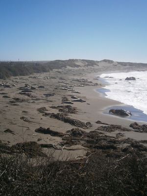 Just south of the Piedras Blancas lighthouse site is Elephant Seal Beach.
 This is a big attraction, and there's a developed parking lot next to it and a boardwalk and a guard rail to walk around looking at the animals while keeping us (and them) away.
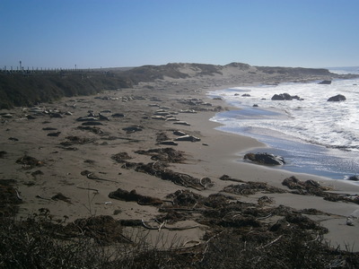
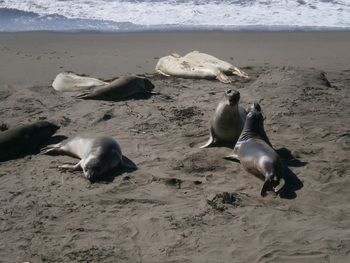 Two young males barking at each other. A lot of the sleepy seals have tossed sand on themselves.
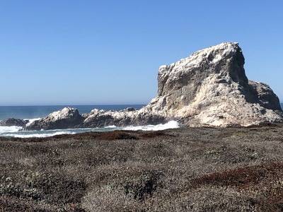
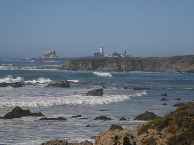 View back to the lighthouse and the White Rocks.
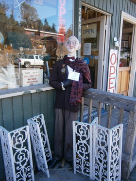 The event tomorrow is the sea trip to Anacapa Island, which leaves from Oxnard, and that lies (way) south from here, through Cambria. It's a busy day in Cambria, with lots of tourists walking around visiting the shops, so we stop and look around ourselves. Lunch is at a little cafe with an eclectic garden art collection. It's coming up to Halloween, so Cambria is holding a "decorated scarecrow" contest.
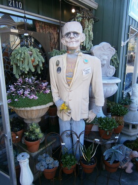 These figures are all over the place. We go into an antique store that has an (apparently authentic) signed Joe Namath jersey for $950. I pass. As we leave, the owner hassles us because Jerri is holding her Arizona water bottle and he thought it was part of his merchandise. At another antique shop, my credit card is declined. I spend a frustrating hour on the phone with USAA trying to get it turned back on, because for some reason they can't get the verification text messages to my phone. We finally get it settled.
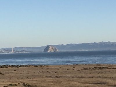 Mapquest says it's two and some-odd hours of driving from Cambria to Oxnard, but we leave after 5, and don't get to Oxnard until after 8. On the way, we see Morro Rock.
Arriving at Oxnard after dark, the turn signal has gone out again, so I turn into a parking lot to fuss with the bulb in the rear cluster and get it working. Then we go back to a Blaze Pizza for take-out dinner and an adjacent Walmart Market for water and sandwiches for tomorrow.
Friday October 29: Anacapa Island
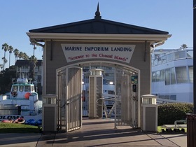
Arise at 5:30. Breakfast is staff-served, even hot water and pancakes from machine; a much appreciated switch from the wuhan paranoia we've put up with so far. After repacking Jerri's backpack for lunch, we depart for an 8-minute drive from the hotel at Five-Points to the harbor. Island Packers is a bit hard to find, but we get there in plenty of time, and obtain our boarding pass and the ticket for the 3:30 return trip. There are only two trips out there each day, and there are NO facilities on the island, so we have to take our own food and sufficient water. Note that the counter girl says "no guarantees".
 For some reason in Southerm California, all the benches at the marina are out in the sun. I'm thinking we're going to get a lot of sun today. So, we sit in the sun until 9:30 when boarding starts.
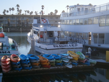 This is our boat, the Vanguard. I can watch the preparations underway, including loading some kayaks into the racks at the stern.
 Cute. Doesn't really look sea-worthy.
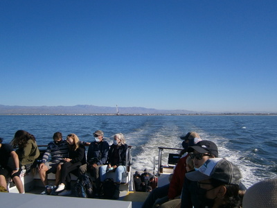 Our time arrives, everyone boards, we take some seats on the top platform. The boat leaves the dock and putters through the marina, past a dredge barge and seals sunning themselves on the beach areas, down the channel, and into the open sea. Here is Oxnard behind us.
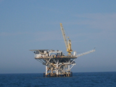 A closer look at one of those many ocean derricks in the Channel.
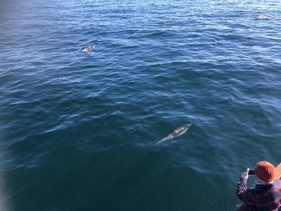 The skipper/narrator alerts us to the presence of pods of dolphins hunting all around the area, and up to the boat. Dolphins are frequently found in the presence of whales...
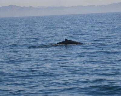 ... and there's one now, the hump of a big humpback. I'm guessing the boat has a fish sonar, so they're able to tell where and how many of the big sea animals there are.
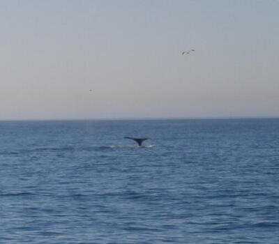 Flukes! What a great way to start this adventure!
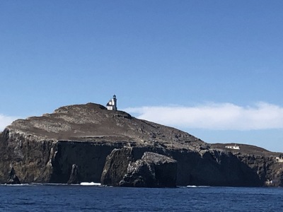 As we near Anacapa Island, we can see the lighthouse perched on top.
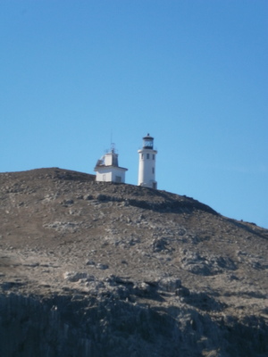 Up to and around the island, better definition on the lighthouse.
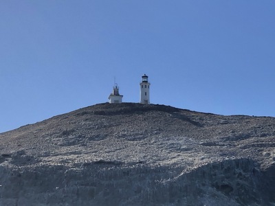 Last view of the lighthouse as the boat enters the narrow little channel where the dock is. The sea is really very heavy today. It's not a "tie-up and walk-off" dock, it's a "back the boat up to the ladder and let people climb off" dock. And that ladder is rising and falling by five feet or more every time the sea surges, which is every few seconds. After several attempts to back the boat up to the ladder, the skipper finally calls it off. The trip out here has become a nature cruise. Disappointing... but I know there's no way Jerri could have negotiated that ladder.
 The sea on the side of the island toward the mainland is a marine preserve. On the other side of the island, the divers in this boat are after spiny lobsters, sea cucumbers, and other fish in the kelp beds. The nature narrator, Brittany, says the lobsters have no claws, but a "grinder" that can take your finger off. Apparently, the divers work with topside air compressors (dive helmets?) rather than SCUBA rigs.
 Another lobster diver boat framed by the arch at the east end of the island. Why is the top of the rock white? I'll bet I know.
 Oh, look, a colony of pelicans!
 Puttering along the north side of the island, there are plentiful signs of erosion cutting caves and keyholes in the rock, like this huge one. There are actually three islets here, with gaps between eroded by the sea, impassible by boats at all times but at low tide a brave person can climb from one to another.
 Leaving the island, with that arch visible.
 A pretty little cabin cruiser passes on our way in. We also pass a diving boat, and Brittany says she and first-mate Zach have worked on that boat. Quite the community. On the way back, we see a few more dolphins, but no whales.
Jerri goes to the "head" about the time some exceptional swells pass. I'm sure it was fun in there. She also talks to a park ranger aboard (who was supposed to be delivered to the island) and asks about the address of the lighthouse to get the stamp. The ranger tells her that the lighthouse has no address but the Channel Islands National Park Visitor Center in Ventura Harbor might help. After we get off the boat, we drive to Ventura Harbor and find the visitors' center. There doesn't appear to be parking for the visitors' center, so I park in a "Marina Tenants Only" spot. It's a pretty good little visitors' center, and includes live feed from the webcams on - and under - the island (www.nps.gov/chis/learn/photosmultimedia/webcams.htm). Jerri discovers they have the lighthouse stamp also! We then eat our packed lunch at a table outside the visitors' center.
(Oh, and it turns out that Island Packers refunds us the difference between the day trip to the island and a nature cruise. They're pretty good: islandpackers.com - which is a good thing, since they're the only option for getting to any of the islands.)
At this point, we are done with the long-range back-and-forth trying to get to all our timed objectives in central California. I get back on the 101 for the four hour drive to Carmel. Through Ventura (remembering our late-night hamburger break), Santa Barbara (for the fourth time), up highway 154 in the daytime (much, much nicer) to Los Olivos, then Santa Maria, then Pismo Beach. 101 goes up through San Luis Obispo, so we don't see Morro Rock again. A long way north. I stop at a Valero/7-Eleven outside King City for a bathroom break; it looks like the general store might be open, but the restaurant looks to not be open. Onward. The GPS sends us on a side street at Chualar (I'm always nervous when the GPS takes us off the main road), for a more direct route to Monterey. Then little back roads into Carmel.
The streets are full of parked cars, and the teensy hotel parking lot lot is cramped - but not as bad as Long Beach. Nothing could be as bad as Long Beach. The air is full of marine layer fog. The lady at the hotel desk is very enthused about Carmel and wants us to drop off the key tomorrow but leave our car in her lot and explore the town on foot. She gives us a map and recommends a 1.5 hour walking tour, see the two beaches (not sure what this means, since there's only one on the map), and all the other beauties of her town. I can't tell her we have an early morning commitment.
 There's lots of cuisine on this road. We settle on an Italian place on the opposite corner next to the Shell gas station (and I note that the Shell sign is camouflaged; Carmel-by-the-Sea is even more hipster than Santa Barbara). Since we have no reservation, we settle for a table outside in the fog with no heater. After a while I pop back across the road to fetch jackets from the car. After another while (and asking about it), they move a working heater next to our table. The food is good (Alaskan cod, chicken parmesan, apple crips, spumoni with a strawberry) with a not-unexpected $100 bill, and it's quite the experience to sit in fog, our table wet, drops falling on us out of the nearby tree.
As we sit there, we observe that there are groups of young to middle-age people walking around (and in one instance, a woman pushing an elderly lady in a wheelchair who is using her cellphone as a headlight). The shops we see around us tend to be art galleries and wine shops. Not hardly any kids. Maybe it's too late for them, but I can't help but compare this to Solvang (not very hipster, kid-friendly) and Cambria (somewhat hipster, some kids around).
For Part 3, go here.